More From Contributor
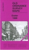
£11.19
Laminated waterproof edition of a detailed topographic map from the Ordnance Survey Explorer series, covering Crediton, Tiverton & Dulverton.. Edition B1 with minor changes; Publication date April 2007 About this series: These highly detailed maps show all the administrative boundaries, settlements as small as isolated farms, the road network down to unfenced roads & country tracks, & field boundaries (hedges & drystone walls) which make navigation across the countryside much easier. Steep gradients on roads are indicated. Various landmarks, e.g. powerlines, archaeological sites, windmills, churches & lighthouses are shown & additional graphics indicate natural terrain features such as cliffs, scree, mud & vegetation variations. The contour interval is 5 metres in the lower parts of the country & 10 metres in the uplands, & spot heights are marked. Each map covers an area of 30 x 20km (i.e. approx. 19 x 12 miles), with some double-sided maps covering more, as indicated in the individual descriptions. The maps are fully GPS compatible, with the National Grid shown at 1km intervals & latitude & longitude indicated by margin ticks at 1'. The Explorer series has replaced the earlier, green-cover Pathfinder maps. The Explorer series is now complete & covers all of Engl&, Wales & Scotl&. Some sheets for popular areas like the National Parks are still branded as Outdoor Leisure (OL) maps, but are now included in this series as the cartography is the same as that in the Explorer Maps. The Explorer maps offer a substantial improvement on the Pathfinder series, with greater use of colour, larger area per map, & stronger emphasis on information for ramblers & tourists. This series is ideal for walking & other outdoor pursuits & each map shows a large amount of information for ramblers & tourists. Public rights of way are shown (except in Scotland), together with other routes with public access: National Trails & Recreational Paths, permitted paths & bridleways, & selected cycle routes. Open access land created under the Countryside & Rights of Way Act 2000 is marked. Tourist information

Includes::
caravan & camp sites, Park & Ride locations, recreation/leisure/sport centres, museums, historic buildings, English Heritage & National Trust sites, rural pubs, etc. The map legend is in English only, except for the tourist information content which is also in French & German.

...
Archived Product
£3.50
Exeter in 1888 in a fascinating series of reproductions of old Ordnance Survey plans in the Alan Godfrey Editions, ideal for anyone interested in the history of their neighbourhood or family. Selected towns in Great Britain & Ireland are covered by maps showing the extent of urban development in the last decades of the 19th & early 20th century. In this title: two versions of this detailed map are available, covering most of central Exeter & its eastern suburbs & stretching from Bonhay Road eastward to Cemetery Road, & from Prospect Park southward to Commercial Road & Friars Green. Features include LSWR railway with Queen Street (now Central) station, Cathedral, Exe Isl&, city centre with individual buildings neatly shown, Lower Cemetery (disused), Mount Dinham, Headweir Mills, Bull Meadow, Royal Devon & Exeter Hospital, Mount Radford, Exeter Castle, Town Barracks, St Michael & All Angels church, Brewery, schools, St Matthew's church, Eye Infirmary, Lower Market, Allhallows church, St David's church, Bury Meadow, Higher Market, Exeter Diocesan Training College, Workhouse, Newtown area, Polsloe Park, Polsloe Priory area, Belmont Leisure Ground, St Sidwell's church, chapels, Lion's Holt, Reformatory for Girls, etc. (note that St David's station is off the map.) Each maps

Includes::
extracts from an early street directory. The 1888 version is colour printed, taken from the Ordnance Survey's beautiful handcoloured First Edition. About the Alan Godfrey Editions of the 25

...
Archived Product
£4.50
Exeter in 1888 in a fascinating series of reproductions of old Ordnance Survey plans in the Alan Godfrey Editions, ideal for anyone interested in the history of their neighbourhood or family. Two versions of this map are available, covering most of central Exeter & its eastern suburbs & stretching from Bonhay Road eastward to Cemetery Road, & from Prospect Park southward to Commercial Road & Friars Green. Features include LSWR railway with Queen Street (now Central) station, Cathedral, Exe Isl&, Lower Cemetery (disused), Mount Dinham, Headweir Mills, Bull Meadow, Royal Devon & Exeter Hospital, Mount Radford, Exeter Castle, Town Barracks, St Michael & All Angels church, Brewery, schools, St Matthew`s church, Eye Infirmary, Lower Market, Allhallows church, St David`s church, Bury Meadow, Higher Market, Exeter Diocesan Training College, Workhouse, Newtown area, Polsloe Park, Polsloe Priory area, Belmont Leisure Ground, St Sidwell`s church, chapels, Lion`s Holt, Reformatory for Girls, etc. (note that St David`s station is off the map.) Each maps

Includes::
extracts from an early street directory. The 1888 version is colour printed, taken from the Ordnance Survey`s beautiful handcoloured First Edition. About the Alan Godfrey Editions of the 25” OS Series Selected towns in Great Britain & Ireland are covered by maps showing the extent of urban development in the last decades of the 19th & early 20th century. The plans have been taken from the Ordnance Survey mapping & reprinted at about 15 inches to one mile (1:4, 340). On the reverse most maps have historical notes & many also include extracts from contemporary directories. Most maps cover about one mile (1.6kms) north/south, one & a half miles (2.4kms) across; adjoining sheets can be combined to provide wider coverage.FOR MORE INFORMATION & A COMPLETE LIST OF ALL AVAILABLE TITLES PLEASE CLICK ON THE SERIES LINK.

...
Archived Product
£3.50
Exeter in 1904 in a fascinating series of reproductions of old Ordnance Survey plans in the Alan Godfrey Editions, ideal for anyone interested in the history of their neighbourhood or family. Two versions of this map are available, covering most of central Exeter & its eastern suburbs & stretching from Bonhay Road eastward to Cemetery Road, & from Prospect Park southward to Commercial Road & Friars Green. Features include LSWR railway with Queen Street (now Central) station, Cathedral, Exe Isl&, Lower Cemetery (disused), Mount Dinham, Headweir Mills, Bull Meadow, Royal Devon & Exeter Hospital, Mount Radford, Exeter Castle, Town Barracks, St Michael & All Angels church, Brewery, schools, St Matthew`s church, Eye Infirmary, Lower Market, Allhallows church, St David`s church, Bury Meadow, Higher Market, Exeter Diocesan Training College, Workhouse, Newtown area, Polsloe Park, Polsloe Priory area, Belmont Leisure Ground, St Sidwell`s church, chapels, Lion`s Holt, Reformatory for Girls, etc. (note that St David`s station is off the map.) Each maps

Includes::
extracts from an early street directory. The 1888 version is colour printed, taken from the Ordnance Survey`s beautiful handcoloured First Edition. About the Alan Godfrey Editions of the 25” OS Series Selected towns in Great Britain & Ireland are covered by maps showing the extent of urban development in the last decades of the 19th & early 20th century. The plans have been taken from the Ordnance Survey mapping & reprinted at about 15 inches to one mile (1:4, 340). On the reverse most maps have historical notes & many also include extracts from contemporary directories. Most maps cover about one mile (1.6kms) north/south, one & a half miles (2.4kms) across; adjoining sheets can be combined to provide wider coverage.FOR MORE INFORMATION & A COMPLETE LIST OF ALL AVAILABLE TITLES PLEASE CLICK ON THE SERIES LINK.

...
Archived Product
£8.99
Exeter & Exmouth in the Cassini Past & Present map series which covers town & cities of England & Wales & offers a unique way of tracing their history & expansion by showing four different periods of their development using Ordnance Survey mapping from the mid-19th century, the late 19th century, the 1920s & the present day. Coverage

Includes::
Cockwood, Exminster, Kenn, Kenton, Lympstone, Starcross, Topsham & Woodbury. Each Past & Present map consists of four panels, all centred on a city or a town & covering exactly the same 15km x 15km area. Three of the panels reproduce Ordnance Survey

...
Archived Product
£7.99
Map No. 192, Exeter & Sidmouth 1809, in the Cassini Historical Series of old Ordnance Survey mapping of England & Wales at 1:50, 000 in a format designed to offer a convenient comparison with the present day coverage from the OS, & most locations in three different editions. Old historical maps have been combined so that the sheet lines correspond to the current Landranger series & reproduced with the scale changed from one inch to one mile to 1:50, 000. Most locations are covered by three separate maps, showing how the area has changed over the decades, with selected major cities also presented in a fourth edition. Old Series: the first detailed survey mapping dating for most areas from the first half of the 19th century, in black & white & with relief shown by hachuring. Revised New Series from 1880s/1900s, with some colouring & a mixture of hachuring & contour lines. Popular Edition from the inter-war years, with contour lines & colouring to indicate woodlands, parks, etc. New Popular Edition from the late 1940s, reproduced in the Cassini series for the major cities. Each map

Includes::
notes on the development of Ordnance Survey & the various series produced by them. For those interested in maps & cartography in general, the Cassini series also provides a fascinating insight into how Ordnance Survey cartographic style has developed over a period of over 100 years. Coverage in this title

Includes::
present day Exmouth, Teignmouth, Dawlish, Budleigh Salterton, Seaton, Ottery St. Mary, Honiton, Little Silver, Will&, Blackborough, Yarcombe, Upottery, Bickleigh, Cullompton, Luppitt, Stockl&, Bradninch, Brampton Speke, Silverton, Clyst Hydon, Dalwood, Newton St. Cyres, Talaton, Broadclyst, Feniton, Whimple, Northleigh, Colyton, Rockbeare, West Hill, Newton Poppleford, Beer, Woodbury, Otterton, Lympstone, Topsham, Shillingford St. George, Kennford, Kenton, Starcross, Ideford, & Kingsteignton, with the Exe estuary. PLEASE NOTE: Stanfords can also print on request mapping from all four series centring the map on a location of your choice. For more information please click on the link below.


...
Archived Product
£14.99
Map No. 192, Exeter & Sidmouth 1809-1919 (3-map set), in the Cassini Historical Series of old Ordnance Survey mapping of England & Wales at 1:50, 000 in a format designed to offer a convenient comparison with the present day coverage from the OS, & most locations in three different editions. Old historical maps have been combined so that the sheet lines correspond to the current Landranger series & reproduced with the scale changed from one inch to one mile to 1:50, 000. Most locations are covered by three separate maps, showing how the area has changed over the decades, with selected major cities also presented in a fourth edition. Old Series: the first detailed survey mapping dating for most areas from the first half of the 19th century, in black & white & with relief shown by hachuring. Revised New Series from 1880s/1900s, with some colouring & a mixture of hachuring & contour lines. Popular Edition from the inter-war years, with contour lines & colouring to indicate woodlands, parks, etc. New Popular Edition from the late 1940s, reproduced in the Cassini series for the major cities. Each map

Includes::
notes on the development of Ordnance Survey & the various series produced by them. For those interested in maps & cartography in general, the Cassini series also provides a fascinating insight into how Ordnance Survey cartographic style has developed over a period of over 100 years. Coverage in this title

Includes::
present day Exmouth, Teignmouth, Dawlish, Budleigh Salterton, Seaton, Ottery St. Mary, Honiton, Little Silver, Will&, Blackborough, Yarcombe, Upottery, Bickleigh, Cullompton, Luppitt, Stockl&, Bradninch, Brampton Speke, Silverton, Clyst Hydon, Dalwood, Newton St. Cyres, Talaton, Broadclyst, Feniton, Whimple, Northleigh, Colyton, Rockbeare, West Hill, Newton Poppleford, Beer, Woodbury, Otterton, Lympstone, Topsham, Shillingford St. George, Kennford, Kenton, Starcross, Ideford, & Kingsteignton, with the Exe estuary. PLEASE NOTE: Stanfords can also print on request mapping from all four series centring the map on a location of your choice. For more information please click on the link below.


...
Archived Product
£7.99
Map No. 192, Exeter & Sidmouth 1898-1900, in the Cassini Historical Series of old Ordnance Survey mapping of England & Wales at 1:50, 000 in a format designed to offer a convenient comparison with the present day coverage from the OS, & most locations in three different editions. Old historical maps have been combined so that the sheet lines correspond to the current Landranger series & reproduced with the scale changed from one inch to one mile to 1:50, 000. Most locations are covered by three separate maps, showing how the area has changed over the decades, with selected major cities also presented in a fourth edition. Old Series: the first detailed survey mapping dating for most areas from the first half of the 19th century, in black & white & with relief shown by hachuring. Revised New Series from 1880s/1900s, with some colouring & a mixture of hachuring & contour lines. Popular Edition from the inter-war years, with contour lines & colouring to indicate woodlands, parks, etc. New Popular Edition from the late 1940s, reproduced in the Cassini series for the major cities. Each map

Includes::
notes on the development of Ordnance Survey & the various series produced by them. For those interested in maps & cartography in general, the Cassini series also provides a fascinating insight into how Ordnance Survey cartographic style has developed over a period of over 100 years. Coverage in this title

Includes::
present day Exmouth, Teignmouth, Dawlish, Budleigh Salterton, Seaton, Ottery St. Mary, Honiton, Little Silver, Will&, Blackborough, Yarcombe, Upottery, Bickleigh, Cullompton, Luppitt, Stockl&, Bradninch, Brampton Speke, Silverton, Clyst Hydon, Dalwood, Newton St. Cyres, Talaton, Broadclyst, Feniton, Whimple, Northleigh, Colyton, Rockbeare, West Hill, Newton Poppleford, Beer, Woodbury, Otterton, Lympstone, Topsham, Shillingford St. George, Kennford, Kenton, Starcross, Ideford, & Kingsteignton, with the Exe estuary. PLEASE NOTE: Stanfords can also print on request mapping from all four series centring the map on a location of your choice. For more information please click on the link below.


...
Archived Product
£9.99
Map No. 192, Exeter & Sidmouth 1919, in the Cassini Historical Series of old Ordnance Survey mapping of England & Wales at 1:50, 000 in a format designed to offer a convenient comparison with the present day coverage from the OS, & most locations in three different editions. Old historical maps have been combined so that the sheet lines correspond to the current Landranger series & reproduced with the scale changed from one inch to one mile to 1:50, 000. Most locations are covered by three separate maps, showing how the area has changed over the decades, with selected major cities also presented in a fourth edition. * Old Series: the first detailed survey mapping dating for most areas from the first half of the 19th century, in black & white & with relief shown by hachuring.* Revised New Series from 1880s/1900s, with some colouring & a mixture of hachuring & contour lines.* Popular Edition from the inter-war years, with contour lines & colouring to indicate woodlands, parks, etc.* New Popular Edition from the late 1940s, reproduced in the Cassini series for the major cities. Each map

Includes::
notes on the development of Ordnance Survey & the various series produced by them. For those interested in maps & cartography in general, the Cassini series also provides a fascinating insight into how Ordnance Survey cartographic style has developed over a period of over 100 years. Coverage in this title

Includes::
present day Exmouth, Teignmouth, Dawlish, Budleigh Salterton, Seaton, Ottery St. Mary, Honiton, Little Silver, Will&, Blackborough, Yarcombe, Upottery, Bickleigh, Cullompton, Luppitt, Stockl&, Bradninch, Brampton Speke, Silverton, Clyst Hydon, Dalwood, Newton St. Cyres, Talaton, Broadclyst, Feniton, Whimple, Northleigh, Colyton, Rockbeare, West Hill, Newton Poppleford, Beer, Woodbury, Otterton, Lympstone, Topsham, Shillingford St. George, Kennford, Kenton, Starcross, Ideford, & Kingsteignton, with the Exe estuary.* PLEASE NOTE: Stanfords can also print on request mapping from all four series *centring the map on a location of your choice.* For more information please click on the link below.


...
Archived Product
£9.09
Map No. 192, Exeter & Sidmouth, in the waterproof & tear-resistant OS Active version of the Ordnance Survey Landranger series at 1:50, 000, including Exmouth, Teignmouth, Dawlish, Budleigh Salterton, Seaton, Ottery St. Mary, Honiton, Little Silver, Will&, Blackborough, Yarcombe, Upottery, Bickleigh, Cullompton, Luppitt, Stockl&, Bradninch, Brampton Speke, Silverton, Clyst Hydon, Dalwood, Newton St. Cyres, Talaton, Broadclyst, Feniton, Whimple, Northleigh, Colyton, Rockbeare, West Hill, Newton Poppleford, Beer, Woodbury, Otterton, Lympstone, Topsham, Shillingford St. George, Kennford, Kenton, Starcross, Ideford, & Kingsteignton, with the Exe estuary & a section of the South West Coast Path, UK's longest National Trail. Edition C5; Publication date April 2012 About Ordnance Survey ...
Archived Product

Exeter And Sidmouth

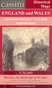
Map No. 192, Exeter and Sidmouth, in the Ordnance Survey Landranger series at 1:50, 000, including Exmouth, Teignmouth, Dawlish, Budleigh Salterton, Seaton, Ottery St. Mary, Honiton, Little Silver, Willand, Blackborough, Yarcombe, Upottery, Bickleigh, Cullompton, Luppitt, Stockland, Bradninch, Brampton Speke, Silverton, Clyst Hydon, Dalwood, Newton St. Cyres, Talaton, Broadclyst, Feniton, Whimple, Northleigh, Colyton, Rockbeare, West Hill, Newton Poppleford, Beer, Woodbury, Otterton, Lympstone, Topsham, Shillingford St. George, Kennford, Kenton, Starcross, Ideford, and Kingsteignton, with the Exe estuary and a section of the South West Coast Path. Edition C4; Revised 1997; Revised for selected changes 1999, 2001, 2003, 2004; Copyright date
2008 This title is also available on our website in a waterproof and tear-resistant version.Maps in this series are only published folded. Stanfords can also print flat versions of Ordnance Survey maps through the OS Select system, centring the map on a location of your choice and with a picture provided by you on the cover. For more information please click on the link at the bottom of this description.About Ordnance Survey
RIP - This product is no longer available on our network. It was last seen on 25.09.2019

This page now acts as a permanent archive for this product. Add more information using the comments box below to ensure it can still be found by future generations.

Use our search facility to see if it is available from an alternative contributor.
  • Availability: Out Of Stock
  • Supplier: Stanfords
  • SKU: 9780319231395
Availability: In Stock
£5.59

Product Description

Map No. 192, Exeter & Sidmouth, in the Ordnance Survey Landranger series at 1:50, 000, including Exmouth, Teignmouth, Dawlish, Budleigh Salterton, Seaton, Ottery St. Mary, Honiton, Little Silver, Will&, Blackborough, Yarcombe, Upottery, Bickleigh, Cullompton, Luppitt, Stockl&, Bradninch, Brampton Speke, Silverton, Clyst Hydon, Dalwood, Newton St. Cyres, Talaton, Broadclyst, Feniton, Whimple, Northleigh, Colyton, Rockbeare, West Hill, Newton Poppleford, Beer, Woodbury, Otterton, Lympstone, Topsham, Shillingford St. George, Kennford, Kenton, Starcross, Ideford, & Kingsteignton, with the Exe estuary & a section of the South West Coast Path. Edition C4; Revised 1997; Revised for selected changes 1999, 2001, 2003, 2004; Copyright date 2008 This title is also available on our website in a waterproof & tear-resistant version. Maps in this series are only published folded. Stanfords can also print flat versions of Ordnance Survey maps through the OS Select system, centring the map on a location of your choice & with a picture provided by you on the cover. For more information please click on the link at the bottom of this description. About Ordnance Survey

Reviews/Comments

Add New

Price History

Vouchers

No voucher codes found.
Do you know a voucher code for this product or supplier? Add it to Insights for others to use.

Facebook

Jargon Buster

Silver - A colour based on the colour of the metal
Silver - A chemical element, metalic. Has the highest elctrical conductance of any element. Also known for its exceptional anitmicrobal properties
Date - A day on a calendar
Date - A social activity whith a current or potential partner
Waterproof - Resistant to water, usualy specified by depth in metres
Resistant - Something that can repel against something.
Print - A mechanical process of putting text onto paper. It can also relate to a pattern on an item.

Supplier Information

Stanfords
Stanfords was established in 1853 and opened their iconic Covent Garden flagship store in 1901. They have become the top retailer of maps, travel books and accessories in the UK and arguably offer the largest selection of maps and travel books worldwide. Famous names such as Captain Robert Falcon Scott, Ranulph Fiennes and Michael Palin have purchased from Stanfords. They now have a shop in Bristol and both stores together with other venues operate a calendar of events including talks, book signings and exhibitions. As a specialist map retailer, the map selection is comprehensive and includes road maps, street maps and walking maps from worldwide destinations, as well as a selection of world atlases and wall maps. Books include travel guides and travel literature. Stanfords also stock globes, from miniatures made of blue marble to magnificent floor-standing globes. The website features a selection of interesting articles on travel topics.
Page Updated: 2023-11-12 20:15:36

Community Generated Product Tags

Oh No! The productWIKI community hasn't generated any tags for this product yet!
Menu