
 United Kingdom
 France
 Germany
 Netherlands
 Sweden
 USA
USA
 Italy
Italy
 Spain
Spain
More From Contributor


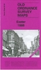

Exeter 1888 (Colour Edition)
Exeter in 1888 in a fascinating series of reproductions of old Ordnance Survey plans in the Alan Godfrey Editions, ideal for anyone interested in the history of their neighbourhood or family. Selected towns in Great Britain and Ireland are covered by maps showing the extent of urban development in the last decades of the 19th and early 20th century.In this title: two versions of this detailed map are available, covering most of central Exeter and its eastern suburbs and stretching from Bonhay Road eastward to Cemetery Road, and from Prospect Park southward to Commercial Road and Friars Green. Features include LSWR railway with Queen Street (now Central) station, Cathedral, Exe Island, city centre with individual buildings neatly shown, Lower Cemetery (disused), Mount Dinham,
Headweir Mills, Bull Meadow, Royal Devon & Exeter Hospital, Mount Radford, Exeter Castle, Town Barracks, St Michael & All Angels church, Brewery, schools, St Matthew's church, Eye Infirmary, Lower Market, Allhallows church, St David's church, Bury Meadow, Higher Market, Exeter Diocesan Training College, Workhouse, Newtown area, Polsloe Park, Polsloe Priory area, Belmont Leisure Ground, St Sidwell's church, chapels, Lion's Holt, Reformatory for Girls, etc. (note that St David's station is off the map.) Each maps includes extracts from an early street directory. The 1888 version is colour printed, taken from the Ordnance Survey's beautiful handcoloured First Edition. About the Alan Godfrey Editions of the 25
Headweir Mills, Bull Meadow, Royal Devon & Exeter Hospital, Mount Radford, Exeter Castle, Town Barracks, St Michael & All Angels church, Brewery, schools, St Matthew's church, Eye Infirmary, Lower Market, Allhallows church, St David's church, Bury Meadow, Higher Market, Exeter Diocesan Training College, Workhouse, Newtown area, Polsloe Park, Polsloe Priory area, Belmont Leisure Ground, St Sidwell's church, chapels, Lion's Holt, Reformatory for Girls, etc. (note that St David's station is off the map.) Each maps includes extracts from an early street directory. The 1888 version is colour printed, taken from the Ordnance Survey's beautiful handcoloured First Edition. About the Alan Godfrey Editions of the 25
Product Description
Reviews/Comments
Add New
Intelligent Comparison
Archived Product
Exeter 1888 (Colour Edition) Stanfords
£4.50
Archived Product
Bath 1883 (Colour Edition) Stanfords
£4.50
Archived Product
Hereford 1885 (Colour Edition) Stanfords
£3.50
Archived Product
Dudley 1882 (Colour Edition) Stanfords
£2.95
Archived Product
Edgbaston 1887 (Colour Edition) Stanfords
£2.95
Archived Product
Newton Heath 1889 (Colour Edition) Stanfords
£2.95
Archived Product
Paisley 1858 (Colour Edition) Stanfords
£2.95
Archived Product
West Bromwich 1886 (Colour Edition) Stanfords
£4.50
Vouchers
No voucher codes found.
Do you know a voucher code for this product or supplier? Add it to Insights for others to use.
Do you know a voucher code for this product or supplier? Add it to Insights for others to use.
 Denmark