
 United Kingdom
 France
 Germany
 Netherlands
 Sweden
 USA
USA
 Italy
Italy
 Spain
Spain
More From Contributor


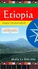


Ethiopia
Ethiopia at 1:1, 600, 000 on an indexed map from Daunpol, with more names of smaller towns or villages than shown on other maps of the country, enlargements for the Omo Valley and north-east Tigray, plus additional tourist information from the Addis Ababa-based Timeless Ethiopia Tour.The map covers Ethiopia with most of Eritrea, Djibouti and the Somaliland state/region of Somalia. Bold altitude colouring with relief shading, spot heights and graphics for swamps, deserts and seasonal rivers and lakes shows the topography. National parks are prominently highlighted. Road network indicates unpaved roads, gives distances on main routes and shows locations of petrol stations and border crossings. Railway lines are included and domestic airports are marked. Symbols indicate various places
of interest including the UNESCO World Heritage sites and locations with campsites and/or tourist accommodation. Latitude and longitude lines are drawn at 1
of interest including the UNESCO World Heritage sites and locations with campsites and/or tourist accommodation. Latitude and longitude lines are drawn at 1
Product Description
Reviews/Comments
Add New
Vouchers
No voucher codes found.
Do you know a voucher code for this product or supplier? Add it to Insights for others to use.
Do you know a voucher code for this product or supplier? Add it to Insights for others to use.
 Denmark