
 United Kingdom
 France
 Germany
 Netherlands
 Sweden
 USA
USA
 Italy
Italy
 Spain
Spain
More From Contributor


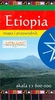


Ethiopia
Ethiopia at 1:2, 000, 000 on an indexed map from ITMB, with a street plan of central Addis Ababa, climate map, and brief notes annotating various places of interest. Topography is shown by altitude coluring in metres but with colour bands based on feet (e.g. 915m to 1525m). Peak heights are given in both metres and feet. Graphics indicate salt lakes and salt pans, wetlands and swamps, oasis and water wells. National parks and other protected areas are highlighted.Road network includes seasonal tracks and oxcart paths, with locations of petrol stations, border crossings, plus intermediate driving distances on main routes. Local airports are marked. Symbols indicate campsites and locations with other types of tourist accommodation, various places of interest, etc. Also marked are
internal administrative boundaries with names of the provinces. The map has latitude and longitude at intervals of 1
internal administrative boundaries with names of the provinces. The map has latitude and longitude at intervals of 1
Product Description
Reviews/Comments
Add New
Intelligent Comparison
Archived Product
Ethiopia Stanfords
£9.95
Archived Product

Ethiopia Stanfords
£9.99
Archived Product

Ethiopia Stanfords
£17.99
Vouchers
No voucher codes found.
Do you know a voucher code for this product or supplier? Add it to Insights for others to use.
Do you know a voucher code for this product or supplier? Add it to Insights for others to use.
 Denmark