
 United Kingdom
 France
 Germany
 Netherlands
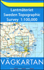
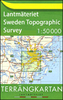
 Sweden
 USA
USA
 Italy
Italy
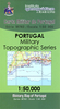
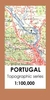
 Spain
Spain
More From Contributor


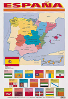
España Wall Map
España from Schofield & Sims – bright, decorative and very colouful laminated wall map at 1:2, 857, 000 approx, showing the division of Spain into its administrative regions and illustrated with regional flags.Each administrative region is presented in a contracting bright colour and shows its main cities. Canary Islands are included as an inset. Under the map is a panel showing the capital of each region and the regional flag.The map is printed on thick, high quality paper and laminated on both sides. It will not crinkle in humid conditions (but is not damp-proof) and can be written on with suitable marker pens without damaging the surface.*LAMINATED and ENCAPSULATED WALL MAPS:*- *laminated* wall maps have a thin layer of plastic usually applied to the printed side only. They can be
written on with suitable marker pens without any damage to the map but, unless laminated on both sides, they are not damp-proof.- *encapsulated* wall maps are sealed between two sheets of plastic. They are more rigid and heavier than laminated maps of the same size. They are damp-proof and do not crinkle in humid conditions. Encapsulation gives the map a shiny surface, similar to being displayed behind glass.- *please note:* many publishers and retailers often use these two terms interchangeably. Our map titles and descriptions follow the definitions provided above.
written on with suitable marker pens without any damage to the map but, unless laminated on both sides, they are not damp-proof.- *encapsulated* wall maps are sealed between two sheets of plastic. They are more rigid and heavier than laminated maps of the same size. They are damp-proof and do not crinkle in humid conditions. Encapsulation gives the map a shiny surface, similar to being displayed behind glass.- *please note:* many publishers and retailers often use these two terms interchangeably. Our map titles and descriptions follow the definitions provided above.

Product Description
Reviews/Comments
Add New
Vouchers
No voucher codes found.
Do you know a voucher code for this product or supplier? Add it to Insights for others to use.
Do you know a voucher code for this product or supplier? Add it to Insights for others to use.
 Denmark