
 United Kingdom
 France
 Germany
 Netherlands
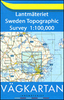
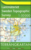
 Sweden
 USA
USA
 Italy
Italy
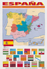
 Spain
Spain
More From Contributor


Eskimo (Inuktitut) Dictionary
The Inuktitut dialect of Inuit, a member of the Eskimo-Aleut language family, is spoken by over 30, 000 natives of eastern Canada, including Quebec and Nunavut. It is easily understood throughout the Inuit communities of Canada, Greenland, and northern Alaska. This unique dictionary encompasses almost every word spoken by the Inuit peoples of North America, including a good many ways to say snow, though fewer than rumoured. Care had been taken to include terms unique to particular Inuit communities. Readers will also find special grammar appendices, a introduction to the language's writing system, and sections with family terms and geographic names. All entries have been romanised for easy use.
Product Description
Reviews/Comments
Add New
Vouchers
No voucher codes found.
Do you know a voucher code for this product or supplier? Add it to Insights for others to use.
Do you know a voucher code for this product or supplier? Add it to Insights for others to use.
 Denmark