More From Contributor

£19.99
In this atlas the authors have brought together, in accessible form, a set of maps which portray a vivid picture of the physical environment of the British Isles. Each set of maps is accompanied by text that explains the nature & causes of the patterns that can be observed. The contents are broadly based, covering the geology, geomorphology, hydrology, climatolgoy, soils, biogeography, & seas of the British Isles & the human impact on each of these aspects. The maps are as uncomplicated as the subject matter allows & the text is designed to be accessible to a wide range of readers. The book was prepared to celebrate the centenary of the Geographical Assocation. From it emerges a remarkable picture of the physical landscape. Together with its companion volume, Britiain in the 1990s: A Social & Economic Atlas, it provides a comprehensive overview of the British Isles. ...
Archived Product
£20.50
Les Environs de Gap à pied, FFRP topo-guide ref. no. P051, one of the titles in an extensive series of light, A5-size, high quality paperback guides published by the Fédération Française de la Randonnée Pédestre in association with local authorities, ramblers’ clubs, etc. The guides have *colour extracts from the French topographic survey at 1:25, 000 or 1:50, 000 overprinted with local hiking routes*. Each guide offers a selection of day walks of different length & difficulty of terrain, all clearly graded. * Several titles also include a section of a long-distance GR route or a shorter GRP (GR de Pays) route or circuit.* The descriptions provide information on various places of interest along the routes & directions for special points marked on the accompanying maps. * All the text is in French*, but there is also a fair amount of information conveyed by symbols: waymarking, parking facilities, villages with local shops, cafes & restaurants, etc. Most guides have numerous colour photos & drawings of local flora & fauna. Guides with day walks are indicated on the accompanying series grid by yellow, blue or green boxes.* In this guide:* 46 day walks fro one & a half to seven hours long, mainly north of Gap. ...
Archived Product
£20.50
Environs de Lyon à pied, FFRP Topo-guide No. RE20, with 41 day walks of varying length & difficulty all accessible within a 60min journey from Lyon on the regional train network (TER). Current edition of this title was published in March 2016. To see the list of other FFRP guides with day walks please click on the series link.ABOUT THE FFRP (Fédération française de la randonnée pédestre) TOPOGUIDES: published in a handy A5 paperback format, the guides are the best companions for hiking in France. In addition to their topo-guides to the long-distance GR routes FFRP also publish an extensive range of guides with local day walks. Each walk in presented on a colour extract from IGN`s 1:50, 000 or 1:25, 000 topographic survey mapping overprinted with the route, with important points cross-referenced to the accompanying text, in French only, placed on the adjoining page. For each walk the guides also indicate the degree of difficulty & provide information on length, time & change in altitude, waymarking signs, access by road & parking facilities. An “info practiques” section of the guide indicates where shops, restaurants & accommodation can be found. The guides are published on high quality paper & include descriptions of the most interesting aspects of the surrounding region: historical & cultural sites, local specialties, fauna & flora, etc, all illustrated with colour photos. ...
Archived Product
£15.99
The environs of Hamburg Cycling Atlas at 1:75, 000 in a series of handy size spiral bound atlases from Verlag Esterbauer, Europe’s leading publishers of cycling maps. Cycling atlases from Verlag Esterbauer have a map legend which

Includes::
English &, although ALL THE TEXT IN THESE GUIDES IS IN GERMAN ONLY, information provided on the maps is sufficient to use them without any knowledge of German, particularly in the absence of similar products in English from other publishers. Please click on our sample image to see an extract from the map legend. Each atlas

Includes::
a selection of local cycling routes & tours, presented on clear, easy to follow maps. The overprint highlighting the routes indicates road surface & density of motorized traffic. Gradients, intermediate distances, danger points, & roads closed to cyclists are marked & route profiles show the degree of difficulty for each cycle path. A wide range of symbols indicate everything from covered & lockable bicycle stands, repair workshops & bike rentals to viewpoints, nature parks, leisure & sport centres, local shopping facilities, emergency services, etc. The guides also give opening hours of museums & other local places of interest. A separate section at the end of each guide list accommodation addresses with phone numbers. To see other titles in this series please click on the series link.


...
Archived Product
£5.99
The MICHELIN zoom map Environs of Parisis the ideal travel companion to fully explore Paris & its surrounding areas, thanks to its easy-to-use format & its scale of 1/100, 000.

Includes::
Senlis, Compiegne, Fontainbleau, Chartres, Vernon The Zoom collection are characterized by the high precision of their detailed scale, specially adapted for very touristy areas or with a high density road network, including new developments & industrial areas. In addition to clarity, reliability & up-to-date information, all Michelin cartography features include a wealth of practical information: places & monuments of tourist interest, picturesque tours, areas for sports & leisure activities... Useful plans of cities & a practical index of localities. Also the maps contain places of interest & signposting of tracks for bicycles & greenways.

...
Archived Product
£14.99
850km of cycling routes in the area around Vienna presented at various scales by Verlag Esterbauer. All the text is in GERMAN only but extensive map legend

Includes::
English, as shown on our sample image. Please note: unlike other guides in this series of cycling atlases of Austrian regions, this title does not list accommodation facilities. Esterbauer’s Bikeline guides in this series can be used without any knowledge of German, particularly in the absence of similar products in English from other publishers. Each atlas

Includes::
a selection of local cycling routes & tours, presented on clear, easy to follow maps. The overprint highlighting the routes indicates road surface & density of motorized traffic. Gradients, intermediate distances, danger points & roads closed to cyclists are marked, & route profiles show the degree of difficulty for each cycle path. A wide range of symbols indicate everything from covered & lockable bicycle stands, repair workshops & bike rentals to viewpoints, nature parks, leisure & sport centres, local shopping facilities, emergency services, etc. The guides also give opening hours of museums & other local places of interest. A separate section at the end of each guide lists accommodation addresses with phone numbers. To see other titles in this series please click on the series link.


...
Archived Product
£10.25
Cycle routes along the valleys of the upper Enz & the Nagold to Pforzheim, & then along the Enz to the Neckar. Detailed maps show the route & its variants & extensive information is conveyed by symbols, indicating road surface, campsites & other accommodation, repair workshops, recreational facilities, places of interest, etc. A list of various types of accommodation facilities is included.IMPORTANT
- PLEASE NOTE: ALL THE TEXT IN THIS TITLE IS GERMAN ONLY. MAP LEGEND

Includes::
ENGLISH, please see our sample image, & the information provided on the maps is sufficient to use this title without any knowledge of German, particularly in the absence of a similar product in English from other publishers. There is currently no English edition this title available in this series. About the series: All the titles have been meticulously researched & are highly regarded in their native Germany. Most titles, as indicated in their individual descriptions, also include a separate section listing selected accommodation, from hotels to campsites, youth hostels & rooms in private houses, all with addresses, telephone numbers & price range. Information on towns along each route

Includes::
a list of places of interest, with opening hours, etc. Several of the guides also have street plans.


...
Archived Product
£11.50
Topographic survey of France at 1:25, 000 in IGN`s excellent TOP25 / Série Bleue series. All the maps are GPS compatible, with a 1km UTM grid plus latitude & longitude lines at 5’ intervals. Contours are at 5m intervals except for mountainous areas where the maps have contours at 10m intervals, vividly enhanced by hill shading & graphics for rocky terrain. Colouring with graphics indicates different types of vegetation or land use (deciduous or coniferous forests, moors, orchards, vineyards, etc). PLEASE NOTE: coverage of France at this scale is currently being revised – the format & the presentation of each title are indicated by the letters at the end of its Sheet Reference number (e.g. 0416ET, 3531ETR, 1923SB, etc.)MAPS WITH FULL TOURIST OVERPRINT & AN ENGLISH MAP LEGEND: all TOP25 maps & the SB editions of Série Bleue have an overprint highlighting waymarked walking trails including long-distance GR routes &, where appropriate, ski routes. Symbols indicate campsites, gîtes d’etape, refuges, equestrian centres & other recreational facilities or sites, tourist information centres, cultural heritage, etc. Towns & locations of particular interest are highlighted.- ET or OT = single-sided TOP25 map covering approx. 29x 21 km / 18x 13 miles.- ETR or OTR = waterproof & tear resistant TOP25 map covering the same area as the corresponding ET or OT number, but double-sided, printed on a smaller size sheet with a good overlap between the sides.- SB = Série Bleue map with full tourist overprint; these maps, first introduced in summer 2014, each cover approx. 29x 24km / 18x 15 miles.SÉRIE BLEUE maps with numbers ending in E (Est) or O (Ouest): most editions now indicate the GR routes, but do not show any other tourist information. Map legend is in French only. Each map covers approx. 14x 20km / 9x 12 miles. ...
Archived Product
£9.99
This is a collection of 15 accounts of expeditions to the world`s most famous peaks, often in appalling conditions. It


...
Archived Product
£24.99
Buckle up for the next installment in our ` Epic` series & the follow-up to Epic Bike Rides of the World. Epic Drives of the World, a beautiful hardback, showcases 50 of the greatest road trips on Earth, from classic routes in America, Australia & Europe, to incredible adventures in Asia & Africa. Organised by continent, each route features a first-hand account, awe-inspiring photographs, illustrated maps & practical advice on when to go, how to get there, where to stay & what to eat. From Hawaii`s Hana Highway & Vietnam`s Ho Chi Minh Road, to Utah`s National Park Circuit & Germany`s Black Forest High Road, Epic Drives of the World will inspire any motorist to hit the open road. African & Middle East drives include:- The self-drive Safari (Zambia)- Crossing the Kalahari (Botswana)- Passing over the Panorama Route (South Africa)- Marrakesh to Taroudannt (Morocco)- Cruising Clarence Drive (South Africa) The Americas drives include:- The Highway to Hana in Hawaii (USA)- The Salar de Uyuni (Bolivia)- The Pacific Coast Highway (USA)- Crossing the Carretera Austral (Chile)- Canada`s Icefields Parkway Asia drives include:- On the trail of Ho Chi Minh (Vietnam)- Crossing the Kathmandu Loop (Nepal)- Hightailing from Thimphu to Gangtey (Bhutan)- South Korea: From top to toe- The road from Srinagar to Manali (India) Europe drives include:- Black Forest High Road (Germany)- The Wilds of Abruzzo (Italy)- Croatia`s Adriatic coast- Norway`s west coast- The Magic Circle (Ireland) Oceania drives include:- Southern Alps explorer (New Zealand)- The Great Ocean Road (Australia)- Northland & the Bay of Islands (New Zealand)- Following the Captain Cook Highway (Australia)- Alice Springs to Darwin (Australia) ...
Archived Product

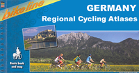
Environs Of Stuttgart Cycling Atlas

Environs of Stuttgart Cycling Atlas in a series of handy size spiral bound atlases from Verlag Esterbauer, Europe’s leading publishers of cycling maps. The atlas covers cycling routes in the environs of the city, including the northern part of the Black Forest.Cycling atlases from Verlag Esterbauer have a map legend which includes English and, although ALL THE TEXT IN THESE GUIDES IS IN GERMAN ONLY, information provided on the maps is sufficient to use them without any knowledge of German, particularly in the absence of similar products in English from other publishers. Please click on our sample image to see an extract from the map legend.Each atlas includes a selection of local cycling routes and tours, presented on clear, easy to follow maps. The overprint highlighting the
routes indicates road surface and density of motorized traffic. Gradients, intermediate distances, danger points, and roads closed to cyclists are marked and route profiles show the degree of difficulty for each cycle path. A wide range of symbols indicate everything from covered and lockable bicycle stands, repair workshops and bike rentals to viewpoints, nature parks, leisure and sport centres, local shopping facilities, emergency services, etc. The guides also give opening hours of museums and other local places of interest. A separate section at the end of each guide list accommodation addresses with phone numbers.To see other titles in this series please click on the series link.
RIP - This product is no longer available on our network. It was last seen on 25.09.2019

This page now acts as a permanent archive for this product. Add more information using the comments box below to ensure it can still be found by future generations.

Use our search facility to see if it is available from an alternative contributor.
  • Availability: Out Of Stock
  • Supplier: Stanfords
  • SKU: 9783850002400
Availability: In Stock
£14.99

Product Description

Environs of Stuttgart Cycling Atlas in a series of handy size spiral bound atlases from Verlag Esterbauer, Europe’s leading publishers of cycling maps. The atlas covers cycling routes in the environs of the city, including the northern part of the Black Forest. Cycling atlases from Verlag Esterbauer have a map legend which

Includes::
English &, although ALL THE TEXT IN THESE GUIDES IS IN GERMAN ONLY, information provided on the maps is sufficient to use them without any knowledge of German, particularly in the absence of similar products in English from other publishers. Please click on our sample image to see an extract from the map legend. Each atlas

Includes::
a selection of local cycling routes & tours, presented on clear, easy to follow maps. The overprint highlighting the routes indicates road surface & density of motorized traffic. Gradients, intermediate distances, danger points, & roads closed to cyclists are marked & route profiles show the degree of difficulty for each cycle path. A wide range of symbols indicate everything from covered & lockable bicycle stands, repair workshops & bike rentals to viewpoints, nature parks, leisure & sport centres, local shopping facilities, emergency services, etc. The guides also give opening hours of museums & other local places of interest. A separate section at the end of each guide list accommodation addresses with phone numbers. To see other titles in this series please click on the series link.

Reviews/Comments

Add New

Intelligent Comparison

Oooops!
We couldn't find anything!
Perhaps this product's unique.... Or perhaps we are still looking for comparisons!
Click to bump this page and we'll hurry up.

Price History

Vouchers

No voucher codes found.
Do you know a voucher code for this product or supplier? Add it to Insights for others to use.

Facebook

Jargon Buster

Black - A colour which does not emit any colour of the spectrum. Black absorbs all frequencies of the spectrum.
Forest - A area with a high density of trees
phone - Short for telephone. A device that transmits sound allowing point to point communication over long distances
Size - is the measurement of how big an object is in space.
Road - a manmade lane or a path that is used to speed up travel.
Wide - Something with a large width.
Accommodation - A room in which someone can live in, for example in a hotel
Degree - An angle measurement, also can be the measurement of an extent that something happens, can also relate to an university academic measurement.
degree - The extremity of something or the angle. Can also relate to a university achievement.

Supplier Information

Stanfords
Stanfords was established in 1853 and opened their iconic Covent Garden flagship store in 1901. They have become the top retailer of maps, travel books and accessories in the UK and arguably offer the largest selection of maps and travel books worldwide. Famous names such as Captain Robert Falcon Scott, Ranulph Fiennes and Michael Palin have purchased from Stanfords. They now have a shop in Bristol and both stores together with other venues operate a calendar of events including talks, book signings and exhibitions. As a specialist map retailer, the map selection is comprehensive and includes road maps, street maps and walking maps from worldwide destinations, as well as a selection of world atlases and wall maps. Books include travel guides and travel literature. Stanfords also stock globes, from miniatures made of blue marble to magnificent floor-standing globes. The website features a selection of interesting articles on travel topics.
Page Updated: 2023-11-12 20:15:36

Community Generated Product Tags

Oh No! The productWIKI community hasn't generated any tags for this product yet!
Menu