More From Contributor
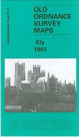
£6.50
Topographic coverage of mainland Spain at 1:25, 000 published by the Centro Nacional de Información Geograficá, the country’s civilian survey organization. The maps have contours at 10m intervals & colouring and/or graphics to show different types of vegetation or land use. Boundaries of national parks & other protected areas are marked. In addition to all the usual information shown on topographic maps at this scale, detailed presentation of the road & rail networks, rural tracks & paths, etc, the maps also show campsites. The maps have a 1-km UTM grid, with margin ticks for latitude & longitude at 1` intervals. Map legend is in Spanish only.PLEASE NOTE: our grid for the whole of Spain is in preparation
- in the meantime, for areas other than those shown on the attached grid please use CNIG’s topographic survey at 1:50, 000 by searching for ‘SI00000832’. Each 25K map covers one quarter of the corresponding 50K map, with the numbering system: I = NW quarter, II = NE quarter, III = SW quarter & IV = SE quarter. CNIG maps in the Provincial Road Maps series at 1:200, 000 are overprinted with the grid for the 1:50, 000 survey & can be used to see the area covered by each 50K or 25K title in more detail. To see the list of titles in this series please click on the series grid
- for map numbers not yet listed on our website please contact us by email.

...
Archived Product
£6.39
A detailed topographic map of Ely & Newmarket from the Ordnance Survey Explorer series, covering Mildenhall & Soham. Edition A1; Publication date April 2006 About this series: These highly detailed maps show all the administrative boundaries, settlements as small as isolated farms, the road network down to unfenced roads & country tracks, & field boundaries (hedges & drystone walls) which make navigation across the countryside much easier. Steep gradients on roads are indicated. Various landmarks, e.g. powerlines, archaeological sites, windmills, churches & lighthouses are shown & additional graphics indicate natural terrain features such as cliffs, scree, mud & vegetation variations. The contour interval is 5 metres in the lower parts of the country & 10 metres in the uplands, & spot heights are marked. Each map covers an area of 30 x 20km (i.e. approx. 19 x 12 miles), with some double-sided maps covering more, as indicated in the individual descriptions. The maps are fully GPS compatible, with the National Grid shown at 1km intervals & latitude & longitude indicated by margin ticks at 1'. The Explorer series has replaced the earlier, green-cover Pathfinder maps. The Explorer series is now complete & covers all of Engl&, Wales & Scotl&. Some sheets for popular areas like the National Parks are still branded as Outdoor Leisure (OL) maps, but are now included in this series as the cartography is the same as that in the Explorer Maps. The Explorer maps offer a substantial improvement on the Pathfinder series, with greater use of colour, larger area per map, & stronger emphasis on information for ramblers & tourists. This series is ideal for walking & other outdoor pursuits & each map shows a large amount of information for ramblers & tourists. Public rights of way are shown (except in Scotland), together with other routes with public access: National Trails & Recreational Paths, permitted paths & bridleways, & selected cycle routes. Open access land created under the Countryside & Rights of Way Act 2000 is marked. Tourist information

Includes::
caravan & camp sites, Park & Ride locations, recreation/leisure/sport centres, museums, historic buildings, English Heritage & National Trust sites, rural pubs, etc. The map legend is in English only, except for the tourist information content which is also in French & German.

...
Archived Product
£14.99
Ely, Newmarket, Mildenhall & Soham area on a detailed topographic & GPS compatible map No. 226, waterproof version, from the Ordnance Survey’s 1:25, 000 Explorer series. MOBILE DOWNLOADS: this title & all the other OS Explorer maps include a code for downloading after purchase the digital version onto your smartphone or tablet for viewing on the OS smartphone app.OS EXPLORER SERIES: to see the list of all the titles in the OS Explorer series, both paper & waterproof versions, please click on the series link. The Explorer series, Ordnance Survey’s most detailed maps recommended for anyone enjoying outdoor activities, provides topographic coverage of Great Britain at 1:25, 000 on GPS compatible maps with hiking trails, cycling routes & extensive tourist information. Each printed map is available either on paper or as a waterproof & tear-resistant OS Active Map, as indicated in its title. Britain’s National Parks & other areas of particular tourist interest are presented on often double-sided OL (Outdoor Leisure) maps, whilst most standard format Explorers cover an area of 30 x 20km (approx. 19 x 12 miles). All three versions (paper, waterproof & digital) are the same & provide plenty of recreational & tourist information, indicating the traditional public right of way paths (except in Scotland where different laws apply), including bridleways & byways. National Trails & other long-distance paths are marked, as well as permissive footpaths or bridleways & on-road or traffic-free cycle routes with, where appropriate, their National/ Regional Cycle Network numbers. Boundaries of access land are clearly marked. A wide range of symbols provides additional tourist information, highlighting camping & caravanning sites, information offices & visitors’ centres, parking & picnicking places, country pubs, sport & recreational facilities including cycle hire locations & mountain biking trails, historic buildings & museums, etc. Exceptionally clear presentation of the landscape is provided by contours at 5m or in the uplands at 10m intervals, with additional spot heights plus colouring and/or graphics for different types of woodlands, orchards, heath, marshl&, scree or boulders, & other topographic features. For GPS users the maps have British National Grid lines at 1km intervals, with latitude & longitude given by margin ticks at 1`. Clearly laid out map legend

Includes::
French & German translations for the tourist information symbols.

...
Archived Product
£8.99
Ely, Newmarket, Mildenhall & Soham area on a detailed topographic & GPS compatible map No. 226, paper version, from the Ordnance Survey’s 1:25, 000 Explorer series. MOBILE DOWNLOADS: this title & all the other OS Explorer maps include a code for downloading after purchase the digital version onto your smartphone or tablet for viewing on the OS smartphone app.OS EXPLORER SERIES: to see the list of all the titles in the OS Explorer series, both paper & waterproof versions, please click on the series link. The Explorer series, Ordnance Survey’s most detailed maps recommended for anyone enjoying outdoor activities, provides topographic coverage of Great Britain at 1:25, 000 on GPS compatible maps with hiking trails, cycling routes & extensive tourist information. Each printed map is available either on paper or as a waterproof & tear-resistant OS Active Map, as indicated in its title. Britain’s National Parks & other areas of particular tourist interest are presented on often double-sided OL (Outdoor Leisure) maps, whilst most standard format Explorers cover an area of 30 x 20km (approx. 19 x 12 miles). All three versions (paper, waterproof & digital) are the same & provide plenty of recreational & tourist information, indicating the traditional public right of way paths (except in Scotland where different laws apply), including bridleways & byways. National Trails & other long-distance paths are marked, as well as permissive footpaths or bridleways & on-road or traffic-free cycle routes with, where appropriate, their National/ Regional Cycle Network numbers. Boundaries of access land are clearly marked. A wide range of symbols provides additional tourist information, highlighting camping & caravanning sites, information offices & visitors’ centres, parking & picnicking places, country pubs, sport & recreational facilities including cycle hire locations & mountain biking trails, historic buildings & museums, etc. Exceptionally clear presentation of the landscape is provided by contours at 5m or in the uplands at 10m intervals, with additional spot heights plus colouring and/or graphics for different types of woodlands, orchards, heath, marshl&, scree or boulders, & other topographic features. For GPS users the maps have British National Grid lines at 1km intervals, with latitude & longitude given by margin ticks at 1`. Clearly laid out map legend

Includes::
French & German translations for the tourist information symbols.

...
Archived Product
£11.19
Laminated waterproof edition of a detailed topographic map of Ely & Newmarket from the Ordnance Survey Explorer series, covering Mildenhall & Soham. Edition A1; Publication date November 2006 About this series: These highly detailed maps show all the administrative boundaries, settlements as small as isolated farms, the road network down to unfenced roads & country tracks, & field boundaries (hedges & drystone walls) which make navigation across the countryside much easier. Steep gradients on roads are indicated. Various landmarks, e.g. powerlines, archaeological sites, windmills, churches & lighthouses are shown & additional graphics indicate natural terrain features such as cliffs, scree, mud & vegetation variations. The contour interval is 5 metres in the lower parts of the country & 10 metres in the uplands, & spot heights are marked. Each map covers an area of 30 x 20km (i.e. approx. 19 x 12 miles), with some double-sided maps covering more, as indicated in the individual descriptions. The maps are fully GPS compatible, with the National Grid shown at 1km intervals & latitude & longitude indicated by margin ticks at 1'. The Explorer series has replaced the earlier, green-cover Pathfinder maps. The Explorer series is now complete & covers all of Engl&, Wales & Scotl&. Some sheets for popular areas like the National Parks are still branded as Outdoor Leisure (OL) maps, but are now included in this series as the cartography is the same as that in the Explorer Maps. The Explorer maps offer a substantial improvement on the Pathfinder series, with greater use of colour, larger area per map, & stronger emphasis on information for ramblers & tourists. This series is ideal for walking & other outdoor pursuits & each map shows a large amount of information for ramblers & tourists. Public rights of way are shown (except in Scotland), together with other routes with public access: National Trails & Recreational Paths, permitted paths & bridleways, & selected cycle routes. Open access land created under the Countryside & Rights of Way Act 2000 is marked. Tourist information

Includes::
caravan & camp sites, Park & Ride locations, recreation/leisure/sport centres, museums, historic buildings, English Heritage & National Trust sites, rural pubs, etc. The map legend is in English only, except for the tourist information content which is also in French & German.

...
Archived Product
£7.99
Map No. 143, Ely & Wisbech 1824-1836, in the Cassini Historical Series of old Ordnance Survey mapping of England & Wales at 1:50, 000 in a format designed to offer a convenient comparison with the present day coverage from the OS, & most locations in three different editions. Old historical maps have been combined so that the sheet lines correspond to the current Landranger series & reproduced with the scale changed from one inch to one mile to 1:50, 000. Most locations are covered by three separate maps, showing how the area has changed over the decades, with selected major cities also presented in a fourth edition. Old Series: the first detailed survey mapping dating for most areas from the first half of the 19th century, in black & white & with relief shown by hachuring. Revised New Series from 1880s/1900s, with some colouring & a mixture of hachuring & contour lines. Popular Edition from the inter-war years, with contour lines & colouring to indicate woodlands, parks, etc. New Popular Edition from the late 1940s, reproduced in the Cassini series for the major cities. Each map

Includes::
notes on the development of Ordnance Survey & the various series produced by them. For those interested in maps & cartography in general, the Cassini series also provides a fascinating insight into how Ordnance Survey cartographic style has developed over a period of over 100 years. Coverage in this title

Includes::
present day Downham Market, March, Chatteris, Wisbech St Mary, Murrow, Emneth, Stowbridge, St John


...
Archived Product
£9.99
Map No. 143, Ely & Wisbech 1824-1836, in the Cassini Historical Series of old Ordnance Survey mapping of England & Wales at 1:50, 000 in a format designed to offer a convenient comparison with the present day coverage from the OS, & most locations in three different editions. Old historical maps have been combined so that the sheet lines correspond to the current Landranger series & reproduced with the scale changed from one inch to one mile to 1:50, 000. Most locations are covered by three separate maps, showing how the area has changed over the decades, with selected major cities also presented in a fourth edition. * Old Series: the first detailed survey mapping dating for most areas from the first half of the 19th century, in black & white & with relief shown by hachuring.* Revised New Series from 1880s/1900s, with some colouring & a mixture of hachuring & contour lines.* Popular Edition from the inter-war years, with contour lines & colouring to indicate woodlands, parks, etc.* New Popular Edition from the late 1940s, reproduced in the Cassini series for the major cities. Each map

Includes::
notes on the development of Ordnance Survey & the various series produced by them. For those interested in maps & cartography in general, the Cassini series also provides a fascinating insight into how Ordnance Survey cartographic style has developed over a period of over 100 years. Coverage in this title

Includes::
present day Downham Market, March, Chatteris, Wisbech St Mary, Murrow, Emneth, Stowbridge, St John’s Fen End, Narborough, Marham, Watlington, Shouldham, Oxborough, Fincham, Outwell, Upwell, Friday Bridge, Guyhirn, Westry, Nordelph, Christchurch, Welney, Hilgay, Stoke Ferry, Northwold, Southery, Methwold, Feltwell, Hockwold cum Wilton, Lakenheath, Beck Row, Mildenhall, Isleham, Littleport, Wimblington, Little Downham, Coveney, Witchford, Mepal, Sutton, Haddenham Stretham & Earith, with the Bedford Level (South Level).* PLEASE NOTE: Stanfords can also print on request mapping from all four series *centring the map on a location of your choice.* For more information please click on the link below.


...
Archived Product
£14.99
Map No. 143, Ely & Wisbech 1824-1922 (3-map set), in the Cassini Historical Series of old Ordnance Survey mapping of England & Wales at 1:50, 000 in a format designed to offer a convenient comparison with the present day coverage from the OS, & most locations in three different editions. Old historical maps have been combined so that the sheet lines correspond to the current Landranger series & reproduced with the scale changed from one inch to one mile to 1:50, 000. Most locations are covered by three separate maps, showing how the area has changed over the decades, with selected major cities also presented in a fourth edition. Old Series: the first detailed survey mapping dating for most areas from the first half of the 19th century, in black & white & with relief shown by hachuring. Revised New Series from 1880s/1900s, with some colouring & a mixture of hachuring & contour lines. Popular Edition from the inter-war years, with contour lines & colouring to indicate woodlands, parks, etc. New Popular Edition from the late 1940s, reproduced in the Cassini series for the major cities. Each map

Includes::
notes on the development of Ordnance Survey & the various series produced by them. For those interested in maps & cartography in general, the Cassini series also provides a fascinating insight into how Ordnance Survey cartographic style has developed over a period of over 100 years. Coverage in this title

Includes::
present day Downham Market, March, Chatteris, Wisbech St Mary, Murrow, Emneth, Stowbridge, St John


...
Archived Product
£9.99
Map No. 143, Ely & Wisbech 1901, in the Cassini Historical Series of old Ordnance Survey mapping of England & Wales at 1:50, 000 in a format designed to offer a convenient comparison with the present day coverage from the OS, & most locations in three different editions. Old historical maps have been combined so that the sheet lines correspond to the current Landranger series & reproduced with the scale changed from one inch to one mile to 1:50, 000. Most locations are covered by three separate maps, showing how the area has changed over the decades, with selected major cities also presented in a fourth edition. * Old Series: the first detailed survey mapping dating for most areas from the first half of the 19th century, in black & white & with relief shown by hachuring.* Revised New Series from 1880s/1900s, with some colouring & a mixture of hachuring & contour lines.* Popular Edition from the inter-war years, with contour lines & colouring to indicate woodlands, parks, etc.* New Popular Edition from the late 1940s, reproduced in the Cassini series for the major cities. Each map

Includes::
notes on the development of Ordnance Survey & the various series produced by them. For those interested in maps & cartography in general, the Cassini series also provides a fascinating insight into how Ordnance Survey cartographic style has developed over a period of over 100 years. Coverage in this title

Includes::
present day Downham Market, March, Chatteris, Wisbech St Mary, Murrow, Emneth, Stowbridge, St John’s Fen End, Narborough, Marham, Watlington, Shouldham, Oxborough, Fincham, Outwell, Upwell, Friday Bridge, Guyhirn, Westry, Nordelph, Christchurch, Welney, Hilgay, Stoke Ferry, Northwold, Southery, Methwold, Feltwell, Hockwold cum Wilton, Lakenheath, Beck Row, Mildenhall, Isleham, Littleport, Wimblington, Little Downham, Coveney, Witchford, Mepal, Sutton, Haddenham Stretham & Earith, with the Bedford Level (South Level).* PLEASE NOTE: Stanfords can also print on request mapping from all four series *centring the map on a location of your choice.* For more information please click on the link below.


...
Archived Product
£9.99
Map No. 143, Ely & Wisbech 1920-1922, in the Cassini Historical Series of old Ordnance Survey mapping of England & Wales at 1:50, 000 in a format designed to offer a convenient comparison with the present day coverage from the OS, & most locations in three different editions. Old historical maps have been combined so that the sheet lines correspond to the current Landranger series & reproduced with the scale changed from one inch to one mile to 1:50, 000. Most locations are covered by three separate maps, showing how the area has changed over the decades, with selected major cities also presented in a fourth edition. * Old Series: the first detailed survey mapping dating for most areas from the first half of the 19th century, in black & white & with relief shown by hachuring.* Revised New Series from 1880s/1900s, with some colouring & a mixture of hachuring & contour lines.* Popular Edition from the inter-war years, with contour lines & colouring to indicate woodlands, parks, etc.* New Popular Edition from the late 1940s, reproduced in the Cassini series for the major cities. Each map

Includes::
notes on the development of Ordnance Survey & the various series produced by them. For those interested in maps & cartography in general, the Cassini series also provides a fascinating insight into how Ordnance Survey cartographic style has developed over a period of over 100 years. Coverage in this title

Includes::
present day Downham Market, March, Chatteris, Wisbech St Mary, Murrow, Emneth, Stowbridge, St John’s Fen End, Narborough, Marham, Watlington, Shouldham, Oxborough, Fincham, Outwell, Upwell, Friday Bridge, Guyhirn, Westry, Nordelph, Christchurch, Welney, Hilgay, Stoke Ferry, Northwold, Southery, Methwold, Feltwell, Hockwold cum Wilton, Lakenheath, Beck Row, Mildenhall, Isleham, Littleport, Wimblington, Little Downham, Coveney, Witchford, Mepal, Sutton, Haddenham Stretham & Earith, with the Bedford Level (South Level).* PLEASE NOTE: Stanfords can also print on request mapping from all four series *centring the map on a location of your choice.* For more information please click on the link below.


...
Archived Product

Ely 1901

Ely in 1901 in a fascinating series of reproductions of old Ordnance Survey plans in the Alan Godfrey Editions, ideal for anyone interested in the history of their neighbourhood or family. The map gives good coverage of the cathedral city of Ely at a time when the Isle of Ely was regarded as a separate county and Ely its county town (in 1909 the County Hall would be sited in March). The map is double-sided to provide maximum coverage. The main map covers the area from the cathedral southward to the station and dock, and westward to the workhouse. Features include engine shed, Cherry Hill, Ely College, Back Hill, Gaol Lane, Militia Barracks, Water Side, Broad Street, River Ouse, The Quay. On the reverse is a section of sheet 26.10, extending coverage of the town northward and
including High Street, St Mary`s Street, Nutholt Lane, Newbarns Road, cemetery, Little London, Market Place, Gaol Street. Also included is a list of private residents from the 1912 directory.About the Alan Godfrey Editions of the 25” OS Series:Selected towns in Great Britain and Ireland are covered by maps showing the extent of urban development in the last decades of the 19th and early 20th century. The plans have been taken from the Ordnance Survey mapping and reprinted at about 15 inches to one mile (1:4, 340). On the reverse most maps have historical notes and many also include extracts from contemporary directories. Most maps cover about one mile (1.6kms) north/south, one and a half miles (2.4kms) across; adjoining sheets can be combined to provide wider coverage.FOR MORE
INFORMATION AND A COMPLETE LIST OF ALL AVAILABLE TITLES PLEASE CLICK ON THE SERIES LINK.
RIP - This product is no longer available on our network. It was last seen on 25.09.2019

This page now acts as a permanent archive for this product. Add more information using the comments box below to ensure it can still be found by future generations.

Use our search facility to see if it is available from an alternative contributor.
  • Availability: Out Of Stock
  • Supplier: Stanfords
  • SKU: 9781841512198
Availability: In Stock
£3.50

Product Description

Ely in 1901 in a fascinating series of reproductions of old Ordnance Survey plans in the Alan Godfrey Editions, ideal for anyone interested in the history of their neighbourhood or family. The map gives good coverage of the cathedral city of Ely at a time when the Isle of Ely was regarded as a separate county & Ely its county town (in 1909 the County Hall would be sited in March). The map is double-sided to provide maximum coverage. The main map covers the area from the cathedral southward to the station & dock, & westward to the workhouse. Features include engine shed, Cherry Hill, Ely College, Back Hill, Gaol Lane, Militia Barracks, Water Side, Broad Street, River Ouse, The Quay. On the reverse is a section of sheet 26.10, extending coverage of the town northward & including High Street, St Mary`s Street, Nutholt Lane, Newbarns Road, cemetery, Little London, Market Place, Gaol Street. Also included is a list of private residents from the 1912 directory. About the Alan Godfrey Editions of the 25” OS Series: Selected towns in Great Britain & Ireland are covered by maps showing the extent of urban development in the last decades of the 19th & early 20th century. The plans have been taken from the Ordnance Survey mapping & reprinted at about 15 inches to one mile (1:4, 340). On the reverse most maps have historical notes & many also include extracts from contemporary directories. Most maps cover about one mile (1.6kms) north/south, one & a half miles (2.4kms) across; adjoining sheets can be combined to provide wider coverage.FOR MORE INFORMATION & A COMPLETE LIST OF ALL AVAILABLE TITLES PLEASE CLICK ON THE SERIES LINK.

Reviews/Comments

Add New

Price History

Vouchers

No voucher codes found.
Do you know a voucher code for this product or supplier? Add it to Insights for others to use.

Facebook

Jargon Buster

Contemporary - Modern era design
Engine - A machine designed to convert fuel into motion
Contemporary - A design reference to indicate post war modern design
water - A chemical substance. Chemical formula H2O.
History - Anything that happens in the past. An acedemic subject.
Road - a manmade lane or a path that is used to speed up travel.
Contemporary - An object that is living in the same time.
Hall - A room at the inside of an entrance of a house.
Ideal - Something that satisfies a perfect criteria.
Family - A group of people that live together made up from parents and children.

Supplier Information

Stanfords
Stanfords was established in 1853 and opened their iconic Covent Garden flagship store in 1901. They have become the top retailer of maps, travel books and accessories in the UK and arguably offer the largest selection of maps and travel books worldwide. Famous names such as Captain Robert Falcon Scott, Ranulph Fiennes and Michael Palin have purchased from Stanfords. They now have a shop in Bristol and both stores together with other venues operate a calendar of events including talks, book signings and exhibitions. As a specialist map retailer, the map selection is comprehensive and includes road maps, street maps and walking maps from worldwide destinations, as well as a selection of world atlases and wall maps. Books include travel guides and travel literature. Stanfords also stock globes, from miniatures made of blue marble to magnificent floor-standing globes. The website features a selection of interesting articles on travel topics.
Page Updated: 2023-11-12 20:15:36

Community Generated Product Tags

Oh No! The productWIKI community hasn't generated any tags for this product yet!
Menu