More From Contributor
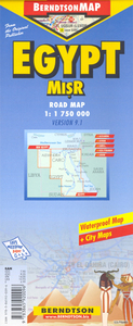
£3.99
A delightful little gift book containing exciting & creative craft & cookery projects inspired by a cracking egg shape. There are five themes: cooking, making cards, making gifts, decorating & making accessories. Each project uses the egg stencil cut out of the front cover & has bright, attractive step-by-step illustrations including chocolate eggs, spring greetings cards, cress eggs & decorated eggs. There are also egg-themed colour stickers for extra decoration. ...
Archived Product
£9.99
Eggs or Anarchy is one of the great, British stories of the Second World War yet to be told in full. It reveals the heroic tale of how Lord Woolton, Minister for Food, really fed Britain. As a nation at war, with supply routes under attack from the Axis powers & resources scarce, it was Woolton`s job to fulfil his promise to the British people, & Prime Minister Winston Churchill in particular, that there would be food on the shelves each week. Persuading the public to not resort to the black market & to manage on the very limited ration was one thing, but Woolton had to fulfil his side of the bargain & maintain supplies in time of crisis. A grammar school-educated genius, he was a fish out of water in Churchill`s cabinet & the PM himself doubted Woolton would survive due to the unstinting criticism he faced from colleagues, the press & public. This is the story of how he battled to save his own career while using every trick in his entrepreneurial book to secure supplies. He battled to outwit unscrupulous dealers on the black market streets of cities within the British Empire
- such as Alexandria in Eygpt
- persuading customs authorities to turn a blind eye to his import schemes. If Britain had gone hungry the outcome of the war could have been very different. This book, for the first time, finds out the real story of how Lord Woolton provided food for Britain & her colonies & discovers that for him there were days when it was literally a choice of `eggs or anarchy`.

...
Archived Product
£8.99
Aegina on a detailed map at 1:25, 000 from the Greek publishers Orama Editions, with a large street plan of Aegina Town, bilingual notes on the island’s history, sights & beaches, a list of hotels, etc. The map of the island presents its topography by contours at 20m intervals enhanced by relief shading. All place names are in both Greek & Latin alphabets. Road network indicates dirt roads & shows driving distances on main routes plus locations of petrol stations. Also marked are local paths & hiking trails, as well as ferry connections to Piraeus & other islands, including the nearby Moni. Places of interest are highlighted, including archaeological sites, beaches, etc. The remaining half of the sheet
Includes:: a large street plan of Aegina Town at 1:4, 200, with street names in both scripts & a dual index; bilingual notes on the island’s history, sights & beaches; a plan of the archaeological site at Afea (Aphaia/ Aphaea); plus a list of hotels. Map legend & all the text include English.
...
Archived Product
£12.99
Map No. 1051, Eglisau, in the topographic survey of Switzerland at 1:25, 000 from Bundesamt für Landestopographie (swisstopo), covering the whole country on 247 small format sheets, with special larger maps published for popular regions including some titles now available in hiking versions. Highly regarded for their superb use of graphic relief & hill shading, the maps give an almost 3-D picture of Switzerland`s mountainous terrain. Contours are at 10 m intervals, with 20m intervals in the mountainous areas. All the maps have a 1-km grid for Swiss national coordinates (datum CH 1903). * Small format sheets (Nos. 1011
- 1374)* Map legend in the language of the area covered by the map. Additional margin ticks show latitude & longitude in steps of 2`. The area covered by each map is 17 x 12 km (11 x 7 miles approx). * Special larger sheets (Nos. from 2501 onwards) – STANDARD editions:* No map legend is included but a separate leaflet can be provided instead. The area covered by each map is 25 x 17 km (15 x 11 miles approx).* Special larger sheets (Nos. from 2501 onwards) – HIKING editions:* An overprint highlights hiking, mountain & alpine paths, including regional & national long-distance trails. The maps also show bus routes with bus stops, plus inns in remote locations. The area covered by each map is 25 x 17 km (15 x 11 miles approx).
...
Archived Product
£7.99
Part of a series of handy, luxurious Flame Tree Pocket Books. Combining high-quality production with magnificent fine art, ...
Archived Product
£7.95
Double-sided map of Egypt from Nelles, combining coverage of the whole of the country at 1:2, 500, 000 with more detailed mapping of the Nile area at 1:750, 000, plus a street plan of Cairo. On one side is a general map of Egypt at 1:2, 500, 000, with relief shading & spot heights to indicate the topography, showing the road network & highlighting main places of interest, including all the country ...
Archived Product
£9.99
Egypt at 1:1, 750, 000 on a waterproof & tear-resistant tourist map with a street plan of central Alexandria, plans of Luxor with the ancient Thebes, Aswan & the Giza Pyramids, a road map of the environs of Cairo, plus additional tourist information. On one side is an indexed road map at 1:1, 750, 000 covering most of the country including Sinai, the Mediterranean & the Red Sea coastlines & the oasis of the Western Desert, as indicated on our coverage image. Relief shading shows the topography, with many spot heights & names of various geographical features. The map is annotated with numerous places of interest both in the most visited parts of the country, the Nile Valley & the southern Sinai, & in the remaining desert areas or the coast. A separate index lists 46 diving sites along the Red Sea & the Gulf of Aqaba. Both road & railway networks are shown, including desert tracks. The map has no geographical coordinates. On the reverse are plans & maps, all indexed with lists of sights & hotels:* a street plan of central Alexandria* a plan of Luxor & the area around it, including Karnak & the famous sights on the western bank of the Nile including Valley of the Kings* a plan of Aswan with the Elephantine Island & the sights across the Nile* a road map at 1:110, 000 showing the environs of Cairo with access to Giza & Saqqara Also provided is a plan of the complex of temples & pyramids at Giza, brief descriptions of the country’s top 15 sights highlighted on the relevant maps & plans, climate charts & other useful tourist information. ...
Archived Product
£9.50
Egypt at 1:1, 125, 000 on an indexed, waterproof & tear-resistant road map with topographic & tourist information, published by Reise Know-How as part of their highly acclaimed World Mapping Project. The map is double-sided to provide the best balance between a good scale & a convenient size sheet, with a very generous overlap between the two sides. The map covers of the whole country, including the whole of the Western Desert & the Sinai, with just the southernmost part of the Red Sea coast shown as an inset. Road network is easy to see on a clear base which shows the country ...
Archived Product
£13.59
Egypt in the Countries & Regions series from Lonely Planet, market-leading comprehensive guides aimed at independent travellers & serving a large range of international destinations. Frank & informal in style, the guides explore an extensive range of sights, activities, accommodation, restaurants & nightlife & are designed for practical use while travelling on the road. Written & researched by a team of experts, each book is independent in its recommendations & suggestions, often offering individual takes on individual destinations. Widely recognised for their reliability, each Lonely Planet country & region guide has the same layout. Introductory sections profile the destination with individual chapters on particular highlights, getting started, (including when to go) itineraries, history, culture, arts, food & drink & the environment. Each guide is organised geographically by region, with individual sections detailing an extensive range of sights, places of interest, attractions, restaurants, nightlife, accommodation & any local activities. The guides have detailed explanations of historical context where relevant. There is also practical guidance on ...
Archived Product
£12.79
Egypt in the Countries, Regions & Cities series from Rough Guides; comprehensively detailed guidebooks specifically designed for independent travellers & serving a range of worldwide destinations. Widely recognised for their free editorial style, Rough Guide authors are allowed to express their personal opinions on a range of subjects. Although sometimes controversial, this editorial stance allows readers to experience more detailed & personal takes on each destination, a feature often more limited in other guidebooks. Cultural & historical nuances are explored in significant depth throughout the text & descriptions on the ambience of individual settings alongside personal recommendations, particularly in cities, are notably prevalent. Each Rough Guide in the Countries, Regions & Cities series has a similar layout. A ...
Archived Product

Egypt

Egypt at 1:2, 000, 000 is an indexed map with additional street plans and enlargements of popular regions on the reverse. The publisher has chosen to concentrate on creating a map which will primarily be of use for a tourist navigating between main points of interest as opposed to stressing more detailed cartography.The key roads through the country are clearly marked although it should be noted that these are far fewer than might be expected due to the desert terrain. Roads navigate either around the deserts, along the Nile or along the coast road. Airports and airfields are shown.In keeping with the publisher
RIP - This product is no longer available on our network. It was last seen on 25.09.2019

This page now acts as a permanent archive for this product. Add more information using the comments box below to ensure it can still be found by future generations.

Use our search facility to see if it is available from an alternative contributor.
  • External links may include paid for promotion
  • Availability: Out Of Stock
  • Supplier: Stanfords
  • SKU: 9781847736260
Availability: In Stock
£4.99

Product Description

Egypt at 1:2, 000, 000 is an indexed map with additional street plans & enlargements of popular regions on the reverse. The publisher has chosen to concentrate on creating a map which will primarily be of use for a tourist navigating between main points of interest as opposed to stressing more detailed cartography. The key roads through the country are clearly marked although it should be noted that these are far fewer than might be expected due to the desert terrain. Roads navigate either around the deserts, along the Nile or along the coast road. Airports & airfields are shown. In keeping with the publisher

Reviews/Comments

Add New

Price History

Vouchers

No voucher codes found.
Do you know a voucher code for this product or supplier? Add it to Insights for others to use.

Facebook

Jargon Buster

Key - A physical or virtual device or code used for opening something
Road - a manmade lane or a path that is used to speed up travel.
Popular - Something that is admired and liked by many people.

Supplier Information

Stanfords
Stanfords was established in 1853 and opened their iconic Covent Garden flagship store in 1901. They have become the top retailer of maps, travel books and accessories in the UK and arguably offer the largest selection of maps and travel books worldwide. Famous names such as Captain Robert Falcon Scott, Ranulph Fiennes and Michael Palin have purchased from Stanfords. They now have a shop in Bristol and both stores together with other venues operate a calendar of events including talks, book signings and exhibitions. As a specialist map retailer, the map selection is comprehensive and includes road maps, street maps and walking maps from worldwide destinations, as well as a selection of world atlases and wall maps. Books include travel guides and travel literature. Stanfords also stock globes, from miniatures made of blue marble to magnificent floor-standing globes. The website features a selection of interesting articles on travel topics.
Page Updated: 2023-11-12 20:15:36

Community Generated Product Tags

Oh No! The productWIKI community hasn't generated any tags for this product yet!
Menu