
 United Kingdom
 France
 Germany
 Netherlands
 Sweden
 USA
USA
 Italy
Italy
 Spain
Spain
More From Contributor


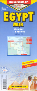
Egypt
Egypt at 1:1, 750, 000 on a waterproof and tear-resistant tourist map with a street plan of central Alexandria, plans of Luxor with the ancient Thebes, Aswan and the Giza Pyramids, a road map of the environs of Cairo, plus additional tourist information.On one side is an indexed road map at 1:1, 750, 000 covering most of the country including Sinai, the Mediterranean and the Red Sea coastlines and the oasis of the Western Desert, as indicated on our coverage image. Relief shading shows the topography, with many spot heights and names of various geographical features. The map is annotated with numerous places of interest both in the most visited parts of the country, the Nile Valley and the southern Sinai, and in the remaining desert areas or the coast. A separate index lists 46
diving sites along the Red Sea and the Gulf of Aqaba. Both road and railway networks are shown, including desert tracks. The map has no geographical coordinates.On the reverse are plans and maps, all indexed with lists of sights and hotels:* a street plan of central Alexandria* a plan of Luxor and the area around it, including Karnak and the famous sights on the western bank of the Nile including Valley of the Kings* a plan of Aswan with the Elephantine Island and the sights across the Nile* a road map at 1:110, 000 showing the environs of Cairo with access to Giza and SaqqaraAlso provided is a plan of the complex of temples and pyramids at Giza, brief descriptions of the country’s top 15 sights highlighted on the relevant maps and plans, climate charts and other useful tourist
information.

Product Description
Reviews/Comments
Add New
Intelligent Comparison
Archived Product

Egypt Stanfords
£7.95
Archived Product

Egypt Stanfords
£9.50
Archived Product
Egypt Stanfords
£13.59
Archived Product
Egypt Stanfords
£12.79
Archived Product

Egypt Stanfords
£16.99
Archived Product
Egypt Stanfords
£16.99
Archived Product
Egypt Stanfords
£5.99
Archived Product
Egypt Stanfords
£16.99
Vouchers
No voucher codes found.
Do you know a voucher code for this product or supplier? Add it to Insights for others to use.
Do you know a voucher code for this product or supplier? Add it to Insights for others to use.
 Denmark