
 United Kingdom
 France
 Germany
 Netherlands
 Sweden
 USA
USA
 Italy
Italy
 Spain
Spain
More From Contributor


Egypt
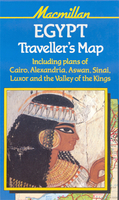
A map of Egypt aimed specially at visitors interested in the country’s history and its archaeological heritage, with street plans, enlargements for mains sites and a chart of the dynasties of ancient Egypt.A general map of the country at 1:1, 000, 000 with elevation colouring and spot heights shows the Nile Valley from the Mediterranean to Aswan, with symbols and drawings highlighting various places of interest, including the less visited sites such as Tell el Amarna, Abydos, Dendera or Edfu. A separate map at 1:250, 000 shows the Sinai Peninsula. The two maps are then supplemented with numerous detailed plans: - an indexed street plan of Cairo at 1:20, 000 with an enlargement for city centre around the Tahrir and the Egyptian Museum; plans of the Khan el Khalili Market, the
Citadel, the pyramids at Giza and Old Cairo; a diagram of the metro network; a map of the environs of the city with plans of Heliopolis and El Mohandessin- an indexed street plan of Alexandria at 1:35, 000 with an enlargement for the central part of the city and a plan of the Catacombs of Kom el Shukafa- several plans of the Luxor area, including detailed plans of the Valley of the Kings and Karnak- a plan of Aswan, with a plan of the Philae temple- a chart of the dynasties of ancient EgyptAlso included is an index for the main map of the Nile Valley with a long list of archaeological sites, plus notes on the country`s history and tourist information.
Citadel, the pyramids at Giza and Old Cairo; a diagram of the metro network; a map of the environs of the city with plans of Heliopolis and El Mohandessin- an indexed street plan of Alexandria at 1:35, 000 with an enlargement for the central part of the city and a plan of the Catacombs of Kom el Shukafa- several plans of the Luxor area, including detailed plans of the Valley of the Kings and Karnak- a plan of Aswan, with a plan of the Philae temple- a chart of the dynasties of ancient EgyptAlso included is an index for the main map of the Nile Valley with a long list of archaeological sites, plus notes on the country`s history and tourist information.

Product Description
Reviews/Comments
Add New
Vouchers
No voucher codes found.
Do you know a voucher code for this product or supplier? Add it to Insights for others to use.
Do you know a voucher code for this product or supplier? Add it to Insights for others to use.
 Denmark