
 United Kingdom
 France
 Germany
 Netherlands
 Sweden
 USA
USA
 Italy
Italy
 Spain
Spain
More From Contributor


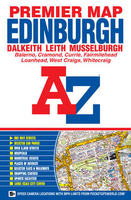
Edinburgh Premier Map
Edinburgh Premier Street Plan from Geographers' A-Z Map Company designed to cover the city within its administrative boundaries, with an enlargement for the city centre and an index listing streets, places and areas, hospitals and hospices, industrial estates, selected flats and walkways, stations, junctions, and selected places of interest, shown where appropriate with their postcodes.The city is covered at 3 1/3 inches to 1 mile (1:19, 000), with an enlargement showing the town centre in greater clarity at 6 2/3 inches to 1 mile (1:9, 500). Coverage includes: Balerno, Bonnyrigg, Cramond, Currie, Dalkeith, Leith, Loanhead, Musselburgh, West Craigs and Whitegraigs. Current edition of this title was published in 2008.The plans show selected A and B roads annotated with
house numbers for easier identification of addresses. One way traffic, restricted access, pedestrianized streets, selected car parks and Park & Ride facilities are marked. Railway stations are shown with names. Colouring and/or symbols indicate public building, services and facilities, including shopping centres or market streets, industrial buildings, hospitals or healthcare, etc. Public toilets are marked, indicating those with facilities for the disabled. The map also shows local authority and postcode boundaries, plus national grid lines. The index is next to the map. This title is also available as a wall map, on paper or encapsulated.
house numbers for easier identification of addresses. One way traffic, restricted access, pedestrianized streets, selected car parks and Park & Ride facilities are marked. Railway stations are shown with names. Colouring and/or symbols indicate public building, services and facilities, including shopping centres or market streets, industrial buildings, hospitals or healthcare, etc. Public toilets are marked, indicating those with facilities for the disabled. The map also shows local authority and postcode boundaries, plus national grid lines. The index is next to the map. This title is also available as a wall map, on paper or encapsulated.
Product Description
Reviews/Comments
Add New
Intelligent Comparison
Archived Product
Edinburgh A-Z Premier Map Stanfords
£5.95
Archived Product

Edinburgh Flexi Map Stanfords
£5.99
Archived Product
Edinburgh Premier Wall Map PAPER Stanfords
£6.99
Archived Product
Edinburgh Pocket Map Stanfords
£1.50
Archived Product
Nottingham Premier Map Stanfords
£5.50
Archived Product
Birmingham Premier Map Stanfords
£5.50
Archived Product
Birmingham Premier Map Stanfords
£6.95
Archived Product

Edinburgh PopOut Map Stanfords
£1.99
Vouchers
No voucher codes found.
Do you know a voucher code for this product or supplier? Add it to Insights for others to use.
Do you know a voucher code for this product or supplier? Add it to Insights for others to use.
 Denmark