
 United Kingdom
 France
 Germany
 Netherlands
 Sweden
 USA
USA
 Italy
Italy
 Spain
Spain
More From Contributor


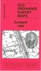


Ecclesfield 1901
Ecclesfield in 1901 in a fascinating series of reproductions of old Ordnance Survey plans in the Alan Godfrey Editions, ideal for anyone interested in the history of their neighbourhood or family. The map covers the village of Ecclesfield north of Sheffield. Features include St Mary`s church, Stock`s Hill, The Wallet, The Cross, St Michael`s Field allotment gardens, Hallamshire Paper Mill, The Hall, Norfolk Foundry, Ecclesfield Common, etc. Coverage extends east to show both Ecclesfield stations (on the Midland and Great Central lines); Butterthwaite, Gibraltar Steel Works, Rainstorth Farm. On the reverse is a directory of Ecclesfield, plus a 1916 railway timetable for the MR`s Sheffield-Barnley line.About the Alan Godfrey Editions of the 25” OS Series:Selected towns in
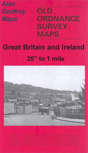
Great Britain and Ireland are covered by maps showing the extent of urban development in the last decades of the 19th and early 20th century. The plans have been taken from the Ordnance Survey mapping and reprinted at about 15 inches to one mile (1:4, 340). On the reverse most maps have historical notes and many also include extracts from contemporary directories. Most maps cover about one mile (1.6kms) north/south, one and a half miles (2.4kms) across; adjoining sheets can be combined to provide wider coverage.FOR MORE INFORMATION AND A COMPLETE LIST OF ALL AVAILABLE TITLES PLEASE CLICK ON THE SERIES LINK.
Great Britain and Ireland are covered by maps showing the extent of urban development in the last decades of the 19th and early 20th century. The plans have been taken from the Ordnance Survey mapping and reprinted at about 15 inches to one mile (1:4, 340). On the reverse most maps have historical notes and many also include extracts from contemporary directories. Most maps cover about one mile (1.6kms) north/south, one and a half miles (2.4kms) across; adjoining sheets can be combined to provide wider coverage.FOR MORE INFORMATION AND A COMPLETE LIST OF ALL AVAILABLE TITLES PLEASE CLICK ON THE SERIES LINK.

Product Description
Reviews/Comments
Add New
Intelligent Comparison
Archived Product
Eccles 1905 Stanfords
£2.95
Archived Product

Eccles 1905 Stanfords
£3.50
Archived Product

Macclesfield North 1907 Stanfords
£3.50
Archived Product
Macclesfield South 1907 Stanfords
£2.95
Archived Product

Macclesfield South 1907 Stanfords
£3.50
Archived Product
Macclesfield Stanfords
£3.99
Archived Product
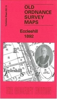
Eccleshill 1892 Stanfords
£3.50
Vouchers
No voucher codes found.
Do you know a voucher code for this product or supplier? Add it to Insights for others to use.
Do you know a voucher code for this product or supplier? Add it to Insights for others to use.
 Denmark