More From Contributor
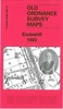
£9.99
Everyone knows about the Houses of Parliament, St Paul's Cathedral & the London Tower, but Eccentric London focuses on the capital's less conventional history. This heavily illustrated book takes the reader around the capital district by district, stopping at a range of unusual locations including the hatters Lock & Co., patronized by Napoleon & little changed since the early 18th century; Highgate Cemetery, with chains leading up through gravestones to tiny bells as an insurance policy should someone be buried alive; & Britain's smallest prison in Trafalgar Square. Eccentric London is an exploration of the hallmarks of London's long & chequered history, illustrated by Ricky Leaver's unique photography. ...
Archived Product
£11.19
Meet a man who listens to tube trains from the road above with a large hearing-trumpet...the inventor who made giant ships out of ice...a chap who rides down the river in an Edwardian bath chair...the guy with the world's biggest collection of pillar boxes. These are just a few of the colourful characters to be found in Eccentric London, the fascinating follow-up to Benedict le Vay's sell-out book, Eccentric Britain. Here the London-born author devises district-by-district guides to everything compelling, curious, bizarre, absurd or hilarious. Plus the oddest shops, museums, jobs, pubs & people you could possibly imagine. ...
Archived Product
£14.99
Discover & experience the unusual & colourful characters & places Eccentric London by Bradt Guides will introduce you to. In this fascinating follow-up to the sell-out Eccentric Britain, Benedict le Vay devises a district-by-district guide to everything compelling, curious, bizarre, absurd or hilarious. Plus the oddest shops, museums, jobs, pubs & people you could possibly imagine. Meet a man who listens to tube trains from the road above with a large hearing-trumpet...the inventor who made giant ships out of ice...a chap who rides down the river in an Edwardian bath chair...the guy with the world`s biggest collection of pillar boxes. Eccentric London shows a fantastic way to explore London. ...
Archived Product
£9.99
Dreaming spires, honeyed stone, cycling dons.. .forget all that tourist twaddle, says Benedict le Vay. Find out the secrets the colleges don`t want you to know, the inside track on the best pubs & eating places, the scandal & gossip about nutty professors & disgraceful students past & present, the brilliant stories about the great, the good & the bad. William Morris called Oxford `a perfect jewel` of a city; Benedict le Vay goes in search of the quirkier gems among its medieval back alleys. Here roam batty dons, daft students, barmy aristocrats & political firebrands. Who does that gargoyle remind you of? Why is a shark plunging into that man`s house? When do students jump naked into the River Cherwell as Latin hymns are sung? What powers the ` Cosmic Triangle` of vibrant East Oxford? How do you control a punt without looking like a plonker? The guide also cover the pubs where Inspector Morse & Bill Clinton enjoyed a pint, where to eat a great fry-up in a unique setting, where to find a weird museum & a calendar of annual eccentric events. ...
Archived Product
£2.95
Eccles in 1905 in a fascinating series of reproductions of old Ordnance Survey plans in the Alan Godfrey Editions, ideal for anyone interested in the history of their neighbourhood or family. Selected towns in Great Britain & Ireland are covered by maps showing the extent of urban development in the last decades of the 19th & early 20th century. In this title: the map covers much of Eccles. The town centre is in the south-west corner of the map & coverage stretches east to Weaste Lane & northward to Cholmondeley Road. Features include Salford football ground, Ladywell Sanatorium, Salford Union Infirmary, Little Bolton, Victoria Church, tramways, Hope Hall, Weaste Hall, Hart Hill, St James church, LNWR railway with Eccles station & section of Docks Branch, Eccles Mill, quilt manufactory, St Mary's church, St Andrew's church, Market Place, Town Hall, Ellesmere Park, etc. On the reverse is a selection of street directory entries, including Church Street, Eccles New Road, Eccles Old Road, Gilda Brook Road. About the Alan Godfrey Editions of the 25 ...
Archived Product
£3.50
Ecclesall Village in 1902 in a fascinating series of reproductions of old Ordnance Survey plans in the Alan Godfrey Editions, ideal for anyone interested in the history of their neighbourhood or family. The map covers the Ecclesall Village area south-west of Sheffield, stretching from All Saints church at Ecclesall westward to Whiteley Wood Hall, & from Dobbing Hill southward to Bents Green. Other features include Silver Hill, Thrift House Farm, Hill Top, Greystones Quarry, Hill Turrets, etc. An Ecclesall Bierlow directory is on the reverse. About the Alan Godfrey Editions of the 25” OS Series: Selected towns in Great Britain & Ireland are covered by maps showing the extent of urban development in the last decades of the 19th & early 20th century. The plans have been taken from the Ordnance Survey mapping & reprinted at about 15 inches to one mile (1:4, 340). On the reverse most maps have historical notes & many also include extracts from contemporary directories. Most maps cover about one mile (1.6kms) north/south, one & a half miles (2.4kms) across; adjoining sheets can be combined to provide wider coverage.FOR MORE INFORMATION & A COMPLETE LIST OF ALL AVAILABLE TITLES PLEASE CLICK ON THE SERIES LINK. ...
Archived Product
£3.50
Ecclesfield in 1901 in a fascinating series of reproductions of old Ordnance Survey plans in the Alan Godfrey Editions, ideal for anyone interested in the history of their neighbourhood or family. The map covers the village of Ecclesfield north of Sheffield. Features include St Mary`s church, Stock`s Hill, The Wallet, The Cross, St Michael`s Field allotment gardens, Hallamshire Paper Mill, The Hall, Norfolk Foundry, Ecclesfield Common, etc. Coverage extends east to show both Ecclesfield stations (on the Midland & Great Central lines); Butterthwaite, Gibraltar Steel Works, Rainstorth Farm. On the reverse is a directory of Ecclesfield, plus a 1916 railway timetable for the MR`s Sheffield-Barnley line. About the Alan Godfrey Editions of the 25” OS Series: Selected towns in Great Britain & Ireland are covered by maps showing the extent of urban development in the last decades of the 19th & early 20th century. The plans have been taken from the Ordnance Survey mapping & reprinted at about 15 inches to one mile (1:4, 340). On the reverse most maps have historical notes & many also include extracts from contemporary directories. Most maps cover about one mile (1.6kms) north/south, one & a half miles (2.4kms) across; adjoining sheets can be combined to provide wider coverage.FOR MORE INFORMATION & A COMPLETE LIST OF ALL AVAILABLE TITLES PLEASE CLICK ON THE SERIES LINK. ...
Archived Product
£3.50
Eccleshill in 1892 in a fascinating series of reproductions of old Ordnance Survey plans in the Alan Godfrey Editions, ideal for anyone interested in the history of their neighbourhood or family. The map covers the village of Eccleshill, east of Bradford, together with the western fringe of Calverley. Coverage stretches from Undercliffe Road eastward to Woodhall Plantation, & from Wellington Road northward to Bank Top. Features include GNR railway with Eccleshill station, St Luke`s church, Union Mills, Fagley Quarry, Woodhall Plantation, Ravenscliffe Wood, Tunwell Mills, Old Mill, Holdsworth Square, Manor Potteries, Gatehouse Farm, Moorside Mill, Radfield Quarry, etc. On the reverse is an 1889 directory of Eccleshill. About the Alan Godfrey Editions of the 25” OS Series: Selected towns in Great Britain & Ireland are covered by maps showing the extent of urban development in the last decades of the 19th & early 20th century. The plans have been taken from the Ordnance Survey mapping & reprinted at about 15 inches to one mile (1:4, 340). On the reverse most maps have historical notes & many also include extracts from contemporary directories. Most maps cover about one mile (1.6kms) north/south, one & a half miles (2.4kms) across; adjoining sheets can be combined to provide wider coverage.FOR MORE INFORMATION & A COMPLETE LIST OF ALL AVAILABLE TITLES PLEASE CLICK ON THE SERIES LINK. ...
Archived Product
£12.99
Map No. 1223, Echallens, in the topographic survey of Switzerland at 1:25, 000 from Bundesamt für Landestopographie (swisstopo), covering the whole country on 247 small format sheets, with special larger maps published for popular regions including some titles now available in hiking versions. Highly regarded for their superb use of graphic relief & hill shading, the maps give an almost 3-D picture of Switzerland`s mountainous terrain. Contours are at 10 m intervals, with 20m intervals in the mountainous areas. All the maps have a 1-km grid for Swiss national coordinates (datum CH 1903). * Small format sheets (Nos. 1011
- 1374)* Map legend in the language of the area covered by the map. Additional margin ticks show latitude & longitude in steps of 2`. The area covered by each map is 17 x 12 km (11 x 7 miles approx). * Special larger sheets (Nos. from 2501 onwards) – STANDARD editions:* No map legend is included but a separate leaflet can be provided instead. The area covered by each map is 25 x 17 km (15 x 11 miles approx).* Special larger sheets (Nos. from 2501 onwards) – HIKING editions:* An overprint highlights hiking, mountain & alpine paths, including regional & national long-distance trails. The maps also show bus routes with bus stops, plus inns in remote locations. The area covered by each map is 25 x 17 km (15 x 11 miles approx).
...
Archived Product
£20.00
” As I sat cradling the man`s head, with his blood & brains sticking to my hands, I heard a voice
- my own voice. It was asking
...
Archived Product

Eccles 1905

Eccles in 1905 in a fascinating series of reproductions of old Ordnance Survey plans in the Alan Godfrey Editions, ideal for anyone interested in the history of their neighbourhood or family. The map covers much of Eccles. The town centre is in the south-west corner of the map and coverage stretches east to Weaste Lane and northward to Cholmondeley Road. Features include Salford football ground, Ladywell Sanatorium, Salford Union Infirmary, Little Bolton, Victoria Church, tramways, Hope Hall, Weaste Hall, Hart Hill, St James church, LNWR railway with Eccles station and section of Docks Branch, Eccles Mill, quilt manufactory, St Mary`s church, St Andrew`s church, Market Place, Town Hall, Ellesmere Park, etc. On the reverse is a selection of street directory entries,
including Church Street, Eccles New Road, Eccles Old Road and Gilda Brook Road. About the Alan Godfrey Editions of the 25” OS Series:Selected towns in Great Britain and Ireland are covered by maps showing the extent of urban development in the last decades of the 19th and early 20th century. The plans have been taken from the Ordnance Survey mapping and reprinted at about 15 inches to one mile (1:4, 340). On the reverse most maps have historical notes and many also include extracts from contemporary directories. Most maps cover about one mile (1.6kms) north/south, one and a half miles (2.4kms) across; adjoining sheets can be combined to provide wider coverage.FOR MORE INFORMATION AND A COMPLETE LIST OF ALL AVAILABLE TITLES PLEASE CLICK ON THE SERIES LINK.
RIP - This product is no longer available on our network. It was last seen on 25.09.2019

This page now acts as a permanent archive for this product. Add more information using the comments box below to ensure it can still be found by future generations.

Use our search facility to see if it is available from an alternative contributor.
  • External links may include paid for promotion
  • Availability: Out Of Stock
  • Supplier: Stanfords
  • SKU: 9781841515700
Availability: In Stock
£3.50

Product Description

Eccles in 1905 in a fascinating series of reproductions of old Ordnance Survey plans in the Alan Godfrey Editions, ideal for anyone interested in the history of their neighbourhood or family. The map covers much of Eccles. The town centre is in the south-west corner of the map & coverage stretches east to Weaste Lane & northward to Cholmondeley Road. Features include Salford football ground, Ladywell Sanatorium, Salford Union Infirmary, Little Bolton, Victoria Church, tramways, Hope Hall, Weaste Hall, Hart Hill, St James church, LNWR railway with Eccles station & section of Docks Branch, Eccles Mill, quilt manufactory, St Mary`s church, St Andrew`s church, Market Place, Town Hall, Ellesmere Park, etc. On the reverse is a selection of street directory entries, including Church Street, Eccles New Road, Eccles Old Road & Gilda Brook Road. About the Alan Godfrey Editions of the 25” OS Series: Selected towns in Great Britain & Ireland are covered by maps showing the extent of urban development in the last decades of the 19th & early 20th century. The plans have been taken from the Ordnance Survey mapping & reprinted at about 15 inches to one mile (1:4, 340). On the reverse most maps have historical notes & many also include extracts from contemporary directories. Most maps cover about one mile (1.6kms) north/south, one & a half miles (2.4kms) across; adjoining sheets can be combined to provide wider coverage.FOR MORE INFORMATION & A COMPLETE LIST OF ALL AVAILABLE TITLES PLEASE CLICK ON THE SERIES LINK.

Reviews/Comments

Add New

Intelligent Comparison

Oooops!
We couldn't find anything!
Perhaps this product's unique.... Or perhaps we are still looking for comparisons!
Click to bump this page and we'll hurry up.

Price History

Vouchers

No voucher codes found.
Do you know a voucher code for this product or supplier? Add it to Insights for others to use.

Facebook

Jargon Buster

Contemporary - Modern era design
Contemporary - A design reference to indicate post war modern design
Football - A sport involving kicking a ball and trying to score a goal
Quilt - A type of bedding
History - Anything that happens in the past. An acedemic subject.
Road - a manmade lane or a path that is used to speed up travel.
Contemporary - An object that is living in the same time.
Mill - A building which can grind grain into flour.
Hall - A room at the inside of an entrance of a house.
Ideal - Something that satisfies a perfect criteria.
Family - A group of people that live together made up from parents and children.

Supplier Information

Stanfords
Stanfords was established in 1853 and opened their iconic Covent Garden flagship store in 1901. They have become the top retailer of maps, travel books and accessories in the UK and arguably offer the largest selection of maps and travel books worldwide. Famous names such as Captain Robert Falcon Scott, Ranulph Fiennes and Michael Palin have purchased from Stanfords. They now have a shop in Bristol and both stores together with other venues operate a calendar of events including talks, book signings and exhibitions. As a specialist map retailer, the map selection is comprehensive and includes road maps, street maps and walking maps from worldwide destinations, as well as a selection of world atlases and wall maps. Books include travel guides and travel literature. Stanfords also stock globes, from miniatures made of blue marble to magnificent floor-standing globes. The website features a selection of interesting articles on travel topics.
Page Updated: 2023-11-12 20:15:36

Community Generated Product Tags

Oh No! The productWIKI community hasn't generated any tags for this product yet!
Menu