
 United Kingdom
 France
 Germany
 Netherlands
 Sweden
 USA
USA
 Italy
Italy
 Spain
Spain
More From Contributor


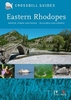


Eastern Rhodope Mountains
Eastern Rhodope Mountains on a detailed road map at 1:120, 000 from Domino with a street plan of Zlatograd, brief descriptions of 87 places of interest, plus on the reverse plans of the archaeological remains at Perperikon and Tatul.On one side is a detailed road map of the eastern part of the Rhodope Mountain along the Greek border. Coverage extends from Zlatagrad in the south-west to Svilengrad in the north-eastern corner. Topography is shown by contours at 50m intervals with faint relief shading and spot heights, plus colouring for forested areas. Boundaries of protected areas are indicated. All place names apart from selected towns plus locations cross-referenced to the descriptions are given in Cyrillic alphabet only.Road network includes dirt roads or tracks and selected local
paths. Railway lines are shown with stations and stops. Various places of interest are highlighted by small drawings and/or cross-referenced to English language descriptions next to the map. The map has no geographical coordinates or an index. Map legend includes English.Also provided is a street plan of Zlatograd with a brief description of its sites and a Bulgarian only legend.The whole of the reverse side is taken up by 3-D drawings of the archaeological remains at Perperikon and Tatul, with bilingual notes.
paths. Railway lines are shown with stations and stops. Various places of interest are highlighted by small drawings and/or cross-referenced to English language descriptions next to the map. The map has no geographical coordinates or an index. Map legend includes English.Also provided is a street plan of Zlatograd with a brief description of its sites and a Bulgarian only legend.The whole of the reverse side is taken up by 3-D drawings of the archaeological remains at Perperikon and Tatul, with bilingual notes.

Product Description
Reviews/Comments
Add New
Intelligent Comparison
Archived Product

Eastern Rhodopes Stanfords
£23.95
Archived Product
Western Rhodope Mountains Domino Map Stanfords
£7.99
Archived Product
Capturing The Mountains Stanfords
£25.00
Vouchers
No voucher codes found.
Do you know a voucher code for this product or supplier? Add it to Insights for others to use.
Do you know a voucher code for this product or supplier? Add it to Insights for others to use.
 Denmark