More From Contributor
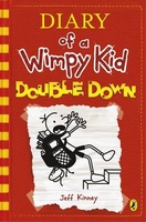
£11.50
Topographic survey of France at 1:25, 000 in IGN`s excellent TOP25 / Série Bleue series. All the maps are GPS compatible, with a 1km UTM grid plus latitude & longitude lines at 5’ intervals. Contours are at 5m intervals except for mountainous areas where the maps have contours at 10m intervals, vividly enhanced by hill shading & graphics for rocky terrain. Colouring with graphics indicates different types of vegetation or land use (deciduous or coniferous forests, moors, orchards, vineyards, etc). PLEASE NOTE: coverage of France at this scale is currently being revised – the format & the presentation of each title are indicated by the letters at the end of its Sheet Reference number (e.g. 0416ET, 3531ETR, 1923SB, etc.)MAPS WITH FULL TOURIST OVERPRINT & AN ENGLISH MAP LEGEND: all TOP25 maps & the SB editions of Série Bleue have an overprint highlighting waymarked walking trails including long-distance GR routes &, where appropriate, ski routes. Symbols indicate campsites, gîtes d’etape, refuges, equestrian centres & other recreational facilities or sites, tourist information centres, cultural heritage, etc. Towns & locations of particular interest are highlighted.- ET or OT = single-sided TOP25 map covering approx. 29x 21 km / 18x 13 miles.- ETR or OTR = waterproof & tear resistant TOP25 map covering the same area as the corresponding ET or OT number, but double-sided, printed on a smaller size sheet with a good overlap between the sides.- SB = Série Bleue map with full tourist overprint; these maps, first introduced in summer 2014, each cover approx. 29x 24km / 18x 15 miles.SÉRIE BLEUE maps with numbers ending in E (Est) or O (Ouest): most editions now indicate the GR routes, but do not show any other tourist information. Map legend is in French only. Each map covers approx. 14x 20km / 9x 12 miles. ...
Archived Product
£11.99
Douai
- Tournai
- Mons area in a series of cycling maps from Sportoena covering Belgium & the adjoining regions of the neighbouring

...
Archived Product
£11.99
One of the titles in a series of topographic maps covering much of north-west Africa, produced as part of the IMW* project in 1960’s. Each map covers an area spanning 6° in longitude & 4° in latitude. There is some variation in colouring & the depiction of terrain, but hill-shading, spot heights & contours are used to show the general relief. Additional graphics show features such as dunes, rock outcrops, cliffs, sand areas, escarpments, marshes, seasonal lakes & watercourses, & areas liable to flooding. Bathymetric contours are also included. Communications detail

Includes::
roads, major trails & railways, although there is some inconsistency in colouring & the extent of classification, e.g. not all maps distinguish seasonal roads. On most maps intermediate road distances are indicated on main routes. Symbols show airports, mosques, mines, oil & gas fields, lighthouses, ruins & significant isolated buildings. Administrative boundaries are marked & latitude & longitude lines are drawn at 1° intervals, with further margin ticks at 1’ intervals. The map legend is in French only on some sheets, & in English & French on others.* The International Map of the World was a project conceived in the early 20th century to compile a world map series at 1:1, 000, 000 through the efforts of participating nations. The value of the program has declined since 1970 & the IMW is no longer regarded as an active international series.

...
Archived Product
£11.50
Topographic survey of France at 1:25, 000 in IGN`s excellent TOP25 / Série Bleue series. All the maps are GPS compatible, with a 1km UTM grid plus latitude & longitude lines at 5’ intervals. Contours are at 5m intervals except for mountainous areas where the maps have contours at 10m intervals, vividly enhanced by hill shading & graphics for rocky terrain. Colouring with graphics indicates different types of vegetation or land use (deciduous or coniferous forests, moors, orchards, vineyards, etc). PLEASE NOTE: coverage of France at this scale is currently being revised – the format & the presentation of each title are indicated by the letters at the end of its Sheet Reference number (e.g. 0416ET, 3531ETR, 1923SB, etc.)MAPS WITH FULL TOURIST OVERPRINT & AN ENGLISH MAP LEGEND: all TOP25 maps & the SB editions of Série Bleue have an overprint highlighting waymarked walking trails including long-distance GR routes &, where appropriate, ski routes. Symbols indicate campsites, gîtes d’etape, refuges, equestrian centres & other recreational facilities or sites, tourist information centres, cultural heritage, etc. Towns & locations of particular interest are highlighted.- ET or OT = single-sided TOP25 map covering approx. 29x 21 km / 18x 13 miles.- ETR or OTR = waterproof & tear resistant TOP25 map covering the same area as the corresponding ET or OT number, but double-sided, printed on a smaller size sheet with a good overlap between the sides.- SB = Série Bleue map with full tourist overprint; these maps, first introduced in summer 2014, each cover approx. 29x 24km / 18x 15 miles.SÉRIE BLEUE maps with numbers ending in E (Est) or O (Ouest): most editions now indicate the GR routes, but do not show any other tourist information. Map legend is in French only. Each map covers approx. 14x 20km / 9x 12 miles. ...
Archived Product
£8.99
D-Day, 6 June 1944, the turning point of the Second World War, was a victory of arms. But it was also a triumph for a different kind of operation: one of deceit... At the heart of the deception was the ` Double Cross System`, a team of double agents whose bravery, treachery, greed & inspiration succeeded in convincing the Nazis that Calais & Norway, not Normandy, were the targets of the 150, 000-strong Allied invasion force. These were not conventional warriors, but their masterpiece of deceit saved thousands of lives. Their codenames were Bronx, Brutus, Treasure, Tricycle & Garbo. This is their story. ...
Archived Product
£6.99
Walter Huff is an insurance investigator like any other
- until the day he meets the beautiful & dangerous Phyllis Nirdlinger &
...
Archived Product
£24.95
Double Take presents thirty-nine uncannily accurate reconstructions of the great images & moments from history – ranging from the earliest known photograph, through the landmark events of the 20th & 21st century, the icons of popular culture & the art world, to the world’s most expensive photograph. These intricately crafted works have been created in miniature by photographers Jojakim Cortis & Adrian Sonderegger. Inspired by the record auction price of $4.3m set by Andreas Gursky’s Rhein II in 2011, they set themselves a challenge: could they use model making & lighting skills to reconstruct the Gursky image in their Zürich studio? The photograph they created from a miniaturized diorama of Rhein II was a success. It worked! This one-off challenge became the starting point for a larger personal project by the duo – a whole series of increasingly elaborate & difficult recreations of photographs of pivotal events throughout history. The whole world, & the surface of the moon, were conjured in their studio. Double Take is not just a technical tour de force – it opens up a wider consideration of image making, of the ‘slideshow’ of famous photographs we each hold in our memory, & of the problem at the heart of the medium: can the photographic image ever be trusted? With a full selection of images showing the making of the reconstructions in the studio, an introduction by Christian Caujolle, a supporting essay by Florian Ebner (of the Pompidou Centre) & an in-depth interview with the photographers, Double Take is the perfect volume for all with a love of photography with a twist & a sense of humour. ...
Archived Product
£14.99
Doubling Back is a fascinating & moving account of walking in the footsteps of others. In 1952 Linda Cracknell`s father embarked on a hike through the Swiss Alps. Fifty years later Linda retraces that fateful journey, following the trail of the man she barely knew. This collection of walking tales takes its theme from that pilgrimage. The walks trace the contours of history, following writers, relations & retreading ways across mountains, valleys & coasts formerly trodden by drovers, saints & adventurers. Each walk is about the reaffirming of memories, beliefs & emotions, & especially of the connection that one can have with the past through particular places. This book celebrates life, family, friendship & walking through landscapes richly textured with stories. Doubling Back is a masterwork of travel writing in the vein of Robert Macfarlane & Roger Deakin, lyrical, poignant, & with stunning descriptions of the landscapes Linda Cracknell leads us through. ...
Archived Product
£8.99
Doubling Back is a fascinating & moving account of walking in the footsteps of others. In 1952 Linda Cracknell`s father embarked on a hike through the Swiss Alps. Fifty years later Linda retraces that fateful journey, following the trail of the man she barely knew. This collection of walking tales takes its theme from that pilgrimage. The walks trace the contours of history, following writers, relations & retreading ways across mountains, valleys & coasts formerly trodden by drovers, saints & adventurers. Each walk is about the reaffirming of memories, beliefs & emotions, & especially of the connection that one can have with the past through particular places. This book celebrates life, family, friendship & walking through landscapes richly textured with stories. Doubling Back is a masterwork of travel writing in the vein of Robert Macfarlane & Roger Deakin, lyrical, poignant, & with stunning descriptions of the landscapes Linda Cracknell leads us through. ...
Archived Product
£5.99
The départments of Doubs & Jura in Franche-Comté at 1:150, 000 in Michelin’s Local Series, with highlighting for scenic routes, an index, a special panel with best sights & recommended driving tours, & street plans of central Besançon & Lons-le-Saunier. Coverage extends from Vesoul & Belfort southwards to just north of Annecy & eastwards from Dole to include the Swiss part of the Jura Mountains with Neuchâtel & Lausanne. PLEASE NOTE: our coverage image, provided by the publishers, does not take into account which areas along the edge of the map are blocked by the index & the additional features – coverage shown in the north-western & south-eastern corners of the image are not included. Maps in Michelin’s Local Series of France have the same cartography (road network & place names shown on the maps) as the publishers’ Regional Series at 1;200, 000 but enlarged here to 1:150, 000 to provide greater clarity & larger, easier to read print size. Road network is presented in great detail, indicating width, motorway services & rest areas, dangerous or restricted entry roads, steep gradients, height & weight restrictions, etc. Scenic sections are highlighted. The maps also show selected cycle paths & nature trails. Railway lines are shown with stations & local airports are marked. Symbols indicate various places of interest, with additional star rating for best sights, based on the publishers’ Green Guides for French regions. Satellite-derived base with colouring for the forested areas & boundaries of national or regional parks shows the topography. In the mountainous regions the maps have bold, very effective relief shading, with a large number of names of peaks, passes, & other topographic features. The maps have latitude & longitude lines at 10’ intervals & are indexed. Map legend

Includes::
English. Each title in addition

Includes::
a panel showing the area’s principal roads & places of interest, plus recommendations for sightseeing tours. Also provided are town centre maps of main cities, indicating principal traffic arteries, one way streets & places of interest. Only selected streets are named & listed in the accompanying index. Please click on the series link to see all the titles in this series.


...
Archived Product

Double Down

Get ready, Book 11 in the phenomenally bestselling Diary of a Wimpy Kid series is coming! The pressure`s really piling up on Greg Heffley. His mom thinks video games are turning his brain to mush, so she wants her son to put down the controller and explore his `creative side`. As if that`s not scary enough, Halloween`s just around the corner and the frights are coming at Greg from every angle. When Greg discovers a bag of gummy worms, it sparks an idea. Can he get his mom off his back by making a movie.. .and will he become rich and famous in the process? Or will doubling down on this plan just double Greg`s troubles?
RIP - This product is no longer available on our network. It was last seen on 25.09.2019

This page now acts as a permanent archive for this product. Add more information using the comments box below to ensure it can still be found by future generations.

Use our search facility to see if it is available from an alternative contributor.
  • Availability: Out Of Stock
  • Supplier: Stanfords
  • SKU: 9780141373010
Availability: In Stock
£12.99

Product Description

Get ready, Book 11 in the phenomenally bestselling Diary of a Wimpy Kid series is coming! The pressure`s really piling up on Greg Heffley. His mom thinks video games are turning his brain to mush, so she wants her son to put down the controller & explore his `creative side`. As if that`s not scary enough, Halloween`s just around the corner & the frights are coming at Greg from every angle. When Greg discovers a bag of gummy worms, it sparks an idea. Can he get his mom off his back by making a movie.. .and will he become rich & famous in the process? Or will doubling down on this plan just double Greg`s troubles?

Reviews/Comments

Add New

Intelligent Comparison

Oooops!
We couldn't find anything!
Perhaps this product's unique.... Or perhaps we are still looking for comparisons!
Click to bump this page and we'll hurry up.

Price History

Vouchers

No voucher codes found.
Do you know a voucher code for this product or supplier? Add it to Insights for others to use.

Facebook

Jargon Buster

Diary - A day to day book record of events and experiences.

Supplier Information

Stanfords
Stanfords was established in 1853 and opened their iconic Covent Garden flagship store in 1901. They have become the top retailer of maps, travel books and accessories in the UK and arguably offer the largest selection of maps and travel books worldwide. Famous names such as Captain Robert Falcon Scott, Ranulph Fiennes and Michael Palin have purchased from Stanfords. They now have a shop in Bristol and both stores together with other venues operate a calendar of events including talks, book signings and exhibitions. As a specialist map retailer, the map selection is comprehensive and includes road maps, street maps and walking maps from worldwide destinations, as well as a selection of world atlases and wall maps. Books include travel guides and travel literature. Stanfords also stock globes, from miniatures made of blue marble to magnificent floor-standing globes. The website features a selection of interesting articles on travel topics.
Page Updated: 2023-11-12 20:15:36

Community Generated Product Tags

Oh No! The productWIKI community hasn't generated any tags for this product yet!
Menu