
 United Kingdom
 France
 Germany
 Netherlands
 Sweden
 USA
USA
 Italy
Italy
 Spain
Spain
More From Contributor


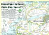
Devon And Cornwall Wall Map
Regional wall map of > at 1:200, 000 (3.2 miles to 1inch) from A to Z, covering: Weston-super-Mare, Bridgwater, Bridport, Lyme Regis, Exmouth, Exeter, Torquay, Salcombe, Plymouth, Penzance, Land's End, Newquay and Minehead.. Clear presentation of the road network shows motorways, A and B roads, some minor and local roads, with gradients of 1:5 and steeper indicated. Service stations, railway lines and stops, ferry terminals, and airports are clearly marked.Tourist information such as points of interest and local facilities are prominently highlighted with a variety of symbols. Topography is shown by altitude tints, if in rather broad bands, with spot heights (in feet) and additional colouring for woodland areas; the National Grid is overprinted on the cartography.
National and unitary authority boundaries are indicated.There is an index for cities, town, and villages at the edge of the map.
National and unitary authority boundaries are indicated.There is an index for cities, town, and villages at the edge of the map.
Product Description
Reviews/Comments
Add New
Vouchers
No voucher codes found.
Do you know a voucher code for this product or supplier? Add it to Insights for others to use.
Do you know a voucher code for this product or supplier? Add it to Insights for others to use.
 Denmark