More From Contributor

£3.50
Denton Town Centre in 1918 in a fascinating series of reproductions of old Ordnance Survey plans in the Alan Godfrey Editions, ideal for anyone interested in the history of their neighbourhood or family. The map covers the central area of Denton, stretching from Holland Street & Windmill Lane eastward to Kingston Mills, & from St Lawrence`s church northward to Audenshaw cemetery. Features include tramways & depot, St Anne`s church, Broomstair Bridge, River Tame, Peak Forest Canal, numerous small works such as hat manufactories, Victoria Iron Works, Market Place, Town Hall, Christ Church, Kingston Bridge, Broomstair Mill, Planet Foundry, Wellington Fur Works, etc. On the reverse are street directory entries for Acre Street, Ashton Road, Howard Lane & Hyde Road. About the Alan Godfrey Editions of the 25” OS Series: Selected towns in Great Britain & Ireland are covered by maps showing the extent of urban development in the last decades of the 19th & early 20th century. The plans have been taken from the Ordnance Survey mapping & reprinted at about 15 inches to one mile (1:4, 340). On the reverse most maps have historical notes & many also include extracts from contemporary directories. Most maps cover about one mile (1.6kms) north/south, one & a half miles (2.4kms) across; adjoining sheets can be combined to provide wider coverage.FOR MORE INFORMATION & A COMPLETE LIST OF ALL AVAILABLE TITLES PLEASE CLICK ON THE SERIES LINK. ...
Archived Product
£2.95
Denton West in 1916 in a fascinating series of reproductions of old Ordnance Survey plans in the Alan Godfrey Editions, ideal for anyone interested in the history of their neighbourhood or family. Selected towns in Great Britain & Ireland are covered by maps showing the extent of urban development in the last decades of the 19th & early 20th century. In this title: the map covers the western part of Denton & extends westward to east Gorton around Gorton Bridge. Features include tramways, a stretch of the Manchester & Ashton Canal, Brook Green, short stretches of the GCR railway, cemetery, Gorton Upper & Lower Reservoirs, Lancashire Felt Works, a stretch of the LNWR line with Denton station, Audenshaw Reservoir Nr.2 etc. On the reverse are street directory entries for Balmoral Drive, Heaton Street, Manchester Road, Oak Drive; plus a railway timetable for the Stockport-Stalybridge & Stockport-Manchester Victoria lines in 1897. About the Alan Godfrey Editions of the 25 ...
Archived Product
£3.50
Denton West in 1916 in a fascinating series of reproductions of old Ordnance Survey plans in the Alan Godfrey Editions, ideal for anyone interested in the history of their neighbourhood or family. The map covers the western part of Denton & extends westward to east Gorton around Gorton Bridge. Features include tramways, a stretch of the Manchester & Ashton Canal, Brook Green, short stretches of the GCR railway, cemetery, Gorton Upper & Lower Reservoirs, Lancashire Felt Works, a stretch of the LNWR line with Denton station, Audenshaw Reservoir Nr.2, etc. On the reverse are street directory entries for Balmoral Drive, Heaton Street, Manchester Road & Oak Drive, plus a railway timetable for the Stockport-Stalybridge & Stockport-Manchester Victoria lines in 1897. About the Alan Godfrey Editions of the 25” OS Series: Selected towns in Great Britain & Ireland are covered by maps showing the extent of urban development in the last decades of the 19th & early 20th century. The plans have been taken from the Ordnance Survey mapping & reprinted at about 15 inches to one mile (1:4, 340). On the reverse most maps have historical notes & many also include extracts from contemporary directories. Most maps cover about one mile (1.6kms) north/south, one & a half miles (2.4kms) across; adjoining sheets can be combined to provide wider coverage.FOR MORE INFORMATION & A COMPLETE LIST OF ALL AVAILABLE TITLES PLEASE CLICK ON THE SERIES LINK. ...
Archived Product
£2.95
Denton with Haughton in 1904 in a fascinating series of reproductions of old Ordnance Survey plans in the Alan Godfrey Editions, ideal for anyone interested in the history of their neighbourhood or family. Selected towns in Great Britain & Ireland are covered by maps showing the extent of urban development in the last decades of the 19th & early 20th century. In this title: the map covers the area around & to the north of Haughton Green, with the Stockport Road area of south Denton to the north. Coverage stretches from Hyde Hall eastward to Gibraltar Mill on the River Tame. Other features include Denton cemetery, Great Wood Pit, Denton Colliery, Three Lane Ends, Vinery Hat Works, Town Lane, Moorfield Mills, St Mary's church, Whittles Farm etc. On the reverse is a selection of street directory entries, including Gibraltar Lane, Haughton Green Road, Stockport Road & Two Trees Lane. About the Alan Godfrey Editions of the 25 ...
Archived Product
£3.50
Denton with Haughton in 1904 in a fascinating series of reproductions of old Ordnance Survey plans in the Alan Godfrey Editions, ideal for anyone interested in the history of their neighbourhood or family. The map covers the area around & to the north of Haughton Green, with the Stockport Road area of south Denton to the north. Coverage stretches from Hyde Hall eastward to Gibraltar Mill on the River Tame. Other features include Denton cemetery, Great Wood Pit, Denton Colliery, Three Lane Ends, Vinery Hat Works, Town Lane, Moorfield Mills, St Mary`s church, Whittles Farm, etc. On the reverse is a selection of street directory entries, including Gibraltar Lane, Haughton Green Road, Stockport Road & Two Trees Lane. About the Alan Godfrey Editions of the 25” OS Series: Selected towns in Great Britain & Ireland are covered by maps showing the extent of urban development in the last decades of the 19th & early 20th century. The plans have been taken from the Ordnance Survey mapping & reprinted at about 15 inches to one mile (1:4, 340). On the reverse most maps have historical notes & many also include extracts from contemporary directories. Most maps cover about one mile (1.6kms) north/south, one & a half miles (2.4kms) across; adjoining sheets can be combined to provide wider coverage.FOR MORE INFORMATION & A COMPLETE LIST OF ALL AVAILABLE TITLES PLEASE CLICK ON THE SERIES LINK. ...
Archived Product
£11.99
About this series A series of practical guides covering many major US cities. Each title offers a range of entries for accommodation & restaurants to suit most budgets. Parks, gardens, museums, galleries, children's attractions, shopping, entertainment & nightlife all have individual chapters. Contact addresses for everything from canoeing & hiking to golf & horse riding. ...
Archived Product
£7.99
Denver in Colorado on an indexed street plan from Rand Mc Nally in their extensive range of maps covering cities in the United States, with enlargements showing in greater detail downtown Denver & access to the city’s international airport. Communities covered by this map include Arvada, Aurora, Centennial, Commerce City, Englewood, Glendale, Greenwood Village, Lakewood, Littleton, Thornton, Westminster & Wheat Ridge.NEW STREET PLAN CARTOGRAPHY FROM RAND Mc NALLY: Rand Mc Nally are currently changing the cartography of their street plans to a more “ European” style. In many titles streets are now shown by parallel lines, providing a much clearer, easier to read presentation. Better use of colouring indicates different types of land use and/or institutions (parks, shopping centres, academic institutions, etc) &, in most titles, different administrative units. More streets are annotated with block numbers. Some new editions still retain the traditional American presentation of streets by a single line, but with more prominent marking for various institutions, facilities & places of interest. Our cartography sample indicates which style is used in this title.COVERAGE: Rand Mc Nally street plans cover cities with their outer suburbs, prominently highlighting principal traffic arteries & connecting main streets. Railway & subway stations are marked. ...
Archived Product
£9.99
Denver County in Colorado on a laminated, waterproof & tear-resistant road map from Mapsco, with an enlargement showing the city’s downtown area in greater detail. On one side the city & the surrounding area are shown at 1:217, 000 approx, with coverage extending north to Fort Collins, east to Bennett, south to Castle Rock & west to Black Hawk. Coverage

Includes::
the counties of Adams, Arapahoe, Boulder, Larimer & Weld. The map indicates controlled access highways, toll roads, main through routes, etc. Road numbers are clearly marked. Also shown are municipal & zip code boundaries & symbols indicate locations of various facilities & places of interest. The index lists both localities & streets. On the reverse a 43x 22cm panel shows downtown Denver in greater detail, highlighting various facilities & places of interest.

...
Archived Product
£7.99
Denver & vicinity in a series of Rand Mc Nally’s regional road maps covering the environs of main US cities. Insets show downtown Denver & access to the city’s airport. Coverage extends north beyond Fort Collins, & south beyond Colorado Springs to Pueblo. In the west the map extends beyond the Peak to Peak Highway to include numerous peaks of the Rocky Mountains. Other communities covered by this map include Arvada, Aurora, Boulder, Cañon City, Castle Rock, Lakewood, Longmont, Lovel&, & parker. Maps in this series present the road network on a clear background with no relief shading to show the area’s topography, but with national or state parks, forests & other protected areas indicated by colouring. Roads are numbered and/or named, showing toll highways, exit numbers of interchanges, services & rest areas. Local airports are marked, but railways & other urban transport lines are not included unless specifically indicated in the individual description. Each town is presented in a different colour, providing those unfamiliar with the region a very clear picture of the area. Various places of interest & facilities are highlighted, including cultural & historical sites, educational institutions, sport & recreational facilities, etc. Each title is indexed. Several maps also include enlargements of the downtown area, plans of international airports, a mileage & driving times diagram for a much wider region than covered by the main map, etc
- for more information please see the individual descriptions. To see all the titles in this series please click on the series link.
...
Archived Product

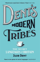
Dent`s Modern Tribes: The Secret Languages Of Britain

Did you know that.. . a soldier`s biggest social blunder is called jack brew - making yourself a cuppa without making one for anyone else? That twitchers have an expression for a bird that can`t be identified - LBJ (the letters stand for Little Brown Job)? Or that builders call plastering the ceiling doing Lionel Richie`s dancefloor? Susie Dent does. Ever wondered why football managers all speak the same way, what a cabbie calls the Houses of Parliament, or how ticket inspectors discreetly request back-up? We are surrounded by hundreds of tribes, each speaking their own distinct slanguage of colourful words, jokes and phrases, honed through years of conversations on the battlefield, in A&E, backstage, or at ten-thousand feet in the air. Susie Dent has spent years interviewing
hundreds of professionals, hobbyists and enthusiasts, and the result is an idiosyncratic phrasebook like no other. From the Freemason`s handshake to the publican`s banter, Dent`s Modern Tribes takes us on a whirlwind tour of Britain, decoding its secret languages and, in the process, finds out what really makes us all tick.
RIP - This product is no longer available on our network. It was last seen on 25.09.2019

This page now acts as a permanent archive for this product. Add more information using the comments box below to ensure it can still be found by future generations.

Use our search facility to see if it is available from an alternative contributor.
  • Availability: Out Of Stock
  • Supplier: Stanfords
  • SKU: 9781473623897
Availability: In Stock
£9.99

Product Description

Did you know that.. . a soldier`s biggest social blunder is called jack brew
- making yourself a cuppa without making one for anyone else? That twitchers have an expression for a bird that can`t be identified
- LBJ (the letters stand for Little Brown Job)? Or that builders call plastering the ceiling doing Lionel Richie`s dancefloor? Susie Dent does. Ever wondered why football managers all speak the same way, what a cabbie calls the Houses of Parliament, or how ticket inspectors discreetly request back-up? We are surrounded by hundreds of tribes, each speaking their own distinct slanguage of colourful words, jokes & phrases, honed through years of conversations on the battlefield, in A&E, backstage, or at ten-thousand feet in the air. Susie Dent has spent years interviewing hundreds of professionals, hobbyists & enthusiasts, & the result is an idiosyncratic phrasebook like no other. From the Freemason`s handshake to the publican`s banter, Dent`s Modern Tribes takes us on a whirlwind tour of Britain, decoding its secret languages &, in the process, finds out what really makes us all tick.

Reviews/Comments

Add New

Intelligent Comparison

Oooops!
We couldn't find anything!
Perhaps this product's unique.... Or perhaps we are still looking for comparisons!
Click to bump this page and we'll hurry up.

Price History

Vouchers

No voucher codes found.
Do you know a voucher code for this product or supplier? Add it to Insights for others to use.

Facebook

Jargon Buster

Football - A sport involving kicking a ball and trying to score a goal
Brown - A colour, commonly associated with earth or soil
Distinct - Something that can be seen to be slightly different.

Supplier Information

Stanfords
Stanfords was established in 1853 and opened their iconic Covent Garden flagship store in 1901. They have become the top retailer of maps, travel books and accessories in the UK and arguably offer the largest selection of maps and travel books worldwide. Famous names such as Captain Robert Falcon Scott, Ranulph Fiennes and Michael Palin have purchased from Stanfords. They now have a shop in Bristol and both stores together with other venues operate a calendar of events including talks, book signings and exhibitions. As a specialist map retailer, the map selection is comprehensive and includes road maps, street maps and walking maps from worldwide destinations, as well as a selection of world atlases and wall maps. Books include travel guides and travel literature. Stanfords also stock globes, from miniatures made of blue marble to magnificent floor-standing globes. The website features a selection of interesting articles on travel topics.
Page Updated: 2023-11-12 20:15:36

Community Generated Product Tags

Oh No! The productWIKI community hasn't generated any tags for this product yet!
Menu