
 United Kingdom
 France
 Germany
 Netherlands
 Sweden
 USA
USA
 Italy
Italy
 Spain
Spain
More From Contributor


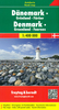
Denmark Cycling Map
Cycling Map of Denmark at 1:500, 000 from Nordisk Korthandel showing the network of numbered national and regional cycle routes, other roads with cycle tracks, campsites and youth hostels, ferry connections with journey times, etc, plus on the reverse additional tourist information.Plain unobtrusive base has colouring only for woodlands, sand dunes and tidal flats. Cycle routes clearly show their national or regional route numbers. The map also indicates other roads with cycle tracks as well as roads where cycling is prohibited. Symbols mark locations of camping places which accept only cyclists and hikers, general campsites and youth hostels. Ferry routes between Jutland and the islands indicate approximate journey times. The map has no geographical coordinates. An enlargement
shows the Copenhagen area in greater detail. The index of place names is on the reverse, together with general information on cycling in Denmark including notes on taking bicycles on trains. Map legend and all the text include English.
shows the Copenhagen area in greater detail. The index of place names is on the reverse, together with general information on cycling in Denmark including notes on taking bicycles on trains. Map legend and all the text include English.
Product Description
Reviews/Comments
Add New
Vouchers
No voucher codes found.
Do you know a voucher code for this product or supplier? Add it to Insights for others to use.
Do you know a voucher code for this product or supplier? Add it to Insights for others to use.
 Denmark