More From Contributor
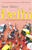
£18.99
Delémont area, map No. 223T, at 1:50, 000 in a special hiking edition of the country’s topographic survey, published by Swisstopo in cooperation with the Swiss Hiking Federation. Cartography, identical to the standard version of the survey, is highly regarded for its superb use of graphic relief & hill shading to provide an almost 3-D picture of Switzerland`s mountainous terrain. Contours are at 20m intervals. An overprint highlights routes maintained by the SHF, distinguishing between hiking routes, mountain routes requiring proper footwear, & alpine routes where equipment is needed. Paths which are part of the national or regional network of long-distance hiking routes are specially marked & in the more recent editions are annotated with their official numbers. The maps show mountain huts, refuges & in remote areas also inns, plus roads with bus service & the positions of bus stops. All the maps have a 1-km grid of the Swiss national coordinates. For a list of all the titles in this series, please click on the series link. ...
Archived Product
£8.99
Delft on an indexed street plan at 1:11, 000 from Falk NV, with an enlargement showing the city’s historic centre in greater detail, plus lists of tram & bus lines, museums, university faculties & buildings, etc. Coverage

Includes::
Den Hoorn, Schipluiden & Delfgau, plus Pijnacker shown on the reverse in an inset. Colouring indicates different types of land use (university buildings, greenhouses, industrial areas, parks, etc). One way or restricted entry streets & car parks are marked. Symbols indicate various facilities including campsites. Map legend

Includes::
English. The lists with information about transport lines, municipal offices, cultural & sport facilities, etc, are in Dutch only.


...
Archived Product
£5.50
Delft in a series of handy size, detailed & indexed city centre street plans of main towns in the Netherlands & Flanders including Brussels from Falk, highlighting recommended walks & places of interest, with six best sights prominently marked & cross-referenced to brief descriptions. The plans also indicate publishers’ recommendations for shopping and/or bars & restaurants. The network of streets & small connecting passages is very clearly presented. Metro stations are marked & tram routes are shown with line numbers & stops. The plans show cycle paths & for drivers indicate main traffic arteries & car parks. Symbols show various facilities such as tourist information centres, markets, canal cruise offices, etc. On the reverse, the street index is accompanied by a calendar of main events, a list of museums, plus contact details for publishers’ recommendations. Map legend & all the text about recommended sights, etc, include English. To see the list of other titles in this series please click on the series link. ...
Archived Product
£4.95
Indexed street plan & guide of Delhi at Approx. 1:45, 400, with inset maps of Connaught Place, Gurgaon, Faridabad, & the environs of Delhi. The map itself is removable from a map cover that

Includes::
a booklet filled with tourist information. One-way streets are shown as are roads under construction; bus stands, railway lines & stops, including the Mass Rapid Transit System are marked. A diagram of the metro is present in a small inset box. Local facilities such as hotels & hospitals, are all highlighted through the use of symbols & also abbreviations (the latter also present on the map legend). Points of interest such as places of worship, museums monuments & tombs are indicated. The insets of Connaught Place, Gurgaon & Faridabad share the same cartographic template as the main map. The inset showing the environs of Delhi shows only the major roads leading into Delhi. The map cover

Includes::
a full-colour 12 page booklet filled with tourist information such as the history, places of interest, useful telephone numbers, accommodation & more. Both the guide & the map legend are in English.


...
Archived Product
£10.95
The Delhi & NCR City Guide is dedicated to exploring the destination in detail with a selection of glossy illustrations. Produced by Outlook Publishing, the guide has been written by local writers & travellers who have lived & breathed one of India's most important cultural centers. The guide explores the region ...
Archived Product
£12.99
Delhi bombards the senses with its vibrant chaos, yet not far away is the peace of the mountains. From spiritual pursuits to mountain trekking, Footprint`s Handbook provides invaluable information on transport, accommodation, eating & entertainment to ensure that your trip

Includes::
the best of this fascinating region of India. * Essentials section with useful advice on getting to & around Northwest India. * Comprehensive, up-to-date listings of where to eat, sleep & relax. *

Includes::
information on tour operators & activities, from spectacular railway journeys to Raj relics. * Detailed maps for Delhi, Amritsar, Leh & other key destinations in the region. * Slim enough to fit in your pocket. With detailed information on all the main sights, plus many lesser-known attractions, Footprint`s Delhi & Northwest India Handbook provides concise & comprehensive coverage of one of the most beautiful regions of India.


...
Archived Product
£9.99
Delhi bombards the senses with its vibrant chaos, yet not far away is the peace of the mountains. From spiritual pursuits to mountain trekking, Footprint Focus provides invaluable information on transport, accommodation, eating & entertainment to ensure that your trip

Includes::
the best of this fascinating country. Essentials section with useful advice on getting to & around Northwest India. Comprehensive, up-to-date listings of where to eat, sleep & play.

Includes::
information on tour operators & activities, from spectacular railway journeys to Raj relics. Detailed maps for Delhi & around. Slim enough to fit in your pocket. With detailed information on all the main sights, plus many lesser-known attractions, Footprint Focus Delhi & Northwest India provides concise & comprehensive coverage of one of the most beautiful regions of India.


...
Archived Product
£9.99
Northwestern India at 1:1, 900, 000 on an indexed map from ITMB, with the reverse side showing a street plan of Delhi with its outer suburbs, plus an enlargement of the Connaught Place central area & diagrams of the metro & rail networks. On one side is an indexed road map of north-western India centred on Delhi & extending north to the Line of Control dividing Jammu & Kashmir. Coverage east along the Ganges extends beyond Varanasi; west to Jodhour, the outskirts of Ahmadabad & to Vadodara (Baroda); & south to Nagpur, the geographical centre of India. The map has altitude colouring (in feet) & shows the country’s road & rail networks & local airports. Symbols highlight various places of interest including historic or scenic sites, hill stations, temples & other religious buildings, castles & forts, national parks & wildlife reserves, etc. Latitude & longitude lines are drawn at intervals of 2°. The reverse side is covered by a street plan of Delhi with its outer suburbs including Ghaziabad. Main traffic arteries are highlighted & many smaller streets are named. Where appropriate, sector or block numbers are provided. Metro stations are clearly marked. Symbols mark various places of interest including selected hotels, main sights, locations of petrol stations & overhead tanks, etc. The plan is indexed &

Includes::
an enlargement for the central Connaught Place area indicating main public buildings, accommodation & restaurants, banks, etc. Also provided are diagrams of the metro & railway networks.

...
Archived Product
£10.99
In an extraordinary portrayal of one of the world`s fastest growing cities, Sam Miller sets out to discover the real Delhi. Following a spiral course through the city, he visits its less celebrated destinations; ancient monuments & imperial buildings give way to the unexpected, the ignored & the eccentric. Through his encounters with Delhi`s people
- from a professor of astrophysics to a crematorium attendant, from ragpickers to members of the Police Brass Band
- Miller creates a richly entertaining portrait of what this megacity means to its residents. The modern Delhi he depicts, in all its humour & humanity, is one whose future concerns us all.

...
Archived Product

Delhi

Berlitz Pocket Guide Delhi combines lively text with vivid full-colour photography to highlight the very best that this fascinating city has to offer. The Where To Go chapter details all the essential sights on a tour of Delhi; from the imposing Moghul-built Red Fort to the peaceful greenery of the Lodi Gardens and the stately splendour of Rajpath. The What to Do chapter explores the wide range of shopping opportunities and nightlife available, whilst the Eating Out chapter investigates the local cuisine and provides a selection of recommended restaurants. To inspire you, the book offers a rundown of Top 10 Attractions, followed by an itinerary for a Perfect Tour of Delhi, whilst sections on the history of the city and the character of its people provide concise background information.
Clear and detailed maps plot all major sights, and the Travel Tips section offers practical advice on how to get there and where to stay.
RIP - This product is no longer available on our network. It was last seen on 25.09.2019

This page now acts as a permanent archive for this product. Add more information using the comments box below to ensure it can still be found by future generations.

Use our search facility to see if it is available from an alternative contributor.
  • External links may include paid for promotion
  • Availability: Out Of Stock
  • Supplier: Stanfords
  • SKU: 9781780040714
Availability: In Stock
£5.99

Product Description

Berlitz Pocket Guide Delhi combines lively text with vivid full-colour photography to highlight the very best that this fascinating city has to offer. The Where To Go chapter details all the essential sights on a tour of Delhi; from the imposing Moghul-built Red Fort to the peaceful greenery of the Lodi Gardens & the stately splendour of Rajpath. The What to Do chapter explores the wide range of shopping opportunities & nightlife available, whilst the Eating Out chapter investigates the local cuisine & provides a selection of recommended restaurants. To inspire you, the book offers a rundown of Top 10 Attractions, followed by an itinerary for a Perfect Tour of Delhi, whilst sections on the history of the city & the character of its people provide concise background information. Clear & detailed maps plot all major sights, & the Travel Tips section offers practical advice on how to get there & where to stay.

Reviews/Comments

Add New

Intelligent Comparison

Oooops!
We couldn't find anything!
Perhaps this product's unique.... Or perhaps we are still looking for comparisons!
Click to bump this page and we'll hurry up.

Price History

Vouchers

No voucher codes found.
Do you know a voucher code for this product or supplier? Add it to Insights for others to use.

Facebook

Jargon Buster

Red - One of the three primary colours
History - Anything that happens in the past. An acedemic subject.
Colour - The categorised spectrum of light visable to humans
Wide - Something with a large width.
Practical - Weather a task is easy to carry out and realistically succeed.
Pocket - A bag shaped insert in clothing used to carry items

Supplier Information

Stanfords
Stanfords was established in 1853 and opened their iconic Covent Garden flagship store in 1901. They have become the top retailer of maps, travel books and accessories in the UK and arguably offer the largest selection of maps and travel books worldwide. Famous names such as Captain Robert Falcon Scott, Ranulph Fiennes and Michael Palin have purchased from Stanfords. They now have a shop in Bristol and both stores together with other venues operate a calendar of events including talks, book signings and exhibitions. As a specialist map retailer, the map selection is comprehensive and includes road maps, street maps and walking maps from worldwide destinations, as well as a selection of world atlases and wall maps. Books include travel guides and travel literature. Stanfords also stock globes, from miniatures made of blue marble to magnificent floor-standing globes. The website features a selection of interesting articles on travel topics.
Page Updated: 2023-11-12 20:15:36

Community Generated Product Tags

Oh No! The productWIKI community hasn't generated any tags for this product yet!
Menu