
 United Kingdom
 France
 Germany
 Netherlands
 Sweden
 USA
USA
 Italy
Italy
 Spain
Spain
More From Contributor

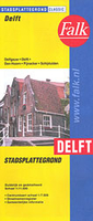
Delft
Delft on an indexed street plan at 1:11, 000 from Falk NV, with an enlargement showing the city’s historic centre in greater detail, plus lists of tram and bus lines, museums, university faculties and buildings, etc.Coverage includes Den Hoorn, Schipluiden and Delfgau, plus Pijnacker shown on the reverse in an inset. Colouring indicates different types of land use (university buildings, greenhouses, industrial areas, parks, etc). One way or restricted entry streets and car parks are marked. Symbols indicate various facilities including campsites. Map legend includes English. The lists with information about transport lines, municipal offices, cultural and sport facilities, etc, are in Dutch only.

Product Description
Reviews/Comments
Add New
Vouchers
No voucher codes found.
Do you know a voucher code for this product or supplier? Add it to Insights for others to use.
Do you know a voucher code for this product or supplier? Add it to Insights for others to use.
 Denmark