More From Contributor
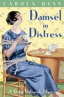
£6.99
Damn You, Autocorrect! brings together some of the laugh-out-loud funny & painfully embarrassing posts from the hit website, which highlight the hilarity that often ensues when text messaging goes wrong: girlfriends getting together for `manila penis, ` (mani pedis); a husband texting his wife that he `laid` the babysitter (paid); a friend asking if someone got tickets to the ` Lady Vagina` (Lady Gaga) concert, & the most popular image on the website so far: a father texting his daughter that he & his mother were going to divorce, when they were in fact just going to Disney. Oops. The phenomenally successful Damnyouautocorrect.com began when author Jillian Madison innocently tried to invite some friends over for gelato. Autocorrect, however, had another idea, & asked them over for a night of `fellatio` instead. & that`s just the tip of the iceberg. Damn You, Autocorrect!

Includes::
200 never before seen submissions to the website, as well as an introduction from the author & website creator, Jillian Madison.

...
Archived Product
£8.99
Dead clients are bad for business, something that Tom Winter, head of security at a private Swiss bank, knows only too well. When a helicopter explosion kills a valuable client & a close colleague, Winter teams up with the mysterious Egyptian businesswoman Fatima Hakim to expose the truth behind their deaths. Together they follow the money trail around the world & back into the Swiss mountains, the NSA watching their every move. As they start closing in on the truth, Winter & Fatima turn from being the hunters to the hunted, finding themselves in a deadly, high-stakes race against the clock. ...
Archived Product
£9.99
Damodar Himal, sheet no. 2884-01, in the topographic survey of Nepal at 1:50, 000 published by the Nepali Government in the late 1990s & early 2000s & produced from remote sensing data by Finnish cartographers as part of that country’s international aid program. The maps cover 15’ x 15’ quadrangles.IMPORTANT – PLEASE NOTE BEFORE ORDERING: AVAILABILITY: although, theoretically at least, still in print, these maps are very difficult to get locally in Nepal and/or from various suppliers elsewhere specializing in obtaining such maps. DELIVERIES MAY TAKE SEVERAL WEEKS OR EVEN MONTHS.PROBLEMS WITH PLACE NAMES: reports from previous users indicate that transliteration of place names differs from that used widely not only on other maps & in guide books but also on the ground itself, in road signs & in the tourist & trekking industry in general. Whilst most names are similar enough to be easily recognizable, e.g. Namche Bajar for Namche Bazar or Lantan for Langtang, we have been told of confusion & difficulties arising from different spellings appearing on these maps.TREKKING ROUTES & TOURIST INFORMATION: whilst the maps show foot trails & mark locations of temples, etc, they carry no specific trekking information. Major trekking routes & places of interest are not highlighted. There is no marking for base camps & other tourist facilities. Map specifications: Contours are at 40m intervals, with graphics and/or coloring to show various features of the terrain (glaciers with moraines & crevasses, quarries, gravel or clay pits, etc.) & vegetation (forests, bush, grass, orchards & plantations, etc). Additional comments such as “open mixed forest mainly bajh & pine” annotate many area. The maps have numerous spot heights, but relatively few peaks are named. Areas outside the country’s borders are left blank. Settlements in remote areas are indicated by markings for individual buildings & the placing of names does not always make it clear which group of buildings they refer to. Road network distinguishes between major & minor foot trails. Symbols mark features such as temples, schools & hospitals, police stations, etc. Also shown are the country’s administrative divisions. The maps have a 1-km UTM grid, plus latitude & longitude lines at intervals of 5’. Map legend & all the text is in English. Coverage: the whole country is now covered, with the north at 1:50, 000, plus central & southern Nepal at 1:25, 000. The two series are complementary, do not overlap & use the same grid & numbering system (apart from the Lumbini Zone, where a different grid & numbering are used). For areas not shown on our grid & titles not listed here, please contact us by e-mail, but please do bear in mind the problems with availability & the likely very long delivery time. ...
Archived Product
£17.99
Damodar Himal on the northern edge of the Annapurna Conservation area presented by Nepa Maps at 1:50, 000 on a map extending from Phu northwards to the Gaurigi & Bhrikuti peaks & west to Muktinath & Ghiling (Geling). Contours are at 40m intervals, with heights for numerous peaks & colouring for the glaciated areas. The map highlights the trek northwards from Phu to the Gaurigi Base Camp & the Bacha Khola Camp, indicating the climbing section between the Bhrikuti Shail BC & the Japanese BC. Also marked is a small section of the Annapurna Circuit across the Thorung La Pass, plus several routes in the western half of the map between Muktinath & Kog, Tamgye, etc. Margin ticks show latitude & longitude at intervals of 2’30”. The map has no index. Map legend

Includes::
English. The whole of the reverse side is covered by notes about the area, including lists of peaks with permit information, first ascents, etc – all the text in this edition is in French only. Titles in this Nepa Maps series have cartography is based on the country’s topographic survey, with contours usually at 40m or 50m intervals, enhanced by relief shading, colouring & graphics to show various features of the terrain, including glaciers, forested or cultivated areas, etc. Numerous peaks, with additional spot heights, plus names of glaciers & mountain ranges are prominently shown. The network of rivers, streams & lakes is shown in great detail, with many smaller rivers & lakes named. Overprint highlights main trekking routes & numerous local trails, with symbols indicating various places of interest & tourist facilities. Most maps are indexed & include additional information such as route profiles, glossaries, etc. All the information is in English & heights are given in metres. To see other titles in this series please click in the series link.

...
Archived Product
£9.99
Damodar Kunda, sheet no. 2984-13, in the topographic survey of Nepal at 1:50, 000 published by the Nepali Government in the late 1990s & early 2000s & produced from remote sensing data by Finnish cartographers as part of that country’s international aid program. The maps cover 15’ x 15’ quadrangles.IMPORTANT – PLEASE NOTE BEFORE ORDERING: AVAILABILITY: although, theoretically at least, still in print, these maps are very difficult to get locally in Nepal and/or from various suppliers elsewhere specializing in obtaining such maps. DELIVERIES MAY TAKE SEVERAL WEEKS OR EVEN MONTHS.PROBLEMS WITH PLACE NAMES: reports from previous users indicate that transliteration of place names differs from that used widely not only on other maps & in guide books but also on the ground itself, in road signs & in the tourist & trekking industry in general. Whilst most names are similar enough to be easily recognizable, e.g. Namche Bajar for Namche Bazar or Lantan for Langtang, we have been told of confusion & difficulties arising from different spellings appearing on these maps.TREKKING ROUTES & TOURIST INFORMATION: whilst the maps show foot trails & mark locations of temples, etc, they carry no specific trekking information. Major trekking routes & places of interest are not highlighted. There is no marking for base camps & other tourist facilities. Map specifications: Contours are at 40m intervals, with graphics and/or coloring to show various features of the terrain (glaciers with moraines & crevasses, quarries, gravel or clay pits, etc.) & vegetation (forests, bush, grass, orchards & plantations, etc). Additional comments such as “open mixed forest mainly bajh & pine” annotate many area. The maps have numerous spot heights, but relatively few peaks are named. Areas outside the country’s borders are left blank. Settlements in remote areas are indicated by markings for individual buildings & the placing of names does not always make it clear which group of buildings they refer to. Road network distinguishes between major & minor foot trails. Symbols mark features such as temples, schools & hospitals, police stations, etc. Also shown are the country’s administrative divisions. The maps have a 1-km UTM grid, plus latitude & longitude lines at intervals of 5’. Map legend & all the text is in English. Coverage: the whole country is now covered, with the north at 1:50, 000, plus central & southern Nepal at 1:25, 000. The two series are complementary, do not overlap & use the same grid & numbering system (apart from the Lumbini Zone, where a different grid & numbering are used). For areas not shown on our grid & titles not listed here, please contact us by e-mail, but please do bear in mind the problems with availability & the likely very long delivery time. ...
Archived Product
£12.99
Map No. 1084, Damvant, in the topographic survey of Switzerland at 1:25, 000 from Bundesamt für Landestopographie (swisstopo), covering the whole country on 247 small format sheets, with special larger maps published for popular regions including some titles now available in hiking versions. Highly regarded for their superb use of graphic relief & hill shading, the maps give an almost 3-D picture of Switzerland`s mountainous terrain. Contours are at 10 m intervals, with 20m intervals in the mountainous areas. All the maps have a 1-km grid for Swiss national coordinates (datum CH 1903). * Small format sheets (Nos. 1011
- 1374)* Map legend in the language of the area covered by the map. Additional margin ticks show latitude & longitude in steps of 2`. The area covered by each map is 17 x 12 km (11 x 7 miles approx). * Special larger sheets (Nos. from 2501 onwards) – STANDARD editions:* No map legend is included but a separate leaflet can be provided instead. The area covered by each map is 25 x 17 km (15 x 11 miles approx).* Special larger sheets (Nos. from 2501 onwards) – HIKING editions:* An overprint highlights hiking, mountain & alpine paths, including regional & national long-distance trails. The maps also show bus routes with bus stops, plus inns in remote locations. The area covered by each map is 25 x 17 km (15 x 11 miles approx).
...
Archived Product
£11.50
Topographic survey of France at 1:25, 000 in IGN`s excellent TOP25 / Série Bleue series. All the maps are GPS compatible, with a 1km UTM grid plus latitude & longitude lines at 5’ intervals. Contours are at 5m intervals except for mountainous areas where the maps have contours at 10m intervals, vividly enhanced by hill shading & graphics for rocky terrain. Colouring with graphics indicates different types of vegetation or land use (deciduous or coniferous forests, moors, orchards, vineyards, etc). PLEASE NOTE: coverage of France at this scale is currently being revised – the format & the presentation of each title are indicated by the letters at the end of its Sheet Reference number (e.g. 0416ET, 3531ETR, 1923SB, etc.)MAPS WITH FULL TOURIST OVERPRINT & AN ENGLISH MAP LEGEND: all TOP25 maps & the SB editions of Série Bleue have an overprint highlighting waymarked walking trails including long-distance GR routes &, where appropriate, ski routes. Symbols indicate campsites, gîtes d’etape, refuges, equestrian centres & other recreational facilities or sites, tourist information centres, cultural heritage, etc. Towns & locations of particular interest are highlighted.- ET or OT = single-sided TOP25 map covering approx. 29x 21 km / 18x 13 miles.- ETR or OTR = waterproof & tear resistant TOP25 map covering the same area as the corresponding ET or OT number, but double-sided, printed on a smaller size sheet with a good overlap between the sides.- SB = Série Bleue map with full tourist overprint; these maps, first introduced in summer 2014, each cover approx. 29x 24km / 18x 15 miles.SÉRIE BLEUE maps with numbers ending in E (Est) or O (Ouest): most editions now indicate the GR routes, but do not show any other tourist information. Map legend is in French only. Each map covers approx. 14x 20km / 9x 12 miles. ...
Archived Product
£6.99
After millennia hiding, Mina Tepes, the princess of the ancient covenant & ruler of all vampires, wants change. Using the vast wealth of the Tepes line, she has paid off the entire gross national debt of Japan & in so doing, gained the authority to create a 'special district' off the coast of Japan that is to become the future haven for vampires from all over the world! Now, on the eve of the landmark press conference announcing the existence of vampires to the world, terrorists & rival factions are plotting to assassinate Mina Tepes. Dance In The Vampire Bund is an ongoing manga series that features stunning artwork & an enthralling original supernatural narrative. ...
Archived Product
£8.99
1963. Kenya is on the verge of independence from British colonial rule. In the Great Rift Valley, Kenyans of all backgrounds come together in the previously white-only establishment of the Jakaranda Hotel. The resident musician is Rajan Salim, who charms visitors with songs inspired by his grandfather`s noble stories of the railway construction that spawned the Kenya they now know. One evening, Rajan is kissed by a mysterious woman in a shadowy corridor. Unable to forget the taste of her lavender-flavoured lips, Rajan sets out to find her. On his journey he stumbles upon the murky, shared history of three men – his grandfather, the owner of the Jakaranda & a British preacher – who were implicated in the controversial birth of a child. What Rajan unearths will open his eyes about the birth not just of a child, but of an entire nation. ...
Archived Product
£25.00
HBO's hit series A GAME OF THRONES is based on George R. R. Martin's internationally bestselling series A SONG OF ICE & FIRE, the greatest fantasy epic of the modern age. A DANCE WITH DRAGONS is the fifth volume in the series. The future of the Seven Kingdoms hangs in the balance. In the east, Daenerys, last scion of House Targaryen, her dragons grown to terrifying maturity, rules as queen of a city built on dust & death, beset by enemies. Now that her whereabouts are known many are seeking Daenerys & her dragons. Among them the dwarf, Tyrion Lannister, who has escaped King's Landing with a price on his head, wrongfully condemned to death for the murder of his nephew, King Joffrey. But not before killing his hated father, Lord Tywin. To the north lies the great Wall of ice & stone
- a structure only as strong as those guarding it. Eddard Stark's bastard son Jon Snow has been elected the 998th Lord Commander of the Night's Watch, but he has enemies both in the Watch & beyond the Wall, where the wildling armies are massing for an assault. On all sides bitter conflicts are reigniting, played out by a grand cast of outlaws & priests, soldiers & skinchangers, nobles & slaves. The tides of destiny will inevitably lead to the greatest dance of all...
...
Archived Product

Damsel In Distress

Simply mad about the girl...In spring a young man`s fancy will turn to love and the Honourable Phillip Petrie is no exception. Daisy`s chum is totally smitten with Miss Gloria Arbuckle, daughter of a millionaire Yank. But before the enthusiastic suitor can pop the question, his beloved is abducted by kidnappers. As a distraught Mr Arbuckle begins assembling the ransom, Phillip enlists Daisy to help him recover his missing sweetheart. Strictly forbidden to contact Scotland Yard, Daisy must resist the temptation to bring dashing Detective Inspector Alec Fletcher onto the case. But as she closes in on the abductors` rural hideway, she begins to suspect that Gloria isn`t the only fair damsel whose life hangs in the balance...Praise for the Daisy Dalrymple series: `Cunning...appropriate
historical detail and witty dialogue are the finishing touches on this engaging 1920s period piece.` Publishers Weekly `As always, Dunn evokes the life and times of 1920s England while providing a plot that is a cut above the average British cosy. This will delight readers who love country-house mysteries.` Booklist `For fans of Dorothy L. Sayers` novels` Library Journal
RIP - This product is no longer available on our network. It was last seen on 25.09.2019

This page now acts as a permanent archive for this product. Add more information using the comments box below to ensure it can still be found by future generations.

Use our search facility to see if it is available from an alternative contributor.
  • External links may include paid for promotion
  • Availability: Out Of Stock
  • Supplier: Stanfords
  • SKU: 9781849013314
Availability: In Stock
£6.99

Product Description

Simply mad about the girl... In spring a young man`s fancy will turn to love & the Honourable Phillip Petrie is no exception. Daisy`s chum is totally smitten with Miss Gloria Arbuckle, daughter of a millionaire Yank. But before the enthusiastic suitor can pop the question, his beloved is abducted by kidnappers. As a distraught Mr Arbuckle begins assembling the ransom, Phillip enlists Daisy to help him recover his missing sweetheart. Strictly forbidden to contact Scotland Yard, Daisy must resist the temptation to bring dashing Detective Inspector Alec Fletcher onto the case. But as she closes in on the abductors` rural hideway, she begins to suspect that Gloria isn`t the only fair damsel whose life hangs in the balance... Praise for the Daisy Dalrymple series: ` Cunning...appropriate historical detail & witty dialogue are the finishing touches on this engaging 1920s period piece.` Publishers Weekly ` As always, Dunn evokes the life & times of 1920s England while providing a plot that is a cut above the average British cosy. This will delight readers who love country-house mysteries.` Booklist ` For fans of Dorothy L. Sayers` novels` Library Journal

Reviews/Comments

Add New

Intelligent Comparison

Oooops!
We couldn't find anything!
Perhaps this product's unique.... Or perhaps we are still looking for comparisons!
Click to bump this page and we'll hurry up.

Price History

Vouchers

No voucher codes found.
Do you know a voucher code for this product or supplier? Add it to Insights for others to use.

Facebook

Jargon Buster

England - A country within the United Kingdom.
Love - Someone who shows deep affection for someone else.
Balance - Something that is evenly weighted to keep something upright.

Supplier Information

Stanfords
Stanfords was established in 1853 and opened their iconic Covent Garden flagship store in 1901. They have become the top retailer of maps, travel books and accessories in the UK and arguably offer the largest selection of maps and travel books worldwide. Famous names such as Captain Robert Falcon Scott, Ranulph Fiennes and Michael Palin have purchased from Stanfords. They now have a shop in Bristol and both stores together with other venues operate a calendar of events including talks, book signings and exhibitions. As a specialist map retailer, the map selection is comprehensive and includes road maps, street maps and walking maps from worldwide destinations, as well as a selection of world atlases and wall maps. Books include travel guides and travel literature. Stanfords also stock globes, from miniatures made of blue marble to magnificent floor-standing globes. The website features a selection of interesting articles on travel topics.
Page Updated: 2023-11-12 20:15:36

Community Generated Product Tags

Oh No! The productWIKI community hasn't generated any tags for this product yet!
Menu