More From Contributor
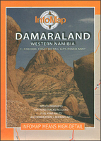
£3.50
Dalston in 1870 in a fascinating series of reproductions of old Ordnance Survey plans in the Alan Godfrey Editions, ideal for anyone interested in the history of their neighbourhood or family. Three versions of this map cover the same area, stretching from Essex Road eastward to London Fields, & from Shacklewell Lane southward to De Beauvoir Crescent; a varied & very busy area, comprising De Beauvoir Town, Kingsland & Balls Pond at the west, Dalston & west Hackney to the east. The North London Railway forms a T-shape across the map, including Dalston Junction & Haggerston stations, while on the later maps the GER line runs down the eastern side, including London Fields & Hackney Downs stations. Kingsland Road & Kingsland High Street run north-south through the centre of the map. Other features include De Beauvoir Square, Kingsland Basin, Bricklayers Almshouses, Dyers Almshouses, Balls Pond Road, Mildmay Compound, German Hospital, Militia Barracks, etc. About the Alan Godfrey Editions of the 25” OS Series: Selected towns in Great Britain & Ireland are covered by maps showing the extent of urban development in the last decades of the 19th & early 20th century. The plans have been taken from the Ordnance Survey mapping & reprinted at about 15 inches to one mile (1:4, 340). On the reverse most maps have historical notes & many also include extracts from contemporary directories. Most maps cover about one mile (1.6kms) north/south, one & a half miles (2.4kms) across; adjoining sheets can be combined to provide wider coverage.FOR MORE INFORMATION & A COMPLETE LIST OF ALL AVAILABLE TITLES PLEASE CLICK ON THE SERIES LINK. ...
Archived Product
£3.50
Dalston in 1894 in a fascinating series of reproductions of old Ordnance Survey plans in the Alan Godfrey Editions, ideal for anyone interested in the history of their neighbourhood or family. Three versions of this map cover the same area, stretching from Essex Road eastward to London Fields, & from Shacklewell Lane southward to De Beauvoir Crescent; a varied & very busy area, comprising De Beauvoir Town, Kingsland & Balls Pond at the west, Dalston & west Hackney to the east. The North London Railway forms a T-shape across the map, including Dalston Junction & Haggerston stations, while on the later maps the GER line runs down the eastern side, including London Fields & Hackney Downs stations. Kingsland Road & Kingsland High Street run north-south through the centre of the map. Other features include De Beauvoir Square, Kingsland Basin, Bricklayers Almshouses, Dyers Almshouses, Balls Pond Road, Mildmay Compound, German Hospital, Militia Barracks, etc. About the Alan Godfrey Editions of the 25” OS Series: Selected towns in Great Britain & Ireland are covered by maps showing the extent of urban development in the last decades of the 19th & early 20th century. The plans have been taken from the Ordnance Survey mapping & reprinted at about 15 inches to one mile (1:4, 340). On the reverse most maps have historical notes & many also include extracts from contemporary directories. Most maps cover about one mile (1.6kms) north/south, one & a half miles (2.4kms) across; adjoining sheets can be combined to provide wider coverage.FOR MORE INFORMATION & A COMPLETE LIST OF ALL AVAILABLE TITLES PLEASE CLICK ON THE SERIES LINK. ...
Archived Product
£3.50
Dalston in 1913 in a fascinating series of reproductions of old Ordnance Survey plans in the Alan Godfrey Editions, ideal for anyone interested in the history of their neighbourhood or family. Three versions of this map cover the same area, stretching from Essex Road eastward to London Fields, & from Shacklewell Lane southward to De Beauvoir Crescent; a varied & very busy area, comprising De Beauvoir Town, Kingsland & Balls Pond at the west, Dalston & west Hackney to the east. The North London Railway forms a T-shape across the map, including Dalston Junction & Haggerston stations, while on the later maps the GER line runs down the eastern side, including London Fields & Hackney Downs stations. Kingsland Road & Kingsland High Street run north-south through the centre of the map. Other features include De Beauvoir Square, Kingsland Basin, Bricklayers Almshouses, Dyers Almshouses, Balls Pond Road, Mildmay Compound, German Hospital, Militia Barracks, etc. About the Alan Godfrey Editions of the 25” OS Series: Selected towns in Great Britain & Ireland are covered by maps showing the extent of urban development in the last decades of the 19th & early 20th century. The plans have been taken from the Ordnance Survey mapping & reprinted at about 15 inches to one mile (1:4, 340). On the reverse most maps have historical notes & many also include extracts from contemporary directories. Most maps cover about one mile (1.6kms) north/south, one & a half miles (2.4kms) across; adjoining sheets can be combined to provide wider coverage.FOR MORE INFORMATION & A COMPLETE LIST OF ALL AVAILABLE TITLES PLEASE CLICK ON THE SERIES LINK. ...
Archived Product
£14.99
In Dilraj Mann`s long awaited graphic novel debut, all eyes turn to East London, where freakish monsters & megalomanical property developers are competing to see who can destroy it first. The only thing that stands in the way of the apocalypse? Hipsters, hotties, & nerds. It`s time to throw down--and look sharp as hell while doing so. ...
Archived Product
£18.99
A STORY OF CORRUPTION, EGO, GREED
- & ONE TERRIBLE MISJUDGMENT. In this jaw-dropping expose, Oliver Shah uncovers the truth
...
Archived Product
£5.99
Damascus in the Footprint Focus Guides, which are targeted at cities, regions & countries worldwide that have no, or very limited, coverage from other publishers. Widely recognised for their reliability & independent writing style, Footprint Focus guides all have the same layout. Smaller than their sister Handbooks, the Focus guides are intended to streamline the information contained so that you have more of what you need, without losing Footprint ...
Archived Product
£12.50
When Peter Clark arrived in Damascus 1992 to open the new British Council office, he was not to know that the next five years were to give him an unique window on the upper echelons of Syrian society in the last few years of Hafez Al-Assad`s rule. Here we see the dramas & routines of everyday life played out against the backdrop of the world`s oldest continually inhabited city on the eve of collapse into civil war. Enchanting & alarming by turns, everyday events combine to paint a vivid & almost nostalgic picture of life in this remarkable city. ...
Archived Product
£7.99
Salim the coachman tells enchanting tales, but suddenly he is struck dumb. Just as Scheherazade told tales to save her life, Salim's friends must spin yarns to save his speech. Set in Damascus in 1959, the novel alternates the real lives of our storytellers with stories from the distant past. These are neither fables nor fairy tales with everlasting, happy endings, & they often require readers to suspend their disbelief. Each chapter is preceded by a one-line hint of what is to come, such as ' How one person's true story was not believed, whereas his most blatant lie was.' ...
Archived Product
£7.99
“ Damascus: Taste of a City” is a touching, thought-provoking book that gives new meaning to what home is & how we experience the feeling of it. It is said: ‘ When a man has lived seven years in Damascus, Damascus lives in him.’ Rafik Schami, a prize-winning novelist & exile, lived in Damascus for twenty-five years. Unable to return to the city he loves, his sister walks him through the streets by phone, vividly describing the sights, sounds & flavours of the ‘ Pearl of the Orient’. With their link established, they wandered through Damascus for a year, he in exile & her giving him the morsels that would inspire this text; so Marie Fadel in the city & Rafik Schami – almost torn apart by longing – on the telephone in Germany. His joy came not only from strolling through the city, but also from realising how the diversity of peoples that have migrated through Damascus have combined to create an outstanding cuisine. He has added their stories to the transcriptions of the walks from the tape recorder that captured every telephone conversation. This book is an incredible example of how two seemingly insurmountable barriers – time & geography – can be overcome. ...
Archived Product
£12.99
Topographic survey of France at 1:25, 000 in IGN`s excellent TOP25 / Série Bleue series. All the maps are GPS compatible, with a 1km UTM grid plus latitude & longitude lines at 5’ intervals. Contours are at 5m intervals except for mountainous areas where the maps have contours at 10m intervals, vividly enhanced by hill shading & graphics for rocky terrain. Colouring with graphics indicates different types of vegetation or land use (deciduous or coniferous forests, moors, orchards, vineyards, etc). PLEASE NOTE: coverage of France at this scale is currently being revised – the format & the presentation of each title are indicated by the letters at the end of its Sheet Reference number (e.g. 0416ET, 3531ETR, 1923SB, etc.)MAPS WITH FULL TOURIST OVERPRINT & AN ENGLISH MAP LEGEND: all TOP25 maps & the SB editions of Série Bleue have an overprint highlighting waymarked walking trails including long-distance GR routes &, where appropriate, ski routes. Symbols indicate campsites, gîtes d’etape, refuges, equestrian centres & other recreational facilities or sites, tourist information centres, cultural heritage, etc. Towns & locations of particular interest are highlighted.- ET or OT = single-sided TOP25 map covering approx. 29x 21 km / 18x 13 miles.- ETR or OTR = waterproof & tear resistant TOP25 map covering the same area as the corresponding ET or OT number, but double-sided, printed on a smaller size sheet with a good overlap between the sides.- SB = Série Bleue map with full tourist overprint; these maps, first introduced in summer 2014, each cover approx. 29x 24km / 18x 15 miles.SÉRIE BLEUE maps with numbers ending in E (Est) or O (Ouest): most editions now indicate the GR routes, but do not show any other tourist information. Map legend is in French only. Each map covers approx. 14x 20km / 9x 12 miles. ...
Archived Product

Damaraland

Damaraland in Namibia at 1:430, 000 on a road map from the South African publishers International Motoring Productions, annotated with numerous GPS waypoints for selected road junctions, settlements and recommended accommodation. Coverage starts just south of Swakopmund and extends northwards to 19º, just beyond Kamanjab.Road classification indicates tarred roads, major and minor gravel roads and 4WD tracks, with driving distances marked on most routes and locations of fuel stations. GPS waypoints for road junctions are marked directly on the map; campsites and other accommodation options are named, with their GPS coordinates listed in a separate table.Symbols indicate locations with access by air and/or tourist lodges and campsites, plus various points of interest. Rather simple
cartography has basic elevation tinting and occasional spot heights; seasonal rivers are marked and main mountain ranges are named. Coverage further north is provided by the publishers’ map of Kaokoland which overlaps with this title.
RIP - This product is no longer available on our network. It was last seen on 25.09.2019

This page now acts as a permanent archive for this product. Add more information using the comments box below to ensure it can still be found by future generations.

Use our search facility to see if it is available from an alternative contributor.
  • External links may include paid for promotion
  • Availability: Out Of Stock
  • Supplier: Stanfords
  • SKU: 9781920566012
Availability: In Stock
£13.99

Product Description

Damaraland in Namibia at 1:430, 000 on a road map from the South African publishers International Motoring Productions, annotated with numerous GPS waypoints for selected road junctions, settlements & recommended accommodation. Coverage starts just south of Swakopmund & extends northwards to 19º, just beyond Kamanjab. Road classification indicates tarred roads, major & minor gravel roads & 4WD tracks, with driving distances marked on most routes & locations of fuel stations. GPS waypoints for road junctions are marked directly on the map; campsites & other accommodation options are named, with their GPS coordinates listed in a separate table. Symbols indicate locations with access by air and/or tourist lodges & campsites, plus various points of interest. Rather simple cartography has basic elevation tinting & occasional spot heights; seasonal rivers are marked & main mountain ranges are named. Coverage further north is provided by the publishers’ map of Kaokoland which overlaps with this title.

Reviews/Comments

Add New

Intelligent Comparison

Oooops!
We couldn't find anything!
Perhaps this product's unique.... Or perhaps we are still looking for comparisons!
Click to bump this page and we'll hurry up.

Price History

Vouchers

No voucher codes found.
Do you know a voucher code for this product or supplier? Add it to Insights for others to use.

Facebook

Jargon Buster

GPS - Global Positioning System - Global position using satellites
fuel - A material used to generate energy.
Gravel - A size of rock between 2mm and 64mm
Road - a manmade lane or a path that is used to speed up travel.
Accommodation - A room in which someone can live in, for example in a hotel
Simple - Basic, easy no difficulty in understanding.

Supplier Information

Stanfords
Stanfords was established in 1853 and opened their iconic Covent Garden flagship store in 1901. They have become the top retailer of maps, travel books and accessories in the UK and arguably offer the largest selection of maps and travel books worldwide. Famous names such as Captain Robert Falcon Scott, Ranulph Fiennes and Michael Palin have purchased from Stanfords. They now have a shop in Bristol and both stores together with other venues operate a calendar of events including talks, book signings and exhibitions. As a specialist map retailer, the map selection is comprehensive and includes road maps, street maps and walking maps from worldwide destinations, as well as a selection of world atlases and wall maps. Books include travel guides and travel literature. Stanfords also stock globes, from miniatures made of blue marble to magnificent floor-standing globes. The website features a selection of interesting articles on travel topics.
Page Updated: 2023-11-12 20:15:36

Community Generated Product Tags

Oh No! The productWIKI community hasn't generated any tags for this product yet!
Menu