More From Contributor

£6.95
Waterproof folded topographic map of the northern Yorkshire Dales at 1:40, 000 from Harvey Maps, produced in association with the Yorkshire Dales National Park Authority. Rights of way are differentiated, including public footpath & bridleways with & without paths on the ground, permissive paths & long distance paths. Cycle trials are shown with different colouring to denote difficulty, with information in the legend on who the path is suitable for & type of bike recommended. The road network is shown, as well as railway lines & stations; national park boundaries are marked. Topography is shown through use of contour lines at 15m intervals, index contours at 75m intervals, spot heights, & altitude colouring at 75m intervals once above 525m. Terrain variations such as crags, large boulders, & sink holes are indicated. The map is GPS compatible. Points of interest & local facilities are clearly displayed, including tea shops, cycle shops, accommodation, & car parks. ...
Archived Product
£10.99
The Dales Way, a 127km / 79 mile long trail from Ilkley in the Yorkshire Dales to Bowness-on Windermere in the Lake District, presented by Rucksack Readers in handy A5 size, spiral-bound, waterproof guide with mapping at 1:112, 000. The 64-page guide provides general advice on when to go, availability of accommodation, etc, &

Includes::
notes on local heritage, geology, habitats & wildlife. Detailed route descriptions, arranged in daily stages, are preceded by a summary of each section of the route giving distance, terrain, & availability of food & drink. The guide is illustrated with numerous colour photos. The route is highlighted on a fold-out map at 1:112, 000. The map has altitude colouring to show the topography & also indicates various facilities & places of interest. No geographical coordinates for GPS users are provided. The publishers themselves recommend that their guide is used in conjunction with the more detailed, contoured & GPS compatible map from Harvey Map Services. To see other titles in this series please click on the series link.

...
Archived Product
£12.95
Terry Marsh’s Cicerone guide to The Dales Way is a comprehensive exploration of this popular walking through the north-west of Engl&. Covering a total of 78 miles, the Dales Way stretches along the eastern fringe of the Lake District between Ilkley & Bowness on Windermere & is one of Britain’s gentlest multi-day routes, ideal for those seeking an introduction to long distance walking. The book is organized in four main sections, with individual sections describing the way through Wharfedale, Dentdale, Lonsdale & the Lakeland fringe & Into Lakel&. Travelling west, the Dales Way makes the most of the delectable surroundings of Wharfedale before crossing into picturesque Dentdale & continuing to Sedbergh. From here, the Way leads to its conclusion at the very edge of Lakel&. The guide is the only one available that covers the Dales Way in both directions & each routes is clearly illustrated with OS mapping & information on points of interest along the way. Colour photographs also give an indication of the highlights of each walk. ...
Archived Product
£14.95
A fully waymarked trail from Ilkley to Bowness-on-Windermere, the Dales Way links two of England`s most celebrated national parks, the Yorkshire Dales & the Lake District. Well served for accommodation & facilities, & with easy walking on riverside paths, it is one of the gentlest multi-day walks in Britain & therefore an ideal introduction to long-distance walking. It can be comfortably completed in 6-8 days. Novices & experienced long-distance walkers alike will find plenty of interest on this wonderful walk, including glorious limestone scenery & characterful historic towns. Presented in six daily stages of 7-19 miles (with suggestions for alternative schedules), this guide describes the Way in both directions, with the main route description running from south to north. Step-by-step route description is accompanied by 1:100, 000 mapping, & a trek planner, showing where facilities are available, is included to facilitate planning. Accommodation listings & useful contacts can be found in the appendices. A separate, conveniently sized map booklet located in the back-cover sleeve provides all the OS 1:25, 000 mapping needed to complete the trail. Accompanying rivers great & small, crossing farmland
- & just a little moorl&, following wandering winding lanes, the Dales Way visits a wide variety of fascinating features
- from churches to viaducts, from traditional villages to ancient stone circles. The guide offers comprehensive notes on local points of interest, as well as an overview of Dales geology, history, plants & wildlife to enhance the walking experience. The practical information is all there too, including when to go, how to get there & what to take, making for an ideal companion to enjoying this delightful route.

...
Archived Product
£11.99
The popular Dales Way long-distance footpath begins in Ilkley, West Yorkshire & runs for 84 miles (135km) to end in the Lake District, in Bowness-on-Windermere. It follows riverside paths along the River Wharf towards Ribblehead & the watershed of northern Engl&, then meanders along the river valleys of Dentdale, the River Mint & the River Kent dropping down into the Lake District to end beside Lake Windermere. It`s a relatively easy walk that takes about a week.

Features:
1. Unique mapping features
- In many walking guides the reader has to read a route description then try to relate it to the map. Our guides are easier to use because walking directions, tricky junctions, places to stay & eat, points of interest & walking times are all writ- ten onto the maps themselves in the places to which they apply. With their uncluttered clarity, these are not general-purpose maps but fully- edited maps drawn by walkers for walkers. Downloadable GPS waypoints also included.2. The largest scale walking maps available
- At just under 1:20, 000 (8cm or 31/8 inches to 1 mile) our maps are bigger than even the most detailed walking maps currently available in the shops.3. An all-in-one guide
- Trailblazer guides include practical informa- tion not usually found in walking guides to the UK: reviews of places to stay, places to eat, attractions along the way & detailed pub- lic transport information showing all access points on the path, for weekend & day walkers.4. 40 large-scale maps at just under 1:20, 000 (8cm or 31/8 inches to 1 mile). 5. Colour overview & stage maps (one stage per page) with trail profiles.6. Walking with a dog. Henry Stedman, the author, was accompanied along the Dales Way by his dog, Daisy.


...
Archived Product
£13.95
The Dales Way, a 135km / 85 mile route in the Yorkshire Dales & the Lake District National Parks, presented at 1:40, 000 on a map from Harvey Map Services. The route itself, between Ilkley & Bowness-on-Windermere, is shown on six panels, with additional three panels covering the access to the start of the Dales Way in Ilkley from Leeds, Harrogate or Shipley near Bradford. Maps in the Harvey’s series covering Great Britain’s national trails & other long-distance footpaths are printed on light, waterproof & tear-resistant synthetic paper & cover the routes at 1:40, 000 or 1:60, 000. Topography is shown by contours at 15m intervals, with additional spot heights plus colouring and/or graphics to provide a very detailed picture of the terrain (boulder fields, scree, crags, etc) & vegetation / land use (pastures, moorl&, woodlands, etc). In Scotland peaks & hills classified as Munros, Corbetts & Donalds are marked. The overprint for the long-distance trail shows sections on local or main roads (highlighting danger points), on tracks, & on footpaths, indicating intermittent or not visible paths. The maps also show other right of way paths, including permissive paths & bridleways. Symbols indicate various facilities & accommodation options (including campsites & youth hostels), pubs & refreshments, food shops, banks, information points, etc, both along the route itself & in the nearby locations. All maps are GPS compatible, with the British National Grid overprinted on each panel. The maps also include useful contact details & general advice. To see other titles in this series please click on the series link. ...
Archived Product
£7.95
All the mapping you need to complete the Dales Way, a 79-mile long-distance route through the Yorkshire Dales, from Ilkley to Bowness-on-Windermere.NOTE: An accompanying Cicerone guidebook
- The Dales Way
- describes the full route with lots of other practical & historical information. The accompanying guidebook

Includes::
a copy of this map booklet. This booklet of Ordnance Survey 1:25, 000 Explorer maps has been designed for convenient use on the trail. It shows the full & up-to-date line of the Dales Way, along with the relevant extract from the OS Explorer map legend. It is conveniently sized for slipping into a jacket pocket or top of a rucksack & comes in a clear PVC sleeve. The Dales Way links two of England`s most celebrated national parks, the Yorkshire Dales & the Lake District. The waymarked route showcases the region`s beautiful limestone landscapes & historic towns & villages as it passes through Wharfedale, Dentdale, Lonsdale & the Lakeland fringe, accompanying rivers great & small, crossing farmland
- & just a little moorland & following wandering winding lanes. Well served for accommodation & facilities, & with easy walking on riverside paths, it is one of the gentlest multi-day walks in Britain & therefore an ideal introduction to long-distance walking.


...
Archived Product
£9.50
Topographical survey of Belgium at 1:20, 000 from Nationaal Geografisch Instituut / Institut Géographique National, the country’s national survey organization. Each 20K map covers one quarter of the corresponding 1:50, 000 map (with adjustments in the border & coastal areas). The maps provide all the information expected of topographic mapping at this scale & in addition have an unusually large amount of vegetation and/or land use information (different types of woodlands, gardens, orchards, heath, etc). The maps have a 1-km UTM grid, with margin ticks for latitude & longitude at intervals of 1`. Map legend & a glossary of terms used on the maps include English. Stanfords keeps as regular stock 20K maps for the World War I battlefields around the Ypres, Messines & Passchendaele, & for the area of the Battle of Waterloo. The 1:20, 000 survey covers the whole of Belgium & maps for other regions can be supplied as special orders. To see the list of titles in this series please click on the series link.PLEASE NOTE: the Long-Distance Footpaths Map of Belgium at 1:300, 000 which shows the division of Belgium into the 50K survey sheets can also be used to see in more detail coverage by the 20K maps. ...
Archived Product
£44.99
Food & surrealism make perfect bedfellows: sex & lobsters, collage & cannibalism, the meeting of a swan & a toothbrush on a pastry case. The opulent dinner parties thrown by Salvador Dali (1904-1989) & his wife & muse, Gala (1894-1982) were the stuff of legend. Luckily for us, Dali published a cookbook in 1973, Les diners de Gala, which reveals some of the sensual, imaginative, & exotic elements that made up their notorious gatherings. This reprint features all 136 recipes over 12 chapters, specially illustrated by Dali, & organized by meal courses, including aphrodisiacs. The illustrations & recipes are accompanied by Dali`s extravagant musings on subjects such as dinner conversation: ” The jaw is our best tool to grasp philosophical knowledge ...
Archived Product
£6.50
Topographic coverage of mainland Spain at 1:25, 000 published by the Centro Nacional de Información Geograficá, the country’s civilian survey organization. The maps have contours at 10m intervals & colouring and/or graphics to show different types of vegetation or land use. Boundaries of national parks & other protected areas are marked. In addition to all the usual information shown on topographic maps at this scale, detailed presentation of the road & rail networks, rural tracks & paths, etc, the maps also show campsites. The maps have a 1-km UTM grid, with margin ticks for latitude & longitude at 1` intervals. Map legend is in Spanish only.PLEASE NOTE: our grid for the whole of Spain is in preparation
- in the meantime, for areas other than those shown on the attached grid please use CNIG’s topographic survey at 1:50, 000 by searching for ‘SI00000832’. Each 25K map covers one quarter of the corresponding 50K map, with the numbering system: I = NW quarter, II = NE quarter, III = SW quarter & IV = SE quarter. CNIG maps in the Provincial Road Maps series at 1:200, 000 are overprinted with the grid for the 1:50, 000 survey & can be used to see the area covered by each 50K or 25K title in more detail. To see the list of titles in this series please click on the series grid
- for map numbers not yet listed on our website please contact us by email.

...
Archived Product

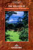
Dales Way (84 Miles)

This is a brand new edition of one of the first guidebooks to this classic walk. ”The Dales Way” is one of Britain`s favourite long-distance walks, running from Ilkley in Wharfedale, through the Yorkshire Dales National Park to a delightful conclusion on the shores of Windermere in the Lake District National Park. At 80 miles in length and generally easy going, the ”Dales Way” makes an ideal introduction to long-distance walking, being comfortably walkable within a week`s holiday. It is well waymarked throughout and spends many miles on delectable riverbanks and passing through some archetypal Dales villages. An additional bonus is that each end of the route is accessible by rail. After a re-survey of the entire route in Spring 2012, numerous changes and improvements have been
made to this already well-used guide, which now includes a stunning collection of more than 50 full colour photographs depicting the countless memorable features and landscapes along the way. The three link routes from Leeds, Bradford and Harrogate are also described.Concise route descriptions are complemented by a wealth of background information, with an introductory section dealing with planning the walk, including useful addresses, contacts and essential services; also an extremely useful log section.
RIP - This product is no longer available on our network. It was last seen on 25.09.2019

This page now acts as a permanent archive for this product. Add more information using the comments box below to ensure it can still be found by future generations.

Use our search facility to see if it is available from an alternative contributor.
  • External links may include paid for promotion
  • Availability: Out Of Stock
  • Supplier: Stanfords
  • SKU: 9781907626104
Availability: In Stock
£8.99

Product Description

This is a brand new edition of one of the first guidebooks to this classic walk. ” The Dales Way” is one of Britain`s favourite long-distance walks, running from Ilkley in Wharfedale, through the Yorkshire Dales National Park to a delightful conclusion on the shores of Windermere in the Lake District National Park. At 80 miles in length & generally easy going, the ” Dales Way” makes an ideal introduction to long-distance walking, being comfortably walkable within a week`s holiday. It is well waymarked throughout & spends many miles on delectable riverbanks & passing through some archetypal Dales villages. An additional bonus is that each end of the route is accessible by rail. After a re-survey of the entire route in Spring 2012, numerous changes & improvements have been made to this already well-used guide, which now

Includes::
a stunning collection of more than 50 full colour photographs depicting the countless memorable features & landscapes along the way. The three link routes from Leeds, Bradford & Harrogate are also described. Concise route descriptions are complemented by a wealth of background information, with an introductory section dealing with planning the walk, including useful addresses, contacts & essential services; also an extremely useful log section.

Reviews/Comments

Add New

Intelligent Comparison

Oooops!
We couldn't find anything!
Perhaps this product's unique.... Or perhaps we are still looking for comparisons!
Click to bump this page and we'll hurry up.

Price History

Vouchers

No voucher codes found.
Do you know a voucher code for this product or supplier? Add it to Insights for others to use.

Facebook

Jargon Buster

Colour - The categorised spectrum of light visable to humans
running - A sport or hobbie of moving rapidly on foot. Can also refer to the running of equipment or run time refering to the length of time an applicance can run or the quiet running of an applicance.
Classic - Something that is still like it was originally a high quality standard.
Ideal - Something that satisfies a perfect criteria.

Supplier Information

Stanfords
Stanfords was established in 1853 and opened their iconic Covent Garden flagship store in 1901. They have become the top retailer of maps, travel books and accessories in the UK and arguably offer the largest selection of maps and travel books worldwide. Famous names such as Captain Robert Falcon Scott, Ranulph Fiennes and Michael Palin have purchased from Stanfords. They now have a shop in Bristol and both stores together with other venues operate a calendar of events including talks, book signings and exhibitions. As a specialist map retailer, the map selection is comprehensive and includes road maps, street maps and walking maps from worldwide destinations, as well as a selection of world atlases and wall maps. Books include travel guides and travel literature. Stanfords also stock globes, from miniatures made of blue marble to magnificent floor-standing globes. The website features a selection of interesting articles on travel topics.
Page Updated: 2023-11-12 20:15:36

Community Generated Product Tags

Oh No! The productWIKI community hasn't generated any tags for this product yet!
Menu