
 United Kingdom
 France
 Germany
 Netherlands
 Sweden
 USA
USA
 Italy
Italy
 Spain
Spain
More From Contributor

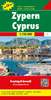
Cyprus Marco Polo Map
Cyprus at 1:200, 000 on a road map from Marco Polo Travel Publishing with prominent highlighting of best sights in both parts of the island, an index which includes geographic features, five street plans, etc. The demarcation zone is clearly marked. Names of towns and villages on the Greek side are shown in both alphabets, with topographic features in Latin alphabet only; on the Turkish side of the border, where appropriate, old Greek names are also included.The map, with cartography from the renowned German publishers MairDumont, boldly highlights motorways, main and secondary roads but also includes many local roads and tracks. Scenic routes are clearly marked and driving distances are shown on most local roads. Picturesque towns and villages, as well as various places of
interest on both sides of the demarcation line are prominently highlighted. Topography is indicated by relief shading with spot heights and colouring for forested areas. The map has latitude and longitude grid at intervals of 10’ with ticks at 1’. Multilingual map legend includes English.The index is in a separate booklet attached to the map cover, together with street plans of the Old Towns in Nicosia (both sides) and Famagusta/Gazimagusa/Ammochostos, plus the central parts of Larnaka, Limassol and Pafos. Also provided are descriptions of 15 best sights across the whole island, a distance/driving times table and information on basic driving regulations. A fold-out flap in the cover presents an overview of Cyprus with the fifteen recommended sights, making it easier to locate them
on the main map.
Product Description
Reviews/Comments
Add New
Vouchers
No voucher codes found.
Do you know a voucher code for this product or supplier? Add it to Insights for others to use.
Do you know a voucher code for this product or supplier? Add it to Insights for others to use.
 Denmark