
 United Kingdom
 France
 Germany
 Netherlands
 Sweden
 USA
USA
 Italy
Italy
 Spain
Spain
More From Contributor

Cyprus F&B Top 10 Tips
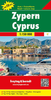
Road map of Cyprus with street plans of six main cities, plans of archeological sites and, on the reverse, notes on the country’s history and brief descriptions of main places of interest. All place names are also given in the Greek alphabet, except in Northern Cyprus, where most names are in Latin alphabet only but with their Turkish alternatives. The map emphasizes main roads, but also includes unpaved roads and cart tracks. Intermediate driving distances are shown on main routes. Symbols highlight various places of interest, including campsites and mountain refuges, archaeological sites, churches, monasteries and mosques, golf courses, caves, etc. The boundary between the two parts of the island and of the British base at Akrotiri is marked. Relief shading with occasional
spot height gives some indication of the topography. The map has no geographical coordinates or an index. Also included are insets showing main streets in the central parts of Nicosia, Famagusta, Kyrenia, Larnaca, Limassol and Pafos. Plans are provided for the archaeological sites at Kourion, Salamis and Saranda Kolones. On the reverse are notes on the island’s history and brief descriptions of several places of interest. Map legend and all the text include English.
spot height gives some indication of the topography. The map has no geographical coordinates or an index. Also included are insets showing main streets in the central parts of Nicosia, Famagusta, Kyrenia, Larnaca, Limassol and Pafos. Plans are provided for the archaeological sites at Kourion, Salamis and Saranda Kolones. On the reverse are notes on the island’s history and brief descriptions of several places of interest. Map legend and all the text include English.

Product Description
Reviews/Comments
Add New
Vouchers
No voucher codes found.
Do you know a voucher code for this product or supplier? Add it to Insights for others to use.
Do you know a voucher code for this product or supplier? Add it to Insights for others to use.
 Denmark