
 United Kingdom
 France
 Germany
 Netherlands
 Sweden
 USA
USA
 Italy
Italy
 Spain
Spain
More From Contributor


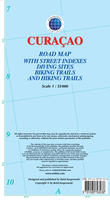
Curaçao
Curaçao at 1:55, 000 on an indexed and GPS compatible map from the Caribbean-based cartographer Michal Kasprowski highlighting numerous diving sites and various places of interest, with street plans of four locations plus on the reverse a more detailed enlargement of the Willemstad urban area.Topography is shown by altitude colouring with spot heights; the Christoffel National Parks is clearly marked. Road network indicates main roads and shows secondary roads and local tracks or footpaths. Recommended biking and hiking trails are highlighted. Symbols show various facilities and places of interest including beaches and snorkelling sites, flamingo areas, scenic views, etc. Along the coast numerous diving sites are marked. The map has latitude and longitude lines at 2’ intervals. The
index lists road/street names. Map legend is in English.On the reverse is an indexed enlargement showing in greater detail at 1:18, 500 the Willemstad urban area, including access to the island’s international airport. Also provided are indexed street plans of Barber, Grote Barber and Tera Cota (all at 1:8, 000), plus central Willemstad at 1:6, 000.
index lists road/street names. Map legend is in English.On the reverse is an indexed enlargement showing in greater detail at 1:18, 500 the Willemstad urban area, including access to the island’s international airport. Also provided are indexed street plans of Barber, Grote Barber and Tera Cota (all at 1:8, 000), plus central Willemstad at 1:6, 000.

Product Description
Reviews/Comments
Add New
Vouchers
No voucher codes found.
Do you know a voucher code for this product or supplier? Add it to Insights for others to use.
Do you know a voucher code for this product or supplier? Add it to Insights for others to use.
 Denmark