
 United Kingdom
 France
 Germany
 Netherlands
 Sweden
 USA
USA
 Italy
Italy
 Spain
Spain
More From Contributor


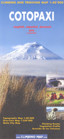
Cotopaxi
Cotopaxi at 1:40, 000 on an excellent map combining topographic coverage of the mountain with panorama maps showing the two approaches to the summit, a road map of the region, a street plan of Quito, information on vegetation an geology, etc.On one side is a map of Cotopaxi at 1:40, 000 with showing routes to the summit. Contours are at 40m intervals, enhanced by relief shading, spot heights, graphics and colouring showing exposed rock, scree, and icefields, plus different types of vegetation: shrubs, grass and swamps. Climbing routes to the summit and other tracks are marked. Symbols highlight locations suitable for camping. The map has a 1km UTM grid, plus margin ticks for latitude and longitude.On the reverse two panorama views show the north and the south face of the
mountain highlighting the routes to the summit, accompanied by brief descriptions, plus a list of GPS waypoints for the northern Normal Route.All the text is in English. Main map legend and route descriptions are also in Spanish and German.The map also includes:* A regional map at 1:250, 000 with altitude colouring, showing access by road and rail from Quito.* A street plan of Quito with an enlargement of the New Town, annotated with facilities and services including lists of travel agencies for trekking and mountaineering, and equipment shops.* Insets showing a panorama of vegetation zones with drawings of fauna and flora; information on corps grown at different altitudes; geological profile of Cotopaxi and retreat of glaciation.* A panorama map of the Avenida de los volcanes, plus
separate insets showing Imbabura, Cayambe, Pichincha, Ilinizas and Chimborazo at approx. 1:150, 000 with altitude colouring, roads and trails, plus camping sites and refuges.

Product Description
Reviews/Comments
Add New
Vouchers
No voucher codes found.
Do you know a voucher code for this product or supplier? Add it to Insights for others to use.
Do you know a voucher code for this product or supplier? Add it to Insights for others to use.
 Denmark