More From Contributor
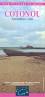
£9.99
Cote D' Azur in the AA Spiral Guides series; comprising a selection of titles exploring a wide range of cities, regions & countries in a handy, spiral loose-leaf format. Fold-out flaps at the front & back of each title give an overview of the main regions covered, with page numbers so visitors can locate their destination easily. Each guide explores the destination geographically by region or area & provides the essential information for the main sites & attractions in addition to a recommended tour of each area by car. An introductory section - ...
Archived Product
£13.99
Cote d` Azur in Cadogan’s popular series of guides to the regions of France; combining solid research, detailed, practical information & individual points of view on each destination – each title is individually authored. Cadogan guides are particularly strong on historical & cultural sightseeing but also carry a good sense of the particular lifestyle of a destination. Informed itineraries on topics such as architecture, food & drink are included, & the low-down on outdoor activities & cultural events is also provided. Authors have handpicked their own recommendations for places to stay & to eat & drink & an added feature of the series is site & building plans, which are included where relevant to descriptions provided in the accompanying text. Introductions to Cadogan guides are more sizeable than many other market competitors, containing a profile of the French region, history, art & architecture, topical matters, food & drink, planning your trip & an A-Z of practical concerns on tourist information. Each title in the series is organized geographically by region & has a particular focus on cultural & historical sights. Guides conclude with a glossary, language tips & recommendations for further reading. ...
Archived Product
£10.99
Côte d` Azur at 1:150, 000 from Freytag & Berndt with street plans of central Nice, Menton, Monte Carlo, Cannes, St. Tropez & Toulon, plus a booklet attached to the cover with brief descriptions of 10 selected places of interest, all highlighted on the map. Relief is portrayed by hill-shading. Road network

Includes::
information indispensable for happy holiday driving: motorway service stations & motels, restricted entry for cars or caravans, scenic roads & special tourist routes, etc. Railway lines & selected long-distance GR routes are also shown. Towns & villages of particular interest are highlighted. Symbols indicate various landmarks, places of interest & facilities, e.g. archaeological sites, churches & castles, campsites & youth hostels, etc. Coverage extends northwards to include most of the Grand Canyon du Verdon. Latitude & longitude lines are drawn at 10` intervals. A separate booklet attached to the map cover has an index listing all the localities with their postcodes, plus brief descriptions of 10 main places of interest, all highlighted on the map. Also included are street plan of central Nice, Menton, Monte Carlo, Cannes, St. Tropez & Toulon. * Map legend & the notes include English.*

...
Archived Product
£12.95
The coasts of Goele, Penthievre & Emeraude are among the main attractions for holiday-makers in Brittany. They are the object of Philip Plisson`s lense in this book, including photographs taken both on foot & by air. Plisson reveals long sandy beaches ending in granite cliffs, the medieval chateau at Fort-la-Latte, the gothic ruins of the abbey at Beauport, & the different faces & colours of the sea. ...
Archived Product
£5.99
Cote-d` Armor & Ille-et-Vilaine départments of Brittany at 1:150, 000 in Michelin’s Local Series of France, with highlighting for scenic routes, an index, a special panel with best sights & recommended driving tours, & street plans of central Rennes & St-Brieuc. The map extends along Brittany’s northern coast from Avranches & Mont-St-Michel to beyond Perros-Guirec, & south to Redon. Coverage

Includes::
Dinan, Dinard, Lannion, Fougères, etc. PLEASE NOTE: our coverage image, provided by the publishers, does not take into account which areas along the edge of the map are blocked by the index & the additional features – in the south-west the area south of Pontivy & west of Redon is not covered. Maps in Michelin’s Local Series of France have the same cartography (road network & place names shown on the maps) as the publishers’ Regional Series at 1;200, 000 but enlarged here to 1:150, 000 to provide greater clarity & larger, easier to read print size. Road network is presented in great detail, indicating width, motorway services & rest areas, dangerous or restricted entry roads, steep gradients, height & weight restrictions, etc. Scenic sections are highlighted. The maps also show selected cycle paths & nature trails. Railway lines are shown with stations & local airports are marked. Symbols indicate various places of interest, with additional star rating for best sights, based on the publishers’ Green Guides for French regions. Satellite-derived base with colouring for the forested areas & boundaries of national or regional parks shows the topography. In the mountainous regions the maps have bold, very effective relief shading, with a large number of names of peaks, passes, & other topographic features. The maps have latitude & longitude lines at 10’ intervals & are indexed. Map legend

Includes::
English. Each title in addition

Includes::
a panel showing the area’s principal roads & places of interest, plus recommendations for sightseeing tours. Also provided are town centre maps of main cities, indicating principal traffic arteries, one way streets & places of interest. Only selected streets are named & listed in the accompanying index. Please click on the series link to see all the titles in this series.


...
Archived Product
£15.95
Cotopaxi at 1:40, 000 on an excellent map combining topographic coverage of the mountain with panorama maps showing the two approaches to the summit, a road map of the region, a street plan of Quito, information on vegetation an geology, etc. On one side is a map of Cotopaxi at 1:40, 000 with showing routes to the summit. Contours are at 40m intervals, enhanced by relief shading, spot heights, graphics & colouring showing exposed rock, scree, & icefields, plus different types of vegetation: shrubs, grass & swamps. Climbing routes to the summit & other tracks are marked. Symbols highlight locations suitable for camping. The map has a 1km UTM grid, plus margin ticks for latitude & longitude. On the reverse two panorama views show the north & the south face of the mountain highlighting the routes to the summit, accompanied by brief descriptions, plus a list of GPS waypoints for the northern Normal Route. All the text is in English. Main map legend & route descriptions are also in Spanish & German. The map also
Includes::* A regional map at 1:250, 000 with altitude colouring, showing access by road & rail from Quito.* A street plan of Quito with an enlargement of the New Town, annotated with facilities & services including lists of travel agencies for trekking & mountaineering, & equipment shops.* Insets showing a panorama of vegetation zones with drawings of fauna & flora; information on corps grown at different altitudes; geological profile of Cotopaxi & retreat of glaciation.* A panorama map of the Avenida de los volcanes, plus separate insets showing Imbabura, Cayambe, Pichincha, Ilinizas & Chimborazo at approx. 1:150, 000 with altitude colouring, roads & trails, plus camping sites & refuges.
...
Archived Product
£6.99
Selected areas of the Cotswolds on a laminated & waterproof map from Goldeneye presenting 10 specially chosen off-road circular routes highlighted on contoured map extracts at scales around 1:25, 000 / 1:50, 000, annotated with directions & accompanied by brief descriptions. Map extracts cover circuits from/around: Bidbury, Bisley – Edgeworth – Woodmancote, Bredon Hill – Dumbleton, Broadway, Charlbury, Cotswold Water Park, Great tew, Northleach, Stow-on-the-Wold – Slaughters, & Winchcombe. Each map panel shows the topography by contour lines, in most titles at 50 foot intervals, with additional altitude colouring & spot heights. The route is prominently highlighted including, where appropriate, sections on the road network & is annotated at various points with instructions. Symbols indicate various landmarks & places of interest. The maps have no coordinates for GPS navigation. Each map extract is accompanied by details of the overall route distance, timing, grade & refreshment points, plus a brief description. ...
Archived Product
£9.95
A celebration of one of Britain`s most beautiful & beloved regions, the Cotswold Sketchbook is packed with over 200 evocative line & watercolour illustrations of some of the author`s favourite villages & towns in this charming part of Engl&. The illustrations are accompanied by historical footnotes, quirky facts, a gazetteer
- &, most importantly, where to park & get a cup of tea! The Cotswolds is one of Britain`s premier tourist areas, drawing visitors from all over the world, which ensures a huge market for the Cotswold Sketchbook, which is both a useful guidebook & a perfect souvenir. Jim Watson is an experienced illustrator & writer with three best-selling, award-winning books on the English Lake District to his credit. A unique book, in handy hardback A5 format, beautifully bound & printed in colour throughout, the Cotswold Sketchbook, along with the Lake District Sketchbook, are the first titles in a new series celebrating the most beautiful regions of Britain. Casebound & printed in colour.
...
Archived Product
£7.95
Whether you are new to the Cotswolds or have lived here all your life, you'll discover a wealth of insights into people & places you've probably never come across before, for example: How did the hamlet of Ready Token get its name? What was the world record broken at Sapperton in 1789? Who were the coin forgers who lived at Bagendon? Where might you see a life-size elephant cast in bronze? Answers to the above are just a few of the interesting facts that you will come across as you travel through 90 miles of history following the ' Cotswold Village Trail'. This 208 pages perfect bound book takes the reader from Mickleton in the North to Westonbirt in the South. It was serialised on Radio during 1998 on Country Matters. A publication by Nicholas Reardon of Reardon Publishing
- the Cotswold Publisher
- a family run publishing house based in the Cotswolds using local authors & having the books printed in the Gloucestershire Cotswolds, Reardon Publishing are also able to offer a whole range of Cotswold books along with maps & videos mostly in the specialised subjects of Walking, Cycling, Driving, & tourism in both the Cotswolds & associated Counties.

...
Archived Product
£11.99
The Cotswolds in the Pathfinder Guides series, produced in association with Ordnance Survey & published by Crimson; comprising a range of walking guides to popular British destinations. Each Pathfinder guide

Includes::
28 varied walks ranging from easy strolls to exhilarating hikes & is accompanied by 1:25, 000 Ordnance Survey mapping with marked, colour-coded routes. Introductory sections profile the county or region covered, with recommendations on the best time to visit & a brief explanation of GPS. An

...
Archived Product

Cotonou

A streetmap indexed for streets, quarters, communes and a variety of locations e.g. hotels, markets, churches, embassies and public buildings. Two insets show at a larger scale (although with little extra detail) the areas around the main railway station and the area of administrative buildings and hotels between the Place de l’Independence and the Sheraton Hotel.Built-up areas, notable buildings and main roads are emphasized, and plantations, open green spaces and flooded areas are also shown. Other detail includes railways, quarter and commune boundaries, with symbols showing post offices, places of worship, hotels, monuments and health centres. The legend is in French only.
RIP - This product is no longer available on our network. It was last seen on 25.09.2019

This page now acts as a permanent archive for this product. Add more information using the comments box below to ensure it can still be found by future generations.

Use our search facility to see if it is available from an alternative contributor.
  • External links may include paid for promotion
  • Availability: Out Of Stock
  • Supplier: Stanfords
  • SKU: 3282118504213
Availability: In Stock
£10.99

Product Description

A streetmap indexed for streets, quarters, communes & a variety of locations e.g. hotels, markets, churches, embassies & public buildings. Two insets show at a larger scale (although with little extra detail) the areas around the main railway station & the area of administrative buildings & hotels between the Place de l’ Independence & the Sheraton Hotel. Built-up areas, notable buildings & main roads are emphasized, & plantations, open green spaces & flooded areas are also shown. Other detail

Includes::
railways, quarter & commune boundaries, with symbols showing post offices, places of worship, hotels, monuments & health centres. The legend is in French only.

Reviews/Comments

Add New

Price History

Vouchers

No voucher codes found.
Do you know a voucher code for this product or supplier? Add it to Insights for others to use.

Facebook

Jargon Buster

Hotel - An establishment which provides lodging for a fee
Railways - A set of tracks that have been laid for the purpose of trains to travel up and down them

Supplier Information

Stanfords
Stanfords was established in 1853 and opened their iconic Covent Garden flagship store in 1901. They have become the top retailer of maps, travel books and accessories in the UK and arguably offer the largest selection of maps and travel books worldwide. Famous names such as Captain Robert Falcon Scott, Ranulph Fiennes and Michael Palin have purchased from Stanfords. They now have a shop in Bristol and both stores together with other venues operate a calendar of events including talks, book signings and exhibitions. As a specialist map retailer, the map selection is comprehensive and includes road maps, street maps and walking maps from worldwide destinations, as well as a selection of world atlases and wall maps. Books include travel guides and travel literature. Stanfords also stock globes, from miniatures made of blue marble to magnificent floor-standing globes. The website features a selection of interesting articles on travel topics.
Page Updated: 2023-11-12 20:15:36

Community Generated Product Tags

Oh No! The productWIKI community hasn't generated any tags for this product yet!
Menu