
 United Kingdom
 France
 Germany
 Netherlands
 Sweden
 USA
USA
 Italy
Italy
 Spain
Spain
More From Contributor


Cornwall - Short Walks
Cornwall in the Short Walks guide series, produced in association with Ordnance Survey and published by Crimson; comprising a range of walking guides to popular British destinations. Each title includes 20 varied walks that are suitable for walkers of all ages and abilities and is accompanied by detailed Explorer 1:25, 000 Ordnance Survey mapping with colour-coded marked routes.The guides are structured in three main sections with different levels of difficulty- short and easy walks, those of modest length that may include uphill walking and more challenging routes that may be longer and over more rugged terrain- covering a total of 20 walks. Each walk has a mini summary and an information box with details of starting points, distance, approximate time, parking and any individual
route features. There is also information on refreshments, local transport and public toilets en route. Appendices provide further useful information on walking safety, GPS, the Countryside Code, local organisations and Ordnance Survey maps.
route features. There is also information on refreshments, local transport and public toilets en route. Appendices provide further useful information on walking safety, GPS, the Countryside Code, local organisations and Ordnance Survey maps.
Product Description
Reviews/Comments
Add New
Intelligent Comparison
Archived Product
Cornwall 40 Short Walks Stanfords
£9.99
Archived Product
Cotswolds - Short Walks Stanfords
£7.99
Archived Product
Cotswolds - Short Walks Stanfords
£5.99
Archived Product
Cotswolds - Short Walks Stanfords
£6.99
Archived Product
Cornwall Walks Stanfords
£11.99
Archived Product
Cornwall Walks Stanfords
£11.99
Archived Product
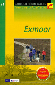
Exmoor - Short Walks Stanfords
£6.99
Archived Product
Dorset - Short Walks Stanfords
£6.99
Vouchers
No voucher codes found.
Do you know a voucher code for this product or supplier? Add it to Insights for others to use.
Do you know a voucher code for this product or supplier? Add it to Insights for others to use.
 Denmark