
 United Kingdom
 France
 Germany
 Netherlands
 Sweden
 USA
USA
 Italy
Italy
 Spain
Spain
More From Contributor


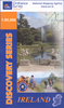
Cork
Cork on an indexed street plan at 1:15, 000 from the Ordnance Survey of Ireland. An enlargement shows the city centre in greater detail, highlighting 34 places of interest and/or facilities. The index is in a separate booklet attached to the map cover.OSI street plans highlight main traffic arteries in each town: national primary and secondary routes, regional roads and main streets, with one way and pedestrianized streets. Colouring indicates public buildings, highlighting the more important ones, railway/bus stations and medical centres. A range of symbols indicate various facilities, including An
Product Description
Reviews/Comments
Add New
Intelligent Comparison
Archived Product
Cook Stanfords
£71.50
Archived Product
York Stanfords
£3.99
Archived Product
York Stanfords
£3.99
Vouchers
No voucher codes found.
Do you know a voucher code for this product or supplier? Add it to Insights for others to use.
Do you know a voucher code for this product or supplier? Add it to Insights for others to use.
 Denmark