
 United Kingdom
 France
 Germany
 Netherlands
 Sweden
 USA
USA
 Italy
Italy
 Spain
Spain
More From Contributor


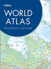


Collins World Atlases
Collins World Atlases feature the same award winning cartography as Times World Atlases. Cartography type is specified for physical maps, i.e. whether maps are displayed in accordance with variations on mercator, conic or azimuthal systems. Atlases contain a wide range of topical reference maps and country based geographical facts, figures and information. Atlases include time zone information. Atlas cartography is very clear and detailed. A significant amount of information is shown for both topographic features and transport infrastructures, whilst a large quantity of cities and towns are displayed according to population and administrative or national significance. National parks and reserves are demarcated and sites of specific interest are pinpointed on most atlases. On the
majority of atlases relief shading is given according to a contour interval scale and spot heights are shown. Maps are presented with lines of latitude and longitude at varying degree intervals, depending on what is most suitable to each page`s cartography, and a letter/number grid combination locates indexed places. *Please note - each Collins atlas may have different specifications, please see individual descriptions. As a rule of thumb, the more expensive the atlas the more detail it contains.*
majority of atlases relief shading is given according to a contour interval scale and spot heights are shown. Maps are presented with lines of latitude and longitude at varying degree intervals, depending on what is most suitable to each page`s cartography, and a letter/number grid combination locates indexed places. *Please note - each Collins atlas may have different specifications, please see individual descriptions. As a rule of thumb, the more expensive the atlas the more detail it contains.*

Product Description
Reviews/Comments
Add New
Vouchers
No voucher codes found.
Do you know a voucher code for this product or supplier? Add it to Insights for others to use.
Do you know a voucher code for this product or supplier? Add it to Insights for others to use.
 Denmark