More From Contributor

£115.00
Delicate gimbaled table top compass made from solid brass with antique bronze finish. Elegant h&-tooled brass construction. A lovely accessory for nautically inspired home interiors. Its origin was from ancient China. Considered an instrument of magic by many, it was used primarily for Feng Shui purposes. Taken to the West it introduced open-sea navigation. Sailing vessels no longer needed to hug the coast. If we do not have this item in stock we will order it for you from our supplier. Delivery generally takes 3 weeks within the UK. For overseas delivery queries please email sales@stanfords.co.uk ...
Archived Product
£9.99
Map No. 148, Collegiate Peaks Wildernes, CO, in an extensive series of GPS compatible, contoured hiking maps of USA’s national & state parks or forests & other popular recreational areas. Cartography based on the national topographic survey, with additional tourist information. The maps, with most titles now printed on light, waterproof & tear-resistant plastic paper, highlight walking trails along with campsites & other accommodation, picnic sites, areas for various recreational pursuits such as horse riding or skiing, drinking water sources, & many other facilities of interest to the outdoor enthusiast. Cartography is based on information from the USGS (United States Geological Survey
- the country’s national survey organization), revised by the National Geographic Maps in cooperation with the National Park Service, USDA Forest Service, etc. Topography is excellently presented by contours (interval varies according to scale), enhanced by relief shading & colouring/graphics for wood cover, glaciers, etc. All heights are given in feet. The maps have a UTM grid plus latitude & longitude margin ticks & GPS waypoints for selected important locations. Each map is double-sided to give either maximum coverage of the chosen area or additional enlargements of its important sections. Accompanying notes provide useful information on relevant regulations, safety precautions, contact addresses, etc.* *IMPORTANT
- PLEASE NOTE: the series is very extensive, ranging in scale from 1:400, 000 for the vast national parks of Alaska to 1:25, 000 for local map in several states. We recommend, therefore, viewing the series by state rather than the whole list.*

...
Archived Product
£5.99
Have fun in the sun with Louis the Lion, make some music with Michael the Monkey, drop in for tea with Margot & Mo & meet all the animals with Collette the Cow! Join these four characters on an early-learning journey of colours, shapes, numbers & noises which is rewarding for both parent & child. ...
Archived Product
£10.99
Colli Euganei
- Abano & Montegrotto Terme area in a series of Tabacco maps at 1:25, 000 covering the Dolomites & the mountains
...
Archived Product
£7.95
Map No. 600, Colli Euganei
- Abano Terme
- Montegrotto Terme, from Kompass in a series of walking maps of selected areas of

...
Archived Product
£18.99
The crash of the Indian plate into Asia is the biggest known collision in geological history, & it continues today. The result is the Himalaya & Karakoram
- one of the largest mountain ranges on Earth. The Karakoram has half of the world`s highest mountains & a reputation as being one of the most remote & savage ranges of all. In this beautifully illustrated book, Mike Searle, a geologist at the University of Oxford & one of the most experienced field geologists of our time, presents a rich account of the geological forces that were involved in creating these mountain ranges. Using his personal accounts of extreme mountaineering & research in the region, he pieces together the geological processes that formed such impressive peaks.
...
Archived Product
£16.99
Collina di Torino, the hills east of Turin, presented at 1:25, 000 in a series of large, contoured & GPS compatible walking maps from Fraternali Editore, printed on light, waterproof & tear-resistant synthetic paper. Maps in this series have topography shown by contour lines at 5m intervals with relief shading, spot heights, & colouring and/or graphics for woodlands, glaciers, marshl&, etc. On waymarked footpaths the maps show official route numbers or initials of long-distance trails such as the GTA (Grande Traversata delle Alpi). Other local paths are also marked & the overprint shows Via Ferrata climbing sections, climbing sites, & selected ski touring routes. Road network is finely graded to indicate both unsurfaced roads & country tracks. Railway lines are shown with stations. Symbols show locations of shelters, refuges & campsites, tourist information offices, historical sites, etc. The maps have a 1km UTM grid. Map legend

Includes::
English. To see other titles in this series please click on the series link.

...
Archived Product
£10.99
Map No. 127, Colline di Forlí, in a series of GPS compatible hiking maps at 1:50, 000 from the Istituto Geografico Adriatico, covering parts of central Italy: eastern Tuscany, with northern Umbria & the Marches, plus the south-eastern of part of Emilia-Romagna. The maps have contours at 50m intervals with additional shading & numerous spot heights. Colouring indicates different types of land use, including woodlands, olive groves, vineyards & orchards. National park & protected areas are marked. An overprint highlights local waymarked hiking routes, indicating their official number or name, including many long-distance routes such GEA (Grande Escursione Appeninica) & the course of the E1 cross-European footpath. Most titles also show cycle routes and/or mountain bike trails. A range of symbols indicate various facilities such as campsites, mountain refuges & other rural accommodation, bars & restaurants, sport & recreational places, historical & cultural monuments, etc. Road network is graded according to width,

Includes::
country tracks, & shows sections closed to motorised traffic plus locations of petrol stations. The maps have a 5km UTM, plus latitude & longitude lines at intervals of 5’. Map legend

Includes::
English. * * Please note: titles shown on the accompanying grid in broken lines are not yet published.*


...
Archived Product
£10.99
Map No. 124, Colline di Rimini, in a series of GPS compatible hiking maps at 1:50, 000 from the Istituto Geografico Adriatico, covering parts of central Italy: eastern Tuscany, with northern Umbria & the Marches, plus the south-eastern of part of Emilia-Romagna. This title covers the holiday resorts on the Adriatic coast around Rimini, Riccione & Cattolica, extending inland to include Sam Marino & Urbino. Maps in this series have contours at 50m intervals with additional shading & numerous spot heights. Colouring indicates different types of land use, including woodlands, olive groves, vineyards & orchards. National park & protected areas are marked. An overprint highlights local waymarked hiking routes, indicating their official number or name, including many long-distance routes such GEA (Grande Escursione Appeninica) & the course of the E1 cross-European footpath. Most titles also show cycle routes and/or mountain bike trails. A range of symbols indicate various facilities such as campsites, mountain refuges & other rural accommodation, bars & restaurants, sport & recreational places, historical & cultural monuments, etc. Road network is graded according to width,

Includes::
country tracks, & shows sections closed to motorised traffic plus locations of petrol stations. The maps have a 5km UTM, plus latitude & longitude lines at intervals of 5’. Map legend

Includes::
English. * * Please note: titles shown on the accompanying grid in broken lines are not yet published.*


...
Archived Product
£10.99
Bologna with its southern environs, including the San Luca Hills, on a contoured & GPS compatible map at 1:25, 000 from L` Escursionista Editore highlighting waymarked walking trails & other local paths, not signposted but open to hikers. An inset extends the coverage north of the city to show the route along the Canale Navile. Topography is presented by contours at 20m intervals with relief shading & colouring indicating orchards & woodlands, plus boundaries of protected areas. Waymarked trails are shown with their route numbers, & the map also highlights other hiking routes open to the general public, indicating points where access may be closed as the path crosses private property. The map has a 1km UTM grid. Map legend

Includes::
English. The map comes with a 50-page booklet, in Italian only, describing the area & its sights.

...
Archived Product

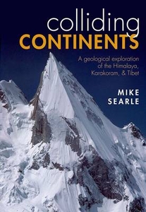
Colliding Continents

The crash of the Indian plate into Asia is the biggest known collision in geological history, and it continues today. The result is the Himalaya and Karakoram - one of the largest mountain ranges on Earth. The Karakoram has half of the world`s highest mountains and a reputation as being one of the most remote and savage ranges of all. In this beautifully illustrated book, Mike Searle, a geologist at the University of Oxford and one of the most experienced field geologists of our time, presents a rich account of the geological forces that were involved in creating these mountain ranges. Using his personal accounts of extreme mountaineering and research in the region, he pieces together the geological processes that formed such impressive peaks.
RIP - This product is no longer available on our network. It was last seen on 25.09.2019

This page now acts as a permanent archive for this product. Add more information using the comments box below to ensure it can still be found by future generations.

Use our search facility to see if it is available from an alternative contributor.
  • External links may include paid for promotion
  • Availability: Out Of Stock
  • Supplier: Stanfords
  • SKU: 9780199653003
Availability: In Stock
£25.00

Product Description

The crash of the Indian plate into Asia is the biggest known collision in geological history, & it continues today. The result is the Himalaya & Karakoram
- one of the largest mountain ranges on Earth. The Karakoram has half of the world`s highest mountains & a reputation as being one of the most remote & savage ranges of all. In this beautifully illustrated book, Mike Searle, a geologist at the University of Oxford & one of the most experienced field geologists of our time, presents a rich account of the geological forces that were involved in creating these mountain ranges. Using his personal accounts of extreme mountaineering & research in the region, he pieces together the geological processes that formed such impressive peaks.

Reviews/Comments

Add New

Intelligent Comparison

Oooops!
We couldn't find anything!
Perhaps this product's unique.... Or perhaps we are still looking for comparisons!
Click to bump this page and we'll hurry up.

Price History

Vouchers

No voucher codes found.
Do you know a voucher code for this product or supplier? Add it to Insights for others to use.

Facebook

Jargon Buster

History - Anything that happens in the past. An acedemic subject.
World - A physical grouping, commonly used to describe earth and everything associated with ti
Earth - A planet third from the sun. Similar size to Venus but rich in water and complex life.
Personal - Something that belongs more to an individual due to it affecting them more by relating to them.

Supplier Information

Stanfords
Stanfords was established in 1853 and opened their iconic Covent Garden flagship store in 1901. They have become the top retailer of maps, travel books and accessories in the UK and arguably offer the largest selection of maps and travel books worldwide. Famous names such as Captain Robert Falcon Scott, Ranulph Fiennes and Michael Palin have purchased from Stanfords. They now have a shop in Bristol and both stores together with other venues operate a calendar of events including talks, book signings and exhibitions. As a specialist map retailer, the map selection is comprehensive and includes road maps, street maps and walking maps from worldwide destinations, as well as a selection of world atlases and wall maps. Books include travel guides and travel literature. Stanfords also stock globes, from miniatures made of blue marble to magnificent floor-standing globes. The website features a selection of interesting articles on travel topics.
Page Updated: 2023-11-12 20:15:36

Community Generated Product Tags

Oh No! The productWIKI community hasn't generated any tags for this product yet!
Menu