
 United Kingdom
 France
 Germany
 Netherlands
 Sweden
 USA
USA
 Italy
Italy
 Spain
Spain
More From Contributor


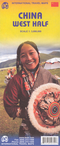
China West ITMB
Western China on a double-sided, indexed road map from ITMB at 1:3, 000, 000, with three insets providing a street plan of central Lhasa, a wider coverage of the city and a plan of the Norbulingka complex. The map divides the region north/south and coverage extends east to approx. 106° (Lanzhou/Chengou).The map has altitude colouring in feet, although spot heights are given in metres. Topographic information includes deserts, swamps, salt lakes and pans, etc. National parks and other protected areas are highlighted. All place names are shown only transliterated. Within Tibet, official Chinese versions are used, e.g. Xigaze rather than the traditional Shigatse.The map shows the region’s road and rail networks and highlights numerous places of interest including archaeological
ruins, monasteries and other religious sites, etc. Also shown are internal administrative boundaries with names of the provinces. The map has latitude and longitude lines are at intervals of 2°.Three insets cover Lhasa: the city at approx. 1:50, 000 with its railway station and temples outside the central district; the Potala area annotated with tourist accommodations and facilities, temples, etc; plus a plan of the Norbulingka complex.
ruins, monasteries and other religious sites, etc. Also shown are internal administrative boundaries with names of the provinces. The map has latitude and longitude lines are at intervals of 2°.Three insets cover Lhasa: the city at approx. 1:50, 000 with its railway station and temples outside the central district; the Potala area annotated with tourist accommodations and facilities, temples, etc; plus a plan of the Norbulingka complex.

Product Description
Reviews/Comments
Add New
Intelligent Comparison
Archived Product

China East ITMB Stanfords
£9.99
Archived Product

Cuba West ITMB Stanfords
£9.99
Archived Product
China West Stanfords
£9.50
Archived Product
China ITMB Stanfords
£9.99
Archived Product

China South ITMB Stanfords
£9.99
Archived Product

Africa Western ITMB Stanfords
£9.99
Vouchers
No voucher codes found.
Do you know a voucher code for this product or supplier? Add it to Insights for others to use.
Do you know a voucher code for this product or supplier? Add it to Insights for others to use.
 Denmark