
 United Kingdom
 France
 Germany
 Netherlands
 Sweden
 USA
USA
 Italy
Italy
 Spain
Spain
More From Contributor


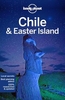

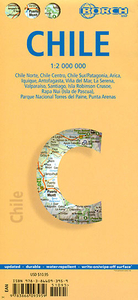
Chile Borch
Laminated and waterproof tourist road map of Chile and Patagonia, with street plans of central Santiago and seven other cities, an enlargement for the Torres del Paine National Park, and maps of the Robinson Crusoe Island and Easter Island. This long country is conveniently presented in three overlapping sections, all at the same scale of 1:2, 000, 000: north of Santiago - Valparaiso to Villarrica and Pucón - Temuco to Cape Horn including the border areas of Argentina, plus the whole of Patagonia south of Peninsula Valdés. The map shows the region’s main road and rail networks and indicates local airports and aerodromes. Numerous national parks and other protected areas are highlighted and symbols mark locations of archaeological and historical sites, beaches and other places of
interest. Topography is shown by relief shading with spot heights. An enlargement at 1:240, 000 shows the Torres del Paine National Park, indicating locations of campsites, refuges and information centres. Street plans show central Santiago, Valparaíso, Antofagasta, Arica, Iquique, La Serena and Viña del Mar and Punta Arenas. Further insets show Robinson Crusoe Island (1:200, 000) and Easter Island (1:160, 000) indicating their distances from the mainland. All the maps and street plans are indexed, with lists of locations/streets and places of interest.
interest. Topography is shown by relief shading with spot heights. An enlargement at 1:240, 000 shows the Torres del Paine National Park, indicating locations of campsites, refuges and information centres. Street plans show central Santiago, Valparaíso, Antofagasta, Arica, Iquique, La Serena and Viña del Mar and Punta Arenas. Further insets show Robinson Crusoe Island (1:200, 000) and Easter Island (1:160, 000) indicating their distances from the mainland. All the maps and street plans are indexed, with lists of locations/streets and places of interest.

Product Description
Reviews/Comments
Add New
Intelligent Comparison
Archived Product
Chicago Borch Stanfords
£8.99
Archived Product
Crete Borch Stanfords
£9.99
Archived Product
Thailand Borch Stanfords
£9.99
Vouchers
No voucher codes found.
Do you know a voucher code for this product or supplier? Add it to Insights for others to use.
Do you know a voucher code for this product or supplier? Add it to Insights for others to use.
 Denmark