More From Contributor

£7.95
Chile at 1:2, 500, 000 from Nelles Verlag, on a double-sided map with coverage including southern Argentina. The map also provides six street plans & enlargements for the environs of Santiago, Torres del Paine & Peninsula Valdes. The northern part of the map, from Arequipa & la Paz to south of Talca covers the adjoining parts of Peru, Bolivia & Argentina, whilst on the reverse is the whole of the Chilean & Argentine Patagonia. Bold relief shading with plenty of names of various peaks & glaciers, plus additional spot heights shows the topography. Numerous national parks & other protected area are highlighted. Road network distinguishes between mainly & partly surfaced highways, & shows distances on main routes. Railway lines & local airports are included, as are the shipping routes from Puerto Montt down the Patagonian fjords. The map also shows internal administrative boundaries in both counties. Various places of interest are prominently marked. Latitude & longitude margin ticks are at 2 ...
Archived Product
£10.99
Chile at 1:2, 500, 000 from Nelles Verlag, on a double-sided map with coverage including southern Argentina. The map also provides six street plans & enlargements for the environs of Santiago, Torres del Paine & Peninsula Valdes. The northern part of the map starts at Arequipa & La Paz & extends south beyond Santiago to Talca, covering the adjoining parts of Peru, Bolivia & Argentina; on the reverse is the whole of the Chilean & Argentinian Patagonia. Bold relief shading with plenty of names of various peaks & glaciers, plus additional spot heights shows the topography. Numerous national parks & other protected area are highlighted. Road network distinguishes between mainly & partly surfaced highways, & shows distances on main routes. Railway lines & local airports are included, as are the shipping routes from Puerto Montt down the Patagonian fjords. The map also shows internal administrative boundaries in both counties. Various places of interest are prominently marked. Latitude & longitude margin ticks are at 2° intervals. The map has no index of localities. Map legend

Includes::
English. Enlargements show in greater details the environs of Santiago & Torres del Paine, plus Peninsula Valdes in Argentina. Also included are street plans, in addition annotated with selected hotels, covering central Santiago, Arica, Antofagasta, Iquique, La Serena & Punta Arenas, plus a map of the Easter Isl&.

...
Archived Product
£9.99
Chile at 1:1, 750, 000 in a series of Adventure maps from the National Geographic Society with cartography provided by Reise Know-How. The map, double-sided & printed on light waterproof & tear-resistant plastic paper, presents this unusually long country in four sections. The two central panels also provide good coverage of the Argentinian Andes, whilst the southern panel (southwards from approx. 46º) extends to all the way to the Atlantic to cover southern Patagonia. Cartographic information provided by Reise Know-How has been adjusted to follow the house style of the NGS Adventure series with greater emphasis on the country’s topography. Altitude colouring in broader bands has been replaced here by contours at 200m intervals, enhanced by relief shading with graphics for salt flats, glaciers & names of mountain ranges, peaks, etc. Boundaries of national parks & other protected areas are very prominently highlighted. Road network distinguishes between paved & unsurfaced roads &

Includes::
selected tracks. Driving distances are shown on main & selected secondary roads & border crossings are marked. Railway lines are included, local airports are indicated & in the fjords between Puerto Montt & Puerto Natales ferry routes are marked. Internal administrative boundaries are shown with names of the provinces. Symbols highlight various places of interest & recreational areas (campsites shown on the RK-H maps are not included here). The map has a grid with latitude & longitude at intervals of 1º & an extensive index of localities with a separate list of national parks & protected areas. Overall, the NGS map presents a more vivid picture of the country’s topography, whilst the original RK-H version provides clearer information for touring the country by road or rail.PLEASE NOTE: to ensure regular supplies & faster delivery to our customers we keep as regular stock the Reise Know-How editions whilst the NGS versions can be ordered on request.

...
Archived Product
£12.79
Chile & Easter Island in the Countries & Regions series from Lonely Planet, market-leading comprehensive guides aimed at independent travellers & serving a large range of international destinations. Frank & informal in style, the guides explore an extensive range of sights, activities, accommodation, restaurants & nightlife & are designed for practical use while travelling on the road. Written & researched by a team of experts, each book is independent in its recommendations & suggestions, often offering individual takes on individual destinations. Widely recognised for their reliability, each Lonely Planet country & region guide has the same layout. Introductory sections profile the destination with individual chapters on particular highlights, getting started, (including when to go) itineraries, history, culture, arts, food & drink & the environment. Each guide is organised geographically by region, with individual sections detailing an extensive range of sights, places of interest, attractions, restaurants, nightlife, accommodation & any local activities. The guides have detailed explanations of historical context where relevant. There is also practical guidance on ...
Archived Product
£15.99
Chile & Easter Island in the Countries & Regions series from Lonely Planet, market-leading comprehensive guides aimed at independent travellers & serving a large range of international destinations. Frank & informal in style, the guides explore an extensive range of sights, activities, accommodation, restaurants & nightlife & are designed for practical use while travelling on the road. Written & researched by a team of experts, each book is independent in its recommendations & suggestions, often offering individual takes on individual destinations. Widely recognised for their reliability, each Lonely Planet country & region guide has the same layout. Introductory sections profile the destination with individual chapters on particular highlights, getting started, (including when to go) itineraries, history, culture, arts, food & drink & the environment. Each guide is organised geographically by region, with individual sections detailing an extensive range of sights, places of interest, attractions, restaurants, nightlife, accommodation & any local activities. The guides have detailed explanations of historical context where relevant. There is also practical guidance on ...
Archived Product
£9.50
Chile at 1:2, 500, 000 on a locally produced road map from Trekkingchile, with on the reverse a street plan of central Santiago, plus a map of main roads around the capital. The road map presents Chile on three panels, with an additional inset for Tierra del Fuego. The map has altitude colouring in bands of 1000m & with a choice of shades which in the southern half of the country hardly convey its mountainous topography. Main peaks are shown with heights & national parks or protected areas are marked. The map shows the network of main & secondary roads & south of Puerto Montt indicates shipping routes. Chile’s regional zones are marked. Latitude & longitude lines are drawn at 1° intervals. Approx. half of the reverse side is taken by a street plan of central Santiago, clearly highlighting locations of various places of interest & facilities, including metro stations, embassies, cultural institutions, etc. Also provided is a very basic road map showing principal transit routes across the city. Map legends are in English. ...
Archived Product
£9.99
Laminated & waterproof tourist road map of Chile & Patagonia, with street plans of central Santiago & seven other cities, an enlargement for the Torres del Paine National Park, & maps of the Robinson Crusoe Island & Easter Isl&. This long country is conveniently presented in three overlapping sections, all at the same scale of 1:2, 000, 000: north of Santiago
- Valparaiso to Villarrica & Pucón
- Temuco to Cape Horn including the border areas of Argentina, plus the whole of Patagonia south of Peninsula Valdés. The map shows the region’s main road & rail networks & indicates local airports & aerodromes. Numerous national parks & other protected areas are highlighted & symbols mark locations of archaeological & historical sites, beaches & other places of interest. Topography is shown by relief shading with spot heights. An enlargement at 1:240, 000 shows the Torres del Paine National Park, indicating locations of campsites, refuges & information centres. Street plans show central Santiago, Valparaíso, Antofagasta, Arica, Iquique, La Serena & Viña del Mar & Punta Arenas. Further insets show Robinson Crusoe Island (1:200, 000) & Easter Island (1:160, 000) indicating their distances from the mainl&. All the maps & street plans are indexed, with lists of locations/streets & places of interest.

...
Archived Product
£12.99
Chile in Marshall Cavendish`s Culture Shock! Series; comprising a range of guides that inform visitors of the finer points & details relating to social etiquette, traditions & customs; bringing visitors to a sensitive yet substantial understanding of the country or city in question. The series targets those who are planning long stays in the destination or extended periods of residence. The guides are written by authors who have experienced the joys & pitfalls of cultural adaptation, & so are ideally placed to provide informative & relevant advice. Each title contains insights into local culture & traditions, guidance on adapting to the local environment, linguistic help & lots of general advice about local culture & idiosyncrasies to help prepare readers for their visit. Each title is structured similarly, beginning with the first impressions a visitor might expect to have. The guides aim to help readers understand the local culture through first appreciating the motivations, beliefs & attitudes of the local people. Practical advice on settling in is provided, with focused sections on accommodation, utilities, health, education & telecommunications. There is also extensive information on the destination’s culture, food & leisure, in addition to a specific section addressing the concerns of those travelling on business. ...
Archived Product
£10.99
Chile in Marshall Cavendish's Culture Shock! Series; comprising a range of guides that inform visitors of the finer points & details relating to social etiquette, traditions & customs; bringing visitors to a sensitive yet substantial understanding of the country or city in question. The series targets those who are planning long stays in the destination or extended periods of residence. The guides are written by authors who have experienced the joys & pitfalls of cultural adaptation, & so are ideally placed to provide informative & relevant advice. Each title contains insights into local culture & traditions, guidance on adapting to the local environment, linguistic help & lots of general advice about local culture & idiosyncrasies to help prepare readers for their visit. Each title is structured similarly, beginning with the first impressions a visitor might expect to have. The guides aim to help readers understand the local culture through first appreciating the motivations, beliefs & attitudes of the local people. Practical advice on settling in is provided, with focused sections on accommodation, utilities, health, education & telecommunications. There is also extensive information on the destination ...
Archived Product
£11.99
Chile on a laminated, waterproof & tear-resistant overview map from the Buenos Aires based de Dios designed to highlight the country’s 100 best places of interest, attractions, & national parks, etc., all with descriptions. A basic road map of the whole country is divided north/south & annotated with 100 colour markers cross-referenced to the information panels. Also highlighted are numerous other places of interest, national parks & nature reserves, etc. * All the text is in English.* ...
Archived Product

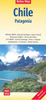
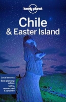
Chile And Easter Island

Lonely Planet’s Chile & Easter Island is your passport to the most relevant, up-to-date advice on what to see and skip, and what hidden discoveries await you. Strap on your pack and hike through winding forests to behold the granite mountain spires of Las Torres; watch sunset turn the Valle de la Luna intense purple, gold, pink and yellow; and puzzle over the giant statues of Easter Island. All with your trusted travel companion. Get to the heart of Chile & Easter Island and begin your journey now!Inside Lonely Planet’s Chile & Easter Island:Colour maps and images throughoutHighlights and itineraries help you tailor your trip to your personal needs and interestsInsider tips to save time and money and get around like a local, avoiding crowds and trouble spotsEssential info at your
fingertips - hours of operation, phone numbers, websites, transit tips, pricesHonest reviews for all budgets - eating, sleeping, sightseeing, going out, shopping, hidden gems that most guidebooks missCultural insights provide a richer, more rewarding travel experience - covering history, people, music, landscapes, wildlife, cuisine, politicsOver 97 maps for easy navigationCovers Santiago, Middle Chile, Southern Heartland, Archipielago Juan Fernandez, Norte Grande, Norte Chico, Sur Chico, Chiloé, Northern Patagonia, Southern Patagonia, Tierra del Fuego, Easter Island
RIP - This product is no longer available on our network. It was last seen on 25.09.2019

This page now acts as a permanent archive for this product. Add more information using the comments box below to ensure it can still be found by future generations.

Use our search facility to see if it is available from an alternative contributor.
  • Availability: Out Of Stock
  • Supplier: Stanfords
  • SKU: 9781786571656
Availability: In Stock
£16.99

Product Description

Lonely Planet’s Chile & Easter Island is your passport to the most relevant, up-to-date advice on what to see & skip, & what hidden discoveries await you. Strap on your pack & hike through winding forests to behold the granite mountain spires of Las Torres; watch sunset turn the Valle de la Luna intense violet, gold, pink & yellow; & puzzle over the giant statues of Easter Isl&. All with your trusted travel companion. Get to the heart of Chile & Easter Island & begin your journey now! Inside Lonely Planet’s Chile & Easter Island: Colour maps & images throughout Highlights & itineraries help you tailor your trip to your personal needs & interests Insider tips to save time & money & get around like a local, avoiding crowds & trouble spots Essential info at your fingertips
- hours of operation, phone numbers, websites, transit tips, prices Honest reviews for all budgets
- eating, sleeping, sightseeing, going out, shopping, hidden gems that most guidebooks miss Cultural insights provide a richer, more rewarding travel experience
- covering history, people, music, landscapes, wildlife, cuisine, politics Over 97 maps for easy navigation Covers Santiago, Middle Chile, Southern Heartl&, Archipielago Juan Fernandez, Norte Grande, Norte Chico, Sur Chico, Chiloé, Northern Patagonia, Southern Patagonia, Tierra del Fuego, Easter Island

Reviews/Comments

Add New

Intelligent Comparison

Oooops!
We couldn't find anything!
Perhaps this product's unique.... Or perhaps we are still looking for comparisons!
Click to bump this page and we'll hurry up.

Price History

Vouchers

No voucher codes found.
Do you know a voucher code for this product or supplier? Add it to Insights for others to use.

Facebook

Jargon Buster

Gold - A precious highly conductive metal
Pink - A colour made by combining red and white
Watch - A small clock designed to be worn on a person
Date - A day on a calendar
Date - A social activity whith a current or potential partner
Yellow - A primary colour. The sun is often described as yellow
Purple - A colour between red and blue. Commonly associated with Cadburys
phone - Short for telephone. A device that transmits sound allowing point to point communication over long distances
History - Anything that happens in the past. An acedemic subject.
Colour - The categorised spectrum of light visable to humans
Heart - An organ that pumps blood around the body. Usually related to love.
Gold - A colour, a type of rich metal. Chemical symbol AU.
Rewarding - Achieving and doing something good.
Puzzle - A problem usually in need of thought for a solution.
Personal - Something that belongs more to an individual due to it affecting them more by relating to them.
Experience - To gain further knowledge by practising.

Supplier Information

Stanfords
Stanfords was established in 1853 and opened their iconic Covent Garden flagship store in 1901. They have become the top retailer of maps, travel books and accessories in the UK and arguably offer the largest selection of maps and travel books worldwide. Famous names such as Captain Robert Falcon Scott, Ranulph Fiennes and Michael Palin have purchased from Stanfords. They now have a shop in Bristol and both stores together with other venues operate a calendar of events including talks, book signings and exhibitions. As a specialist map retailer, the map selection is comprehensive and includes road maps, street maps and walking maps from worldwide destinations, as well as a selection of world atlases and wall maps. Books include travel guides and travel literature. Stanfords also stock globes, from miniatures made of blue marble to magnificent floor-standing globes. The website features a selection of interesting articles on travel topics.
Page Updated: 2023-11-12 20:15:36

Community Generated Product Tags

Oh No! The productWIKI community hasn't generated any tags for this product yet!
Menu