
 United Kingdom
 France
 Germany
 Netherlands
 Sweden
 USA
USA
 Italy
Italy
 Spain
Spain
More From Contributor


Chicago Borch
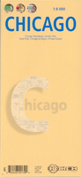
Laminated, waterproof, indexed street plan of downtown Chicago at 1:8, 000 from Borch, with small maps of Lincoln Park, Hyde Park, the environs of Chicago, and O’Hare airport. The main map shows one-way streets, with rail, metro, trolley and riverbus lines and stops clearly marked. Points of interest such as museums, theaters, places of worship are shown; the map also includes 30 ‘Top Sights’ that are also indexed.A map of Lincoln Park at 1:16, 000 shows a similar level of detail to the main map, as does the small map of Hyde Park on the reverse, at 1:20, 000. The reverse also has a map of the environs of Chicago at 1:250, 000, showing the major road network, airports, and rail and metro stops. Both of these maps are indexed. A small inset of O’Hare airport shows
road access, terminals, and parking lots.A Chicago Transit Authority diagram of the public transport network is provided, as is a small map of US administrative and time zones, as well as a small box detailing climate, population and statistical data on Chicago.
road access, terminals, and parking lots.A Chicago Transit Authority diagram of the public transport network is provided, as is a small map of US administrative and time zones, as well as a small box detailing climate, population and statistical data on Chicago.

Product Description
Reviews/Comments
Add New
Vouchers
No voucher codes found.
Do you know a voucher code for this product or supplier? Add it to Insights for others to use.
Do you know a voucher code for this product or supplier? Add it to Insights for others to use.
 Denmark