More From Contributor

£6.99
Discover The Channel Islands with Marco Polo! This compact, straightforward guide is clearly structured for ease of use. It gets you right to the heart of the destination, & provides you with all the latest information & lots of Insider Tips for a thrilling Channel Island adventure.

Includes::
a road atlas & an additional pull-out map & clear, user-friendly structure & layout. Get your bearings with the ` Where to Start` panels & ensure you don`t miss out on the key sights using the ` Highlights` section
- The ` Best Of` pages feature unique aspects of the islands & also suggest places to go for free, tips for things to do when it`s raining & good places to relax. Insider Tips & much more besides: Marco Polo enables you to fully experience the Channel Islands, from the two main islands of Jersey & Guernsey to tiny Herm. Discover what other attractions there are in addition to the endless (surfing) beach of St Ouen`s Bay on Jersey & the spectacular isthmus of La Coupee on Sark, where you can feed on fresh oysters in a rustic World War II bunker without the posh ambience. You`ll also discover that in the exemplary Jersey Zoo you can even camp out & experience all the sounds of an African tropical night. With the Marco Polo Excursions & Tours you can explore the Channel Islands along specific routes, & the Low Budget tips will help you to save money. The author`s Insider Tips encourage you to experience the islands in an individual & authentic way. Don`t go on holiday without a Marco Polo guide!


...
Archived Product
£9.99
Map No. 252, Channel Islands National Parkin California, at 1:25, 000/1:50, 000 in an extensive series of GPS compatible, contoured hiking maps of USA’s national & state parks or forests & other popular recreational areas. Cartography based on the national topographic survey, with additional tourist information. The maps, with most titles now printed on light, waterproof & tear-resistant plastic paper, highlight walking trails along with campsites & other accommodation, picnic sites, areas for various recreational pursuits such as horse riding or skiing, drinking water sources, & many other facilities of interest to the outdoor enthusiast. Cartography is based on information from the USGS (United States Geological Survey
- the country’s national survey organization), revised by the National Geographic Maps in cooperation with the National Park Service, USDA Forest Service, etc. Topography is excellently presented by contours (interval varies according to scale), enhanced by relief shading & colouring/graphics for wood cover, glaciers, etc. All heights are given in feet. The maps have a UTM grid plus latitude & longitude margin ticks & GPS waypoints for selected important locations. Each map is double-sided to give either maximum coverage of the chosen area or additional enlargements of its important sections. Accompanying notes provide useful information on relevant regulations, safety precautions, contact addresses, etc.IMPORTANT
- PLEASE NOTE: the series is very extensive, ranging in scale from 1:400, 000 for the vast national parks of Alaska to 1:25, 000 for local map in several states. We recommend, therefore, viewing the series by state rather than the whole list.

...
Archived Product
£4.99
Channel Islands in the Pocket Guide series from Berlitz; a collection of handy, pocket-sized guides dedicated to an extensive range of cities, regions & countries worldwide. Written in narrative form, individual guides explore the history, main sights & attractions, food & drink, accommodation & local culture of the destination in detail. Each Berlitz pocket guide has a similar format, with colour-coded sections helping readers locate information quickly in addition to distinctive chapters exploring the city or region. An introduction outlines the destination for visitors & a section dedicated to 'A Brief History' actually explores the area in relative depth. A where to go chapter is organized by region & city & is written in prose form with references to individual sites highlighted in bold for clarity. There are also further suggestions on where & when to eat. Recommendations for leisure activities in the region, including sport, nightlife & shopping, are also provided & tailored accordingly for each destination. Handy travel tips are listed alphabetically in a dedicated section, providing practical guidance & helping visitors make the most of their stay. The main hotels, particularly for cities, are also listed in an accommodation section, offering a brief overview with approximate price bandings & relevant contact details. ...
Archived Product
£42.50
This revision of the RCC Pilotage Foundation`s pilot updates the combined volume for this area which encompasses the Channel Islands & extends from St Vaast La Hougue on the east of the Cherbourg peninsula, & works westwards along the Normandy & Brittany coasts to Ouessant. Coverage

Includes::
the Plateau des Roches Douvres as well as detailed sections on the navigable rivers. The navigator benefits enormously from the painstaking approach with which Peter Carnegie has documented his own explorations of these, his home waters. His numerous annotated photographs & the many accompanying charts detail the network of transits between the off-lying rocks & islands of the region. Waypoints are used judiciously to further inform, but the emphasis remains on time-proven & trusted methods of safe navigation in these waters of high tidal range & fast-moving currents. The Channel Islands, Normandy & Brittany coasts can seem a daunting sailing area for those unaccustomed to their ways, but ‘ Carnegie’s book provides reassurance & so much practical advice that anyone using it will feel confident of success.` (Yachting Monthly). It is the definitive pilot for anyone interested in the challenge of exploring the less frequently used passages & anchorages.

...
Archived Product
£9.99
This easy-to-read tidal atlas

Includes::
comprehensive & detailed tidal streams & tidal heights & an annual

...
Archived Product
£12.99
Map No. 1346, Chanrion, in the topographic survey of Switzerland at 1:25, 000 from Bundesamt für Landestopographie (swisstopo), covering the whole country on 247 small format sheets, with special larger maps published for popular regions including some titles now available in hiking versions. Highly regarded for their superb use of graphic relief & hill shading, the maps give an almost 3-D picture of Switzerland`s mountainous terrain. Contours are at 10 m intervals, with 20m intervals in the mountainous areas. All the maps have a 1-km grid for Swiss national coordinates (datum CH 1903). * Small format sheets (Nos. 1011
- 1374)* Map legend in the language of the area covered by the map. Additional margin ticks show latitude & longitude in steps of 2`. The area covered by each map is 17 x 12 km (11 x 7 miles approx). * Special larger sheets (Nos. from 2501 onwards) – STANDARD editions:* No map legend is included but a separate leaflet can be provided instead. The area covered by each map is 25 x 17 km (15 x 11 miles approx).* Special larger sheets (Nos. from 2501 onwards) – HIKING editions:* An overprint highlights hiking, mountain & alpine paths, including regional & national long-distance trails. The maps also show bus routes with bus stops, plus inns in remote locations. The area covered by each map is 25 x 17 km (15 x 11 miles approx).
...
Archived Product
£6.95
Topographic coverage of mainland Spain at 1:50, 000 in the MTN50 (Mapa Topográfico Nacional) series from the Centro Nacional de Información Geografica, the country’s civilian survey organization. The maps have contours at 20m intervals, enhanced by relief shading, plus colouring and/or graphics to show different types of terrain, vegetation or land use. Boundaries of national parks & other protected areas are marked. In addition to all the usual information featured on topographic mapping at this scale, detailed presentation of the road & rail networks, rural tracks & paths, etc, the maps also show campsites & mountain refuges. On more recent editions some GRs, the official long-distance hiking routes, are also marked (although not as clearly as on hiking maps from other publishers). Each map covers 29.5x 18.5 km (with adjustments in the border or coastal areas). The maps have a 1-km UTM grid, plus margin ticks for latitude & longitude at 1` intervals. Map legend is in Spanish only.HOW TO CHOOSE THE RIGHT 50K MAP: all the titles in CNIG’s 200K Provincial Road Maps series at 1:200, 000 are overprinted with the grid for the 1:50, 000 maps & can be used to see the area covered by each 50K title. TO SEE THE LIST OF TITLES IN THIS SERIES PLEASE CLICK ON THE SERIES LINK.PLEASE NOTE
- MAP TITLES: the grids shown on our website serve both the civilian & the military 1:50, 000 topographic series. Although the areas covered by maps in both series are identical (apart from some border or coastal sheets), occasionally map titles differ – only one title is shown on the grid, usually the military one. In Galicia, the Basque country & in the Catalan speaking areas the tendency now is to use local place names rather than the often better known Castilian ones. Where possible, both versions are included in our titles. Map titles listed on our website are based on information received by us at the time of publication, but sometimes maps arrive showing a completely different title! As long as the map number is as ordered, the correct map has been supplied.
...
Archived Product
£7.99
This lyrical evocation of growing up on the banks of the Seine was originally published in 1964. In this minutely observed landscape, where even the wind is a character in its own right, we meet blind Battouflet, the singing hermit of the hillside, solemn Clotilde, the author`s first girlfriend who lives in a chateau in the heart of the forest, & a desiccated & disturbing spinster, Mlle. Firman. Fedden writes with preternatural clarity, taking the reader with him into a long-forgotten yet echoingly familiar world. When Fedden finds himself expelled from this realm by his emerging sexuality, he leaves us reeling with nostalgia for that timeless sense of the present that is the magic of childhood. ...
Archived Product
£11.50
Topographic survey of France at 1:25, 000 in IGN`s excellent TOP25 / Série Bleue series. All the maps are GPS compatible, with a 1km UTM grid plus latitude & longitude lines at 5’ intervals. Contours are at 5m intervals except for mountainous areas where the maps have contours at 10m intervals, vividly enhanced by hill shading & graphics for rocky terrain. Colouring with graphics indicates different types of vegetation or land use (deciduous or coniferous forests, moors, orchards, vineyards, etc). PLEASE NOTE: coverage of France at this scale is currently being revised – the format & the presentation of each title are indicated by the letters at the end of its Sheet Reference number (e.g. 0416ET, 3531ETR, 1923SB, etc.)MAPS WITH FULL TOURIST OVERPRINT & AN ENGLISH MAP LEGEND: all TOP25 maps & the SB editions of Série Bleue have an overprint highlighting waymarked walking trails including long-distance GR routes &, where appropriate, ski routes. Symbols indicate campsites, gîtes d’etape, refuges, equestrian centres & other recreational facilities or sites, tourist information centres, cultural heritage, etc. Towns & locations of particular interest are highlighted.- ET or OT = single-sided TOP25 map covering approx. 29x 21 km / 18x 13 miles.- ETR or OTR = waterproof & tear resistant TOP25 map covering the same area as the corresponding ET or OT number, but double-sided, printed on a smaller size sheet with a good overlap between the sides.- SB = Série Bleue map with full tourist overprint; these maps, first introduced in summer 2014, each cover approx. 29x 24km / 18x 15 miles.SÉRIE BLEUE maps with numbers ending in E (Est) or O (Ouest): most editions now indicate the GR routes, but do not show any other tourist information. Map legend is in French only. Each map covers approx. 14x 20km / 9x 12 miles. ...
Archived Product
£12.99
The third book in the monstrously funny & action-packed Darkmouth series. It`s going to be legendary. The adventures of the most unfortunate Legend Hunter ever to don fighting armour & pick up a desiccator continue... Finn`s been through so much, he`ll now be allowed do what he wants with the rest of his life, right? Wrong. Whether he likes it or not, he`s going to be made a proper Legend Hunter. But then suddenly people start disappearing, Legends are appearing where they shouldn`t, Broonie`s complaining, Emmie`s got a secret
- & an attack so big is coming that Finn has the weight of the world on his shoulders. The weight of two worlds, actually...
...
Archived Product

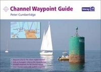
Channel Waypoint Guide

A comprehensive waypoint pilot for both sides of the English Channel, from the Isles of Scilly to Ramsgate, and Calais to the Chenal du Four. Includes the Channel Islands and over 50 cross-channel routes. This Waypoint Guide has been compiled for the convenience of anyone who uses electronic systems for navigating the popular cruising areas of the English Channel, under sail or power. The waypoints presented in this guide have certainly been set with safety in mind, but they have also been chosen to be practical in all kinds of passage-making circumstances, whether yachts are pottering fairly close inshore within a local area, cruising between neighbouring coastal areas, or arriving on a particular stretch of coast after a longish offshore passage. Near the front of the guide is a
set of charts, waypoints and routes for crossing different sections of the English Channel. In full colour with charts devised by Jane Cumberlidge
RIP - This product is no longer available on our network. It was last seen on 25.09.2019

This page now acts as a permanent archive for this product. Add more information using the comments box below to ensure it can still be found by future generations.

Use our search facility to see if it is available from an alternative contributor.
  • External links may include paid for promotion
  • Availability: Out Of Stock
  • Supplier: Stanfords
  • SKU: 9781846233838
Availability: In Stock
£19.95

Product Description

A comprehensive waypoint pilot for both sides of the English Channel, from the Isles of Scilly to Ramsgate, & Calais to the Chenal du Four.

Includes::
the Channel Islands & over 50 cross-channel routes. This Waypoint Guide has been compiled for the convenience of anyone who uses electronic systems for navigating the popular cruising areas of the English Channel, under sail or power. The waypoints presented in this guide have certainly been set with safety in mind, but they have also been chosen to be practical in all kinds of passage-making circumstances, whether yachts are pottering fairly close inshore within a local area, cruising between neighbouring coastal areas, or arriving on a particular stretch of coast after a longish offshore passage. Near the front of the guide is a set of charts, waypoints & routes for crossing different sections of the English Channel. In full colour with charts devised by Jane Cumberlidge

Reviews/Comments

Add New

Intelligent Comparison

Oooops!
We couldn't find anything!
Perhaps this product's unique.... Or perhaps we are still looking for comparisons!
Click to bump this page and we'll hurry up.

Price History

Vouchers

No voucher codes found.
Do you know a voucher code for this product or supplier? Add it to Insights for others to use.

Facebook

Jargon Buster

Colour - The categorised spectrum of light visable to humans
Set - a group of items usually related to one another. Some objects cannot function without the complete set of items.
Safety - prevents damage being caused.
Convenience - A way of being able to carry out a task with little effort
Practical - Weather a task is easy to carry out and realistically succeed.
Popular - Something that is admired and liked by many people.
Pilot - Someone who is qualified to fly a plane.

Supplier Information

Stanfords
Stanfords was established in 1853 and opened their iconic Covent Garden flagship store in 1901. They have become the top retailer of maps, travel books and accessories in the UK and arguably offer the largest selection of maps and travel books worldwide. Famous names such as Captain Robert Falcon Scott, Ranulph Fiennes and Michael Palin have purchased from Stanfords. They now have a shop in Bristol and both stores together with other venues operate a calendar of events including talks, book signings and exhibitions. As a specialist map retailer, the map selection is comprehensive and includes road maps, street maps and walking maps from worldwide destinations, as well as a selection of world atlases and wall maps. Books include travel guides and travel literature. Stanfords also stock globes, from miniatures made of blue marble to magnificent floor-standing globes. The website features a selection of interesting articles on travel topics.
Page Updated: 2023-11-12 20:15:36

Community Generated Product Tags

Oh No! The productWIKI community hasn't generated any tags for this product yet!
Menu