
 United Kingdom
 France
 Germany
 Netherlands
 Sweden
 USA
USA
 Italy
Italy
 Spain
Spain
More From Contributor


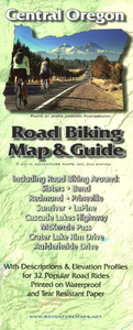
Central Oregon Road Biking Map & Guide
The Central Oregon Road Biking Map & Guide is a waterproof, topographic map that includes detailed road biking information for Bend, Sisters and all of Central Oregon including Redmond, Prineville, Sunriver, LaPine, Cascade Lakes Hwy, Mckenzie Pass, Crater Lake National Park, Aufderheide Drive. It includes 32 detailed ride suggestions with elevation profiles.

Product Description
Reviews/Comments
Add New
Vouchers
No voucher codes found.
Do you know a voucher code for this product or supplier? Add it to Insights for others to use.
Do you know a voucher code for this product or supplier? Add it to Insights for others to use.
 Denmark