
 United Kingdom
 France
 Germany
 Netherlands
 Sweden
 USA
USA
 Italy
Italy
 Spain
Spain
More From Contributor


Central Nottingham 1899
Central Nottingham in 1899 in a fascinating series of reproductions of old Ordnance Survey plans in the Alan Godfrey Editions, ideal for anyone interested in the history of their neighbourhood or family. The map covers the heart of Nottingham, stretching from Portland Road and General Cemetery eastward to Sneinton Elements and Randolph Street, and from High Pavement northward to Cranmer Street. Features include Victoria station, Market Place, St Mary`s church, St Philip`s church, St Stephen`s church, Sneinton Market, St Matthias church, St Catharine`s church and cemetery, Rosehill Farm, St Ann`s church, lace factories, St Barnabas RC Cathedral, Arboretum, High School, tramways, University College, lace dressing rooms, Theatre Royal, Guildhall, Music Hall, House of
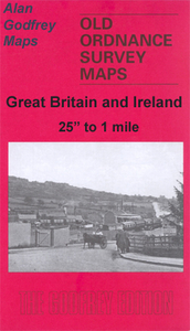
Refuge, St Mark`s church, etc. On the reverse are street directory entries for Bridlesmith`s Gate, Broadway, Goose Gate, High Pavement, Market Street, Stoney Street, Victoria Street and Weekday Cross. About the Alan Godfrey Editions of the 25” OS Series:Selected towns in Great Britain and Ireland are covered by maps showing the extent of urban development in the last decades of the 19th and early 20th century. The plans have been taken from the Ordnance Survey mapping and reprinted at about 15 inches to one mile (1:4, 340). On the reverse most maps have historical notes and many also include extracts from contemporary directories. Most maps cover about one mile (1.6kms) north/south, one and a half miles (2.4kms) across; adjoining sheets can be combined to provide wider
coverage.FOR MORE INFORMATION AND A COMPLETE LIST OF ALL AVAILABLE TITLES PLEASE CLICK ON THE SERIES LINK.

Product Description
Reviews/Comments
Add New
Vouchers
No voucher codes found.
Do you know a voucher code for this product or supplier? Add it to Insights for others to use.
Do you know a voucher code for this product or supplier? Add it to Insights for others to use.
 Denmark