
 United Kingdom
 France
 Germany
 Netherlands
 Sweden
 USA
USA
 Italy
Italy
 Spain
Spain
More From Contributor


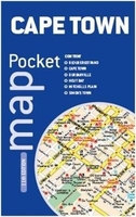
Cape Town Map Studio Pocket Map
Central Cape Town at 1:10, 000 on a handy size pocket street plan from Map Studio highlighting various places of interest, with on the reverse a road map of the Cape Peninsula and the city including access to the international airport.On one side is a detailed street plan of Cape Town’s central districts highlighting main traffic arteries and exits onto the motorways. One way streets and locations of traffic lights and car parks are marked. The plan highlights selected hotels, museums, historical sights, etc. The plan is indexed and includes a separate list of sights and facilities within the waterfront area.On the reverse the city with its outer districts and the Cape Peninsula is shown on a road map at 1:100, 000. The map highlights various places of interest such as heritage
sights and wineries, caravan parks, etc. The index lists roads and suburbs. Also provided are enlargements showing the N1/M5 and N2/M3 motorway junctions, plus a plan of the Kirstenbosch Gardens.
sights and wineries, caravan parks, etc. The index lists roads and suburbs. Also provided are enlargements showing the N1/M5 and N2/M3 motorway junctions, plus a plan of the Kirstenbosch Gardens.

Product Description
Reviews/Comments
Add New
Vouchers
No voucher codes found.
Do you know a voucher code for this product or supplier? Add it to Insights for others to use.
Do you know a voucher code for this product or supplier? Add it to Insights for others to use.
 Denmark