
 United Kingdom
 France
 Germany
 Netherlands
 Sweden
 USA
USA
 Italy
Italy
 Spain
Spain
More From Contributor


Cape Town Flexi Map
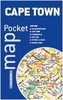
Cape Town on a laminated, tear-resistant Insight Flexi Map with an indexed street plan of the city, maps of the Cape Peninsula and the south-western part of the province, a diagram of the Metrorail, plus extensive tourist information. The plan covers the city’s central districts. One way streets and car parks are clearly marked. Main public buildings, places of interest and selected hotels are prominently highlighted and named. The plan is indexed for streets, districts, parks, hotels, shopping, points of interest and public buildings. Also provided is a diagram of the Metrorail lines.On the reverse two maps cover the Cape Peninsula (1:165, 000) and the south-western part of the Western Cape Province (1:2, 000, 000) including the Winelands and the Cederberg Mountains. Both maps
indicate numerous places of interest and are indexed, as appropriate, for streets, places and points of interest.A special feature of the Insight Flexi series are panels with additional tourist information:- 31 main sights, neatly grouped into sections covering Major City Attractions, Museums, Landscapes and Beaches, Family Attractions, plus Further Afield, are given brief descriptions and are prominently highlighted on the relevant maps.- Further panels provide information on Getting Around and Facts for Visitors, including tourist information offices, public holidays, opening times, money, telecommunications and monthly climate charts.To see the list of other titles in this series please click on the series link.
indicate numerous places of interest and are indexed, as appropriate, for streets, places and points of interest.A special feature of the Insight Flexi series are panels with additional tourist information:- 31 main sights, neatly grouped into sections covering Major City Attractions, Museums, Landscapes and Beaches, Family Attractions, plus Further Afield, are given brief descriptions and are prominently highlighted on the relevant maps.- Further panels provide information on Getting Around and Facts for Visitors, including tourist information offices, public holidays, opening times, money, telecommunications and monthly climate charts.To see the list of other titles in this series please click on the series link.

Product Description
Reviews/Comments
Add New
Vouchers
No voucher codes found.
Do you know a voucher code for this product or supplier? Add it to Insights for others to use.
Do you know a voucher code for this product or supplier? Add it to Insights for others to use.
 Denmark