
 United Kingdom
 France
 Germany
 Netherlands
 Sweden
 USA
USA
 Italy
Italy
 Spain
Spain
More From Contributor


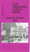
Cannock North 1902
Cannock North in 1902 in a fascinating series of reproductions of old Ordnance Survey plans in the Alan Godfrey Editions, ideal for anyone interested in the history of their neighbourhood or family. Tthe map is double-sided. The main map covers the area east of the town, with much of railway and canal interest. Features here include East Cannock Colliery, Cannock Chase Colliery, The Mount, Cannock Extension Canal with Hednesford Basin Wharf, Hemlock`s Farm, Sidon Hill, Milking Bank, stretch of LNWR Cannock Branch to East Cannock Junction, stretch of LNWR Norton Branch, LNWR Littleworth Extension Branch, etc. On the reverse is a large section of the adjacent map 51.09 which extends coverage westward to the town of Cannock. Features here include brewery, Market Place, St Luke`s
church, Market Hall, Stafford Road area, Oldfallow, Stony Lea, Blackfords, Broomhill Bank, Cannock Cemetery and Oldfallow House (at top of map). About the Alan Godfrey Editions of the 25” OS Series:Selected towns in Great Britain and Ireland are covered by maps showing the extent of urban development in the last decades of the 19th and early 20th century. The plans have been taken from the Ordnance Survey mapping and reprinted at about 15 inches to one mile (1:4, 340). On the reverse most maps have historical notes and many also include extracts from contemporary directories. Most maps cover about one mile (1.6kms) north/south, one and a half miles (2.4kms) across; adjoining sheets can be combined to provide wider coverage.FOR MORE INFORMATION AND A COMPLETE LIST OF ALL AVAILABLE
TITLES PLEASE CLICK ON THE SERIES LINK.

Product Description
Reviews/Comments
Add New
Intelligent Comparison
Archived Product

Cannock South 1902 Stanfords
£3.50
Archived Product

Haydock North 1906 Stanfords
£3.50
Archived Product
Warwick North 1923 Stanfords
£3.50
Archived Product

Wigan North 1907 Stanfords
£3.50
Archived Product

Colne North 1910 Stanfords
£3.50
Vouchers
No voucher codes found.
Do you know a voucher code for this product or supplier? Add it to Insights for others to use.
Do you know a voucher code for this product or supplier? Add it to Insights for others to use.
 Denmark