
 United Kingdom
 France
 Germany
 Netherlands
 Sweden
 USA
USA
 Italy
Italy
 Spain
Spain
More From Contributor

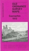


Caerphilly North 1915
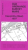
Caerphilly Centre and North in 1915 in a fascinating series of reproductions of old Ordnance Survey plans in the Alan Godfrey Editions, ideal for anyone interested in the history of their neighbourhood or family. Selected towns in Great Britain and Ireland are covered by maps showing the extent of urban development in the last decades of the 19th and early 20th century.In this title: the map covers the centre of Caerphilly and the area north and east, including Caerphilly Castle. The railway station is at the foot of the map, split by the sheetlines. Coverage extends eastward to Gwern-y-domen and northward along Pontygwindy Road. Features include town centre, with Market Place, Castle Street, picture theatre, Van Road, Bartlett Street, castle, Austin Foundry, Van, Castell y Van
remains, Coed y Mardy, disused Rhos-Llantwit colliery, stretch of Caerphilly Branch railway heading north-east from town. On the reverse is a directory of Caerphilly in 1906.About the Alan Godfrey Editions of the 25
remains, Coed y Mardy, disused Rhos-Llantwit colliery, stretch of Caerphilly Branch railway heading north-east from town. On the reverse is a directory of Caerphilly in 1906.About the Alan Godfrey Editions of the 25
Product Description
Reviews/Comments
Add New
Vouchers
No voucher codes found.
Do you know a voucher code for this product or supplier? Add it to Insights for others to use.
Do you know a voucher code for this product or supplier? Add it to Insights for others to use.
 Denmark