-
Home
-
Contributors
-
International
-
Account
-
Information
More From Contributor
Includes:: comprehensive & easy-to-use sailing charts ...
Includes:: comprehensive & easy-to-use sailing charts ...
Includes:: extensive updating throughout. Some areas of the chart redrawn to improve positional accuracy.
Includes:: latest depths in Anse de Perros & the approaches to Le Trieux. Buoyage in the approaches to Riviere de Treguier & Le Legue fully updated. ...
Includes:: comprehensive & easy-to-use sailing charts ...
Includes:: comprehensive & easy-to-use sailing charts ...
Includes:: plans/insets of the following locations:- Weymouth Harbour- Lulworth Cove- Worbarrow Bay- Swanage- Studland Bay- Christchurch- River Stour Each chart contains insets showing local harbours annotated with symbols indicating what facilities can be found there (marinas, mooring & berth facilities, fuel, water, chandlers, etc.). Depths are shown in metres. Charts are fully updated to the latest printing date, & often include further corrections on a separate sheet. Subsequent corrections can be found on the Imray website. Positions referring to WGS84 Datum, such as most GPS readings, can be plotted directly onto these charts. Base cartography uses contours, several levels of colour shading, & spot measurements to indicate depth relative to Lowest Astronomical Tide, including distinct colour highlighting for tidally-covered l&. A large number of hatchings & markings are used to indicate coast types, salt flats, marshl&, etc. Compliant IALA ‘ System A’ buoys are clearly marked, & indications of other navigational aides such as light floats are given where possible. Lighthouses are clearly marked with arcs of visibility. A complex & comprehensive system of symbols is used to indicate all types of submerged obstructions, including wrecks, rocks, pipelines & cables, with depths where known. Flood tides, eddies races, ebb tide streams & other current information is given. A wide range of symbols indicate onshore features, anchorages, harbour details & other points of note. Danger areas, restricted areas & traffic zones are all shown. ...
Includes:: comprehensive & easy-to-use sailing charts ...

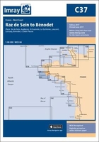
C37 Raz De Sein To Benodet
often include further corrections on a separate sheet. Subsequent corrections can be found on the Imray website. Positions referring to WGS84 Datum, such as most GPS readings, can be plotted directly onto these charts.Base cartography uses contours, several levels of colour shading, and spot measurements to indicate depth relative to Lowest Astronomical Tide, including distinct colour highlighting for tidally-covered land. A large number of hatchings & markings are used to indicate coast types, salt flats, marshland, etc.Compliant IALA ‘System A’ buoys are clearly marked, and indications of other navigational aides such as light floats are given where possible. Lighthouses are clearly marked with arcs of visibility. A complex and comprehensive system of symbols is used to
indicate all types of submerged obstructions, including wrecks, rocks, pipelines and cables, with depths where known. Flood tides, eddies races, ebb tide streams and other current information is given. A wide range of symbols indicate onshore features, anchorages, harbour details and other points of note. Danger areas, restricted areas and traffic zones are all shown.
This page now acts as a permanent archive for this product. Add more information using the comments box below to ensure it can still be found by future generations.
Use our search facility to see if it is available from an alternative contributor.
- External links may include paid for promotion
- Availability: Out Of Stock
- Supplier: Stanfords
- SKU: 9781846238864
Product Description
Chart of the Raz de Sein to Benodet in Imray’s series of charts of Northwest Europe, which are comprehensive & easy-to-use sailing charts published on rip-proof, waterproof paper- ideal to be used on small tables or in cockpits. They show detailed coastline & depth information, & are constantly corrected to reflect latest information. The C Charts offer coverage for cruising on larger-size sheets; they are suitable for offshore passage making & the medium scales chosen also allow safe inshore navigation. Each chart contains insets showing local harbours annotated with symbols indicating what facilities can be found there (marinas, mooring & berth facilities, fuel, water, chandlers, etc.). Depths are shown in metres. Charts are fully updated to the latest printing date, & often include further corrections on a separate sheet. Subsequent corrections can be found on the Imray website. Positions referring to WGS84 Datum, such as most GPS readings, can be plotted directly onto these charts. Base cartography uses contours, several levels of colour shading, & spot measurements to indicate depth relative to Lowest Astronomical Tide, including distinct colour highlighting for tidally-covered l&. A large number of hatchings & markings are used to indicate coast types, salt flats, marshl&, etc. Compliant IALA ‘ System A’ buoys are clearly marked, & indications of other navigational aides such as light floats are given where possible. Lighthouses are clearly marked with arcs of visibility. A complex & comprehensive system of symbols is used to indicate all types of submerged obstructions, including wrecks, rocks, pipelines & cables, with depths where known. Flood tides, eddies races, ebb tide streams & other current information is given. A wide range of symbols indicate onshore features, anchorages, harbour details & other points of note. Danger areas, restricted areas & traffic zones are all shown.
Reviews/Comments
Add New
Intelligent Comparison
We couldn't find anything!
Perhaps this product's unique.... Or perhaps we are still looking for comparisons!
Click to bump this page and we'll hurry up.
Price History
Vouchers
Do you know a voucher code for this product or supplier? Add it to Insights for others to use.


 United Kingdom
 France
 Germany
 Netherlands
 Sweden
 USA
USA
 Italy
Italy
 Spain
Spain


 Denmark