
 United Kingdom
 France
 Germany
 Netherlands
 Sweden
 USA
USA
 Italy
Italy
 Spain
Spain
More From Contributor


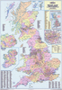
British Isles: Global Mapping Physical Wall Map
Laminated physical wall map of the British Isles and Ireland at 1:1, 000, 000 from Global Mapping, showing topography with altitude colourning and additional spot heights.Road detail shows motorways, A roads and B roads, with only motorway and A numbers marked; service stations, railways, car ferries, ferry routes, and airports are indicated. International, national, and county and unitary authority boundaries are subtly highlighted, with county names overprinted in dark red.There is also a distance table for numerous destinations, as well as a separate inset showing the Channel and Shetland Islands.The lamination on this wall map allows you to write on it with a felt marker and wipe it clean afterwards. It is also more durable than an ordinary paper wall map.
Product Description
Reviews/Comments
Add New
Intelligent Comparison
Archived Product

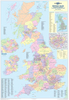
British Isles Global Mapping Political Wall Map SMALL PAPER Stanfords
£8.99
Archived Product
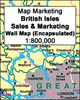
British Isles Global Mapping Political Wall Map ENCAPSULATED Stanfords
£25.99
Archived Product
World: Global Mapping Political Wall Maps Stanfords
£7.99
Archived Product
British Isles: Ordnance Survey Physical Wall Map Stanfords
£9.99
Archived Product
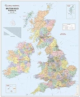
Great Britain: Global Mapping British Isles Physical Wall Map Stanfords
£11.99
Archived Product

British Isles Physical Panoramic Wall Map Stanfords
£19.99
Archived Product
Europe: Global Mapping Political Wall Map PAPER Stanfords
£10.99
Archived Product
Europe: Global Mapping Political Wall Map PAPER Stanfords
£10.99
Vouchers
No voucher codes found.
Do you know a voucher code for this product or supplier? Add it to Insights for others to use.
Do you know a voucher code for this product or supplier? Add it to Insights for others to use.
 Denmark