More From Contributor

£7.99
1951. Brighton. With the war over & the Nazis brought to justice at Nuremberg, Mirabelle Bevan (Secret Service, retired) thinks her skills are no longer required. After her lover's death she retires to the seaside to put the past behind her & takes a job at a debt collection agency run by the charismatic Big Ben Mc Guigan. But when the case of Romana Laszlo
- a pregnant Hungarian refugee
- comes in, Mirabelle soon discovers that her specialist knowledge is vital. With enthusiastic assistance from insurance clerk Vesta Churchill, they follow a mysterious trail of gold sovereigns & corpses that only they can unravel.

...
Archived Product
£1.50
This is a new edition pocket sheet map in the AA's ground breaking series of Street-by-Street atlases. Britain's clearest mapping comes in a handy, pocket-sized format. Conveniently sized to carry with you on your journey, the map

Includes::
NCP car parks & one-way streets, public toilets, pubs, hotels, petrol stations & public buildings. Fully revised & updated for 2007, this map is all you need to keep you on the move in Brighton.

...
Archived Product
£8.99
Graham Greene`s Brighton Rock is the classic murder tale set in 1930s Brighton & which was made into a successful feature film in 1948. A gang war is raging through the dark underworld of Brighton. Seventeen-year-old Pinkie, malign & ruthless, has killed a man. Believing he can escape retribution, he is unprepared for the courageous, life-embracing Ida Arnold. Greene`s gripping thriller, exposes a world of loneliness & fear, of life lived on the `dangerous edge of things`. Although ostensibly an underworld thriller, the book is also an exploration of the nature of sin & the basis of morality; Pinkie & Rose are Roman Catholics, as was Greene, & their beliefs are contrasted with Ida`s strong but non-religious moral sensibility. ...
Archived Product
£9.99
Brighton Rock, Graham Greene`s iconic tale of the razor-wielding Pinkie, is gripping & terrifying
- an unputdownable read. First
...
Archived Product
£7.99
Brighton in the Shortlist Guide series from Time Out; exploring a range of international destinations in a handy, pocket-sized format designed to introduce visitors to the best nightlife, entertainment & local attractions in the city. Expert local writers provide an encyclopaedic knowledge of each city, ensuring that the guides have won a reputation for their accuracy & reliability. Each guide opens with a ...
Archived Product
£13.99
From the extravagances of the Royal Pavilion to the slums of nearby Albion Hill in the past, & from the elegance of the Regency squares to the amusement arcades on the Palace Pier today, Brighton & Hove has always been a place of high contrasts; these exist most noticeably over time, as shown by the photographs in this collection. Through the matching of old & rare images with modern ones taken from the same camera location today, this book allows the reader to soak in the many changes that have occurred over the years. Brighton & Hove Then & Now will appeal to visitors, & to everyone who knows the city. ...
Archived Product
£14.99
Brighton & Lewes area, including the South Downs National Park & a section of the South Downs Way / E9 European Long-distance Path, on a waterproof & tear-resistant OS Active version of map No. 198 from the Ordnance Survey’s Landranger series at 1:50, 000, with contoured & GPS compatible topographic mapping plus tourist information.MOBILE DOWNLOADS: As well as the physical edition of the map, each Landranger title now

Includes::
a code for downloading after purchase its digital version onto your smartphone or tablet for viewing on the OS smartphone app.OS LANDRANGER SERIES: to see the list of all the titles in the OS Landranger series, both paper & waterproof versions, please click on the series link. Maps in the Landranger series provide plenty of recreational & tourist information, indicating the traditional public right of way paths (except in Scotland where different laws apply), including bridleways & byways restricted or open to motorized traffic. National Trails & selected other long-distance paths are marked, as well as on-road & traffic-free cycle routes with their National/ Regional Cycle Network numbers. National Trust/ National Trust for Scotland & Forestry Commission land is clearly marked, indicating open or restricted access. A range of symbols highlights camping & caravanning sites, youth hostels, tourist information offices & visitors’ centres, parking & picnicking places, World Heritage sites, sport & recreational facilities, etc. The maps provide detailed presentation of topography with contours at 10m intervals, numerous spot heights & additional colouring and/or graphics for different types of woodlands, orchards or parkl&, rock features including scree & cliffs, water features inland & along the sea shore with marshl&, dunes, s&, mud, shingle & the high water mark. All the standard information expected of survey mapping at this scale is included: finely graded road network, railway lines with stations, cuttings, embankments, etc; individual isolated buildings; archaeological & historical sites, etc. For GPS users the British National Grid is shown at 1km intervals, with latitude & longitude given by margin ticks at 1` & cross hairs on the map at 5`. Each map covers an area of 40 x 40km, (approx. 25 x 25 miles).

...
Archived Product
£8.99
Brighton & Lewes area, including the South Downs National Park & a section of the South Downs Way / E9 European Long-distance Path, on a paper version of map No. 198 from the Ordnance Survey’s Landranger series at 1:50, 000, with contoured & GPS compatible topographic mapping plus tourist information.MOBILE DOWNLOADS: As well as the physical edition of the map, each Landranger title now

Includes::
a code for downloading after purchase its digital version onto your smartphone or tablet for viewing on the OS smartphone app.OS LANDRANGER SERIES: to see the list of all the titles in the OS Landranger series, both paper & waterproof versions, please click on the series link. Maps in the Landranger series provide plenty of recreational & tourist information, indicating the traditional public right of way paths (except in Scotland where different laws apply), including bridleways & byways restricted or open to motorized traffic. National Trails & selected other long-distance paths are marked, as well as on-road & traffic-free cycle routes with their National/ Regional Cycle Network numbers. National Trust/ National Trust for Scotland & Forestry Commission land is clearly marked, indicating open or restricted access. A range of symbols highlights camping & caravanning sites, youth hostels, tourist information offices & visitors’ centres, parking & picnicking places, World Heritage sites, sport & recreational facilities, etc. The maps provide detailed presentation of topography with contours at 10m intervals, numerous spot heights & additional colouring and/or graphics for different types of woodlands, orchards or parkl&, rock features including scree & cliffs, water features inland & along the sea shore with marshl&, dunes, s&, mud, shingle & the high water mark. All the standard information expected of survey mapping at this scale is included: finely graded road network, railway lines with stations, cuttings, embankments, etc; individual isolated buildings; archaeological & historical sites, etc. For GPS users the British National Grid is shown at 1km intervals, with latitude & longitude given by margin ticks at 1` & cross hairs on the map at 5`. Each map covers an area of 40 x 40km, (approx. 25 x 25 miles).

...
Archived Product
£4.50
This is a new edition in the AA's ground-breaking series of street atlases. It is fully revised & updated for 2007. Street by Street Brighton Midi has been fully updated with a stylish new cover design, in a handy glovebox size. The maps clearly show AA recommended restaurants, pubs, hotels, one-way streets & car parks. 24-hour petrol stations & garden centres are highlighted & the mapping uses National Grid referencing
- used by the emergency services. Featuring a clever use of colour to ensure they can be read under street lighting, these maps are all you need to find your way in Brighton.
...
Archived Product
£2.95
Brighton: Seaside City: Attractions on Foot by Bike Bus & Train by Quickmaps is a useful, handy-size pocket map that highlights attractions on foot, bike, bus & train. On one side is a simple street plan of the city centre & its attractions showing `flavour` & character of streets & places. It also covers part of Hove & Kemptown highlighting interesting features with comments & marking out routes for ‘walking & wandering’. There are symbols for bars, pubs, places to eat & stay. The other side covers ‘outside Brighton’ & coverage extends along the shoreline to Shoreham by Sea & Rotting Dean. It also extends North into the South Downs. Nearby Lewes is included for those who want something other than the beach & bustle of Brighton & wish to delve into local history of this quintessential English town. Additional local information is offered by capturing the QR code on the rear cover with a smartphone. ...
Archived Product

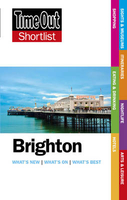
Brighton Shortlist Guide - 2nd Ed.

Brighton in the Shortlist Guide series from Time Out; exploring a range of international destinations in a handy, pocket-sized format designed to introduce visitors to the best nightlife, entertainment and local attractions in the city. Expert local writers provide an encyclopaedic knowledge of each city, ensuring that the guides have won a reputation for their accuracy and reliability. Each guide opens with a ‘Don’t Miss’ section profiling recommendations by the author and accompanied by detailed commentary. An Itineraries chapter provides inspiration for travellers with a series of thematic walks around the city. The main section explores the city by region, with each area divided into sights and museums, eating and drinking, shopping, nightlife and arts and leisure. Contact
details, addresses, opening times and prices for each establishment are also given where relevant.A further section on Essentials provides listings of hotels by area, accompanied by a description and with details of opening times, addresses, directions and outline room prices. Further information on getting to the city and around is also provided. There is also a Resources index, with practical guidance on accidents and emergencies, credit card loss, customs, dental emergencies, disabled visitors, embassies and consulates, left luggage, opening hours, smoking, telephones, tickets, visas and what’s on where.
RIP - This product is no longer available on our network. It was last seen on 25.09.2019

This page now acts as a permanent archive for this product. Add more information using the comments box below to ensure it can still be found by future generations.

Use our search facility to see if it is available from an alternative contributor.
  • Availability: Out Of Stock
  • Supplier: Stanfords
  • SKU: 9781905042968
Availability: In Stock
£7.99

Product Description

Brighton in the Shortlist Guide series from Time Out; exploring a range of international destinations in a handy, pocket-sized format designed to introduce visitors to the best nightlife, entertainment & local attractions in the city. Expert local writers provide an encyclopaedic knowledge of each city, ensuring that the guides have won a reputation for their accuracy & reliability. Each guide opens with a ‘ Don’t Miss’ section profiling recommendations by the author & accompanied by detailed commentary. An Itineraries chapter provides inspiration for travellers with a series of thematic walks around the city. The main section explores the city by region, with each area divided into sights & museums, eating & drinking, shopping, nightlife & arts & leisure. Contact details, addresses, opening times & prices for each establishment are also given where relevant.A further section on Essentials provides listings of hotels by area, accompanied by a description & with details of opening times, addresses, directions & outline room prices. Further information on getting to the city & around is also provided. There is also a Resources index, with practical guidance on accidents & emergencies, credit card loss, customs, dental emergencies, disabled visitors, embassies & consulates, left luggage, opening hours, smoking, telephones, tickets, visas & what’s on where.

Reviews/Comments

Add New

Intelligent Comparison

Oooops!
We couldn't find anything!
Perhaps this product's unique.... Or perhaps we are still looking for comparisons!
Click to bump this page and we'll hurry up.

Price History

Vouchers

No voucher codes found.
Do you know a voucher code for this product or supplier? Add it to Insights for others to use.

Facebook

Jargon Buster

Entertainment - Something that provides amusement
Practical - Weather a task is easy to carry out and realistically succeed.
Pocket - A bag shaped insert in clothing used to carry items

Supplier Information

Stanfords
Stanfords was established in 1853 and opened their iconic Covent Garden flagship store in 1901. They have become the top retailer of maps, travel books and accessories in the UK and arguably offer the largest selection of maps and travel books worldwide. Famous names such as Captain Robert Falcon Scott, Ranulph Fiennes and Michael Palin have purchased from Stanfords. They now have a shop in Bristol and both stores together with other venues operate a calendar of events including talks, book signings and exhibitions. As a specialist map retailer, the map selection is comprehensive and includes road maps, street maps and walking maps from worldwide destinations, as well as a selection of world atlases and wall maps. Books include travel guides and travel literature. Stanfords also stock globes, from miniatures made of blue marble to magnificent floor-standing globes. The website features a selection of interesting articles on travel topics.
Page Updated: 2023-11-12 20:15:36

Community Generated Product Tags

Oh No! The productWIKI community hasn't generated any tags for this product yet!
Menu