More From Contributor
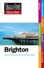
£7.99
Map No. 198, Brighton & Lewes 1898, in the Cassini Historical Series of old Ordnance Survey mapping of England & Wales at 1:50, 000 in a format designed to offer a convenient comparison with the present day coverage from the OS, & most locations in three different editions. Old historical maps have been combined so that the sheet lines correspond to the current Landranger series & reproduced with the scale changed from one inch to one mile to 1:50, 000. Most locations are covered by three separate maps, showing how the area has changed over the decades, with selected major cities also presented in a fourth edition. Old Series: the first detailed survey mapping dating for most areas from the first half of the 19th century, in black & white & with relief shown by hachuring. Revised New Series from 1880s/1900s, with some colouring & a mixture of hachuring & contour lines. Popular Edition from the inter-war years, with contour lines & colouring to indicate woodlands, parks, etc. New Popular Edition from the late 1940s, reproduced in the Cassini series for the major cities. Each map

Includes::
notes on the development of Ordnance Survey & the various series produced by them. For those interested in maps & cartography in general, the Cassini series also provides a fascinating insight into how Ordnance Survey cartographic style has developed over a period of over 100 years. Coverage in this title

Includes::
present day Worthing, Horsham, Haywards Heath, Crawley, Burgess Hill, Uckfield, Newhaven, Seaford, Shoreham-by-Sea, Turners Hill, Forest Row, Sinfold, Balcombe, Sharpthorne, Nutley, Ardingly, Handcross, Slinfold, Southwater, Broadford Bridge, Cowfold, Partridge Green, Hurstpierpoint, South Chailey, Ashington, Henfield, Clayton, Ringmer, Glyndebourne, Woodingdean, Stayning, Findon, & part of the Low Weald. PLEASE NOTE: Stanfords can also print on request mapping from all four series centring the map on a location of your choice. For more information please click on the link below.


...
Archived Product
£9.99
Map No. 198, Brighton & Lewes 1920, in the Cassini Historical Series of old Ordnance Survey mapping of England & Wales at 1:50, 000 in a format designed to offer a convenient comparison with the present day coverage from the OS, & most locations in three different editions. Old historical maps have been combined so that the sheet lines correspond to the current Landranger series & reproduced with the scale changed from one inch to one mile to 1:50, 000. Most locations are covered by three separate maps, showing how the area has changed over the decades, with selected major cities also presented in a fourth edition. * Old Series: the first detailed survey mapping dating for most areas from the first half of the 19th century, in black & white & with relief shown by hachuring.* Revised New Series from 1880s/1900s, with some colouring & a mixture of hachuring & contour lines.* Popular Edition from the inter-war years, with contour lines & colouring to indicate woodlands, parks, etc.* New Popular Edition from the late 1940s, reproduced in the Cassini series for the major cities. Each map

Includes::
notes on the development of Ordnance Survey & the various series produced by them. For those interested in maps & cartography in general, the Cassini series also provides a fascinating insight into how Ordnance Survey cartographic style has developed over a period of over 100 years. Coverage in this title

Includes::
present day Worthing, Horsham, Haywards Heath, Crawley, Burgess Hill, Uckfield, Newhaven, Seaford, Shoreham-by-Sea, Turners Hill, Forest Row, Sinfold, Balcombe, Sharpthorne, Nutley, Ardingly, Handcross, Slinfold, Southwater, Broadford Bridge, Cowfold, Partridge Green, Hurstpierpoint, South Chailey, Ashington, Henfield, Clayton, Ringmer, Glyndebourne, Woodingdean, Stayning, Findon, & part of the Low Weald.* PLEASE NOTE: Stanfords can also print on request mapping from all four series *centring the map on a location of your choice.* For more information please click on the link below.


...
Archived Product
£9.09
Map No. 198, Brighton & Lewes, in the waterproof & tear-resistant OS Active version of the Ordnance Survey Landranger series at 1:50, 000, including Worthing, Horsham, Haywards Heath, Crawley, Burgess Hill, Uckfield, Newhaven, Seaford, Shoreham-by-Sea, Turners Hill, Forest Row, Sinfold, Balcombe, Sharpthorne, Nutley, Ardingly, Handcross, Slinfold, Southwater, Broadford Bridge, Cowfold, Partridge Green, Hurstpierpoint, South Chailey, Ashington, Henfield, Clayton, Ringmer, Glyndebourne, Woodingdean, Stayning, Findon, part of the Low Weald & a section of the South Downs Way. Edition E2 with minor changes; Publication date April 2012 About Ordnance Survey ...
Archived Product
£10.39
Map No. 198, Brighton & Lewes, in a waterproof & tear-resistant version of the Ordnance Survey Landranger series at 1:50, 000, including Worthing, Horsham, Haywards Heath, Crawley, Burgess Hill, Uckfield, Newhaven, Seaford, Shoreham-by-Sea, Turners Hill, Forest Row, Sinfold, Balcombe, Sharpthorne, Nutley, Ardingly, Handcross, Slinfold, Southwater, Broadford Bridge, Cowfold, Partridge Green, Hurstpierpoint, South Chailey, Ashington, Henfield, Clayton, Ringmer, Glyndebourne, Woodingdean, Stayning, Findon, & part of the Low Weald. Edition E2; Revised 2001; Revised for selected changes 2002, 2008; Copyright date 2009 This title is also available on our website in a paper version. Maps in this series are only published folded. Stanfords can also print flat versions of Ordnance Survey maps through the OS Select system, centring the map on a location of your choice & with a picture provided by you on the cover. For more information please click on the link at the bottom of this description. About Ordnance Survey ...
Archived Product
£7.99
1951. Brighton. With the war over & the Nazis brought to justice at Nuremberg, Mirabelle Bevan (Secret Service, retired) thinks her skills are no longer required. After her lover's death she retires to the seaside to put the past behind her & takes a job at a debt collection agency run by the charismatic Big Ben Mc Guigan. But when the case of Romana Laszlo
- a pregnant Hungarian refugee
- comes in, Mirabelle soon discovers that her specialist knowledge is vital. With enthusiastic assistance from insurance clerk Vesta Churchill, they follow a mysterious trail of gold sovereigns & corpses that only they can unravel.

...
Archived Product
£8.99
Graham Greene`s Brighton Rock is the classic murder tale set in 1930s Brighton & which was made into a successful feature film in 1948. A gang war is raging through the dark underworld of Brighton. Seventeen-year-old Pinkie, malign & ruthless, has killed a man. Believing he can escape retribution, he is unprepared for the courageous, life-embracing Ida Arnold. Greene`s gripping thriller, exposes a world of loneliness & fear, of life lived on the `dangerous edge of things`. Although ostensibly an underworld thriller, the book is also an exploration of the nature of sin & the basis of morality; Pinkie & Rose are Roman Catholics, as was Greene, & their beliefs are contrasted with Ida`s strong but non-religious moral sensibility. ...
Archived Product
£9.99
Brighton Rock, Graham Greene`s iconic tale of the razor-wielding Pinkie, is gripping & terrifying
- an unputdownable read. First
...
Archived Product
£7.99
Brighton in the Shortlist Guide series from Time Out; exploring a range of international destinations in a handy, pocket-sized format designed to introduce visitors to the best nightlife, entertainment & local attractions in the city. Expert local writers provide an encyclopaedic knowledge of each city, ensuring that the guides have won a reputation for their accuracy & reliability. Each guide opens with a ...
Archived Product
£7.99
Brighton in the Shortlist Guide series from Time Out; exploring a range of international destinations in a handy, pocket-sized format designed to introduce visitors to the best nightlife, entertainment & local attractions in the city. Expert local writers provide an encyclopaedic knowledge of each city, ensuring that the guides have won a reputation for their accuracy & reliability. Each guide opens with a ‘ Don’t Miss’ section profiling recommendations by the author & accompanied by detailed commentary. An Itineraries chapter provides inspiration for travellers with a series of thematic walks around the city. The main section explores the city by region, with each area divided into sights & museums, eating & drinking, shopping, nightlife & arts & leisure. Contact details, addresses, opening times & prices for each establishment are also given where relevant.A further section on Essentials provides listings of hotels by area, accompanied by a description & with details of opening times, addresses, directions & outline room prices. Further information on getting to the city & around is also provided. There is also a Resources index, with practical guidance on accidents & emergencies, credit card loss, customs, dental emergencies, disabled visitors, embassies & consulates, left luggage, opening hours, smoking, telephones, tickets, visas & what’s on where. ...
Archived Product
£13.99
From the extravagances of the Royal Pavilion to the slums of nearby Albion Hill in the past, & from the elegance of the Regency squares to the amusement arcades on the Palace Pier today, Brighton & Hove has always been a place of high contrasts; these exist most noticeably over time, as shown by the photographs in this collection. Through the matching of old & rare images with modern ones taken from the same camera location today, this book allows the reader to soak in the many changes that have occurred over the years. Brighton & Hove Then & Now will appeal to visitors, & to everyone who knows the city. ...
Archived Product

Brighton Pocket Map

This is a new edition pocket sheet map in the AA's ground breaking series of Street-by-Street atlases. Britain's clearest mapping comes in a handy, pocket-sized format. Conveniently sized to carry with you on your journey, the map includes NCP car parks and one-way streets, public toilets, pubs, hotels, petrol stations and public buildings. Fully revised and updated for 2007, this map is all you need to keep you on the move in Brighton.
RIP - This product is no longer available on our network. It was last seen on 25.09.2019

This page now acts as a permanent archive for this product. Add more information using the comments box below to ensure it can still be found by future generations.

Use our search facility to see if it is available from an alternative contributor.
  • Availability: Out Of Stock
  • Supplier: Stanfords
  • SKU: 9780749552206
Availability: In Stock
£1.50

Product Description

This is a new edition pocket sheet map in the AA's ground breaking series of Street-by-Street atlases. Britain's clearest mapping comes in a handy, pocket-sized format. Conveniently sized to carry with you on your journey, the map

Includes::
NCP car parks & one-way streets, public toilets, pubs, hotels, petrol stations & public buildings. Fully revised & updated for 2007, this map is all you need to keep you on the move in Brighton.

Reviews/Comments

Add New

Intelligent Comparison

Oooops!
We couldn't find anything!
Perhaps this product's unique.... Or perhaps we are still looking for comparisons!
Click to bump this page and we'll hurry up.

Price History

Vouchers

No voucher codes found.
Do you know a voucher code for this product or supplier? Add it to Insights for others to use.

Facebook

Jargon Buster

Car - A machine used for transport which runs on roads
Pocket - A bag shaped insert in clothing used to carry items

Supplier Information

Stanfords
Stanfords was established in 1853 and opened their iconic Covent Garden flagship store in 1901. They have become the top retailer of maps, travel books and accessories in the UK and arguably offer the largest selection of maps and travel books worldwide. Famous names such as Captain Robert Falcon Scott, Ranulph Fiennes and Michael Palin have purchased from Stanfords. They now have a shop in Bristol and both stores together with other venues operate a calendar of events including talks, book signings and exhibitions. As a specialist map retailer, the map selection is comprehensive and includes road maps, street maps and walking maps from worldwide destinations, as well as a selection of world atlases and wall maps. Books include travel guides and travel literature. Stanfords also stock globes, from miniatures made of blue marble to magnificent floor-standing globes. The website features a selection of interesting articles on travel topics.
Page Updated: 2023-11-12 20:15:36

Community Generated Product Tags

Oh No! The productWIKI community hasn't generated any tags for this product yet!
Menu