
 United Kingdom
 France
 Germany
 Netherlands
 Sweden
 USA
USA
 Italy
Italy
 Spain
Spain
More From Contributor


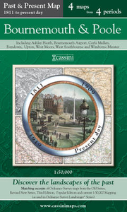
Bournemouth And Poole
Folded street map of Bournemouth and Poole from A to Z, with coverage extending to: Merley; Bournemouth Airport; Fairmile; Christchurch; Southbourne; Sandbanks; Brownsea Island; Hamworthy; Turlin Moor and Rockley Sands (inset map, and part of Corfe Mullen.There are also large scale maps of Bournemouth and Poole town centres.Motorways, A roads, B roads, dual carriageways, one way streets, pedestrianized/restricted access roads and car parks are shown. The run of street numbers on A and B roads is indicated. Tracks and footpaths are mapped, as are selected cycleways, railways, stations, level crossings and rail bridges. Colour coding distinguishes land use, e.g. shopping centre, educational establishment or industrial building. Post offices, churches, tourist information
centres and emergency services are located, as are public toilets with and without disabled access. Post town and postcode boundaries are demarcated and the atlas is indexed by street name and places of particular interest.This edition printed 2010
centres and emergency services are located, as are public toilets with and without disabled access. Post town and postcode boundaries are demarcated and the atlas is indexed by street name and places of particular interest.This edition printed 2010
Product Description
Reviews/Comments
Add New
Intelligent Comparison
Archived Product
Bournemouth And Purbeck Stanfords
£5.59
Archived Product
Bournemouth And Purbeck 1811 Stanfords
£7.99
Archived Product
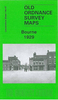
Bournemouth And Purbeck 1919 Stanfords
£7.99
Archived Product
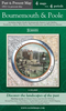
Bournemouth And Poole Past And Present Stanfords
£9.99
Vouchers
No voucher codes found.
Do you know a voucher code for this product or supplier? Add it to Insights for others to use.
Do you know a voucher code for this product or supplier? Add it to Insights for others to use.
 Denmark