
 United Kingdom
 France
 Germany
 Netherlands
 Sweden
 USA
USA
 Italy
Italy
 Spain
Spain
More From Contributor

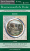
Bournemouth And Purbeck
Map No. 195, Bournemouth and Purbeck, in the Ordnance Survey Landranger series at 1:50, 000, including Wimborne Minster, Poole, Christchurch, Ringwood, Fordingbridge, Wareham, Swanage, Corfe Castle, Upton, Corfe Mullen, Lytchett, Spetisbury, Witchhampton, Tarrant Hilton, Gussage All Saints, Three Legged Cross, Longham, Hurn, Bransgore, Ferndown, Cranborne, Alderholt, Verwood, North Gorley, Burley, Sway, New Milton, and Milford on Sea. Edition D3; Revised 2000/2001; Revised for selected changes 2002, 2004, 2008; Copyright date 2009 This title is also available on our website in a waterproof and tear-resistant version.Maps in this series are only published folded. Stanfords can also print flat versions of Ordnance Survey maps through the OS Select system,
centring the map on a location of your choice and with a picture provided by you on the cover. For more information please click on the link at the bottom of this description.About Ordnance Survey
centring the map on a location of your choice and with a picture provided by you on the cover. For more information please click on the link at the bottom of this description.About Ordnance Survey
Product Description
Reviews/Comments
Add New
Intelligent Comparison
Archived Product
Bournemouth And Purbeck 1811 Stanfords
£7.99
Archived Product
Bournemouth And Purbeck 1919 Stanfords
£7.99
Archived Product
Bournemouth And Purbeck 1897-1909 Stanfords
£7.99
Archived Product
Bournemouth And Poole Stanfords
£3.95
Archived Product
Bournemouth And Purbeck WATERPROOF Stanfords
£10.39
Archived Product
Bournemouth And Purbeck OS ACTIVE Map Stanfords
£9.09
Archived Product
Bournemouth (Midi Pbk) Stanfords
£4.99
Vouchers
No voucher codes found.
Do you know a voucher code for this product or supplier? Add it to Insights for others to use.
Do you know a voucher code for this product or supplier? Add it to Insights for others to use.
 Denmark